SEAS 2006: Sanctuary Ecosystem Assessment Surveys
Introduction
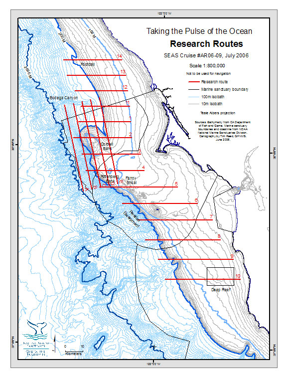
SEAS 'O6 is a 10-day research cruise off the coast of central and northern California including the waters of the Gulf of the Farallones, Cordell Bank and the northern portion of the Monterey Bay National Marine Sanctuary. The three contiguous sanctuaries are a complex region of great biological diversity with internationally significant wildlife breeding and foraging areas, significant commercial and recreational fisheries, and they encompass numerous federally, state and locally protected marine and estuarine waters. Our cruise spans waters north of the sanctuaries off Sonoma County (an area colloquially termed "The Football") to the near shore waters off San Mateo County "Deep Reef".
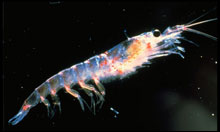 |
| Krill. (Photo: Stephen Leatherwood) | This cruise is one of a series conducted from April 2005 to September 2008, to record the oceanographic processes, noting where upwelling is most productive, in relationship to physical features of the seafloor, and the creatures that live within, on and above the water column.
SEAS 'O6 will document abundance and distribution of krill, a small shrimp-like crustacean, and their predators. Krill forms the basis of the sanctuaries' complex food web for fish, seabirds, and marine mammals, and are indicators of ocean productivity.
Research findings will be used in resource management decisions and to inspire an ocean conservation ethic.
|