Error processing SSI file
|
Mission Log: May 16, 2008
NOAA Ship Nancy Foster
By Steve Desper
 |
|
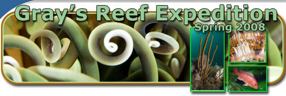
Preparing to Deploy Small Boat.
|
While scientific work aboard the RV Nancy Foster goes on 24 hours a day, work that needs to be done on Gray's Reef goes forward only with permission of the sea. Sea conditions must be such that Greg Walker, Chief Bosun, and Gordon Pringle, Bosun Group Leader, can safely launch the small boats over the side of the Nancy Foster so that the divers can safely board the small boats. Chief Scientist and Dive Master Greg McFall works with Nancy Foster Captain Rogers to make the decision about whether or not it is safe to dive. This morning the waves were 3-5 feet which is too high to safely deploy the launches (ideal state for a safe diving operation would be 3 feet or less), so Greg and Captain Rogers decided to postpone diving operations until the seas settle down. Therefore, the scientists who have been diving twice a day have a chance to rest and begin to review data and photographs they have collected. Greg McFall, also an accomplished underwater photographer, has been photographing the flora and fauna of Gray's Reef for seven years. Danny and Kenan were able to spend time confirming the familiar and observing the new through Greg's dive images from this week.
The hard work the scientists put in aboard ship pays big dividends when they return to their labs on shore. For instance, a five day research cruise will provide Danny and his students with enough data to keep them busy organizing and analyzing for months. It is easy to see the value of these scientific cruises for scientists, resource managers, students, and everyone who cares about the state of our oceans.
 |
|
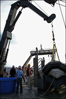
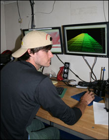
Andrew removes outliers from multibeam data.
|
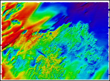
Fortunately, the high seas don't prevent the sea floor mapping project from continuing. As the R/V Nancy Foster steamed back and forth today she continued mapping an area that is approximately 13 nautical miles long and two nautical miles wide. A nautical mile is approximately 1.1 statute miles. Before the mapping begins, Senior Survey Technician Missy Partyka or Survey Technician Melody Ovard deploys an instrument called a CTD (conductivity, temperature, and depth instrument) over the side of the ship and into the water to measure the salinity and temperature of the water at specific depths. These water characteristics are necessary to ensure the accuracy of the data used to make the images of the sea floor. The computer programs used to interpret the bathymetric data from the multi-beam sonar can draw false color maps of the areas surveyed. In the image included, the various colors represent water depths with blue representing the greatest water depth (72 feet) and red representing the most shallow water depth (47 feet). These maps help scientists and resource managers decide where to look for sea bottom features that may be reefs, ledges, or live hard bottom areas to study further. Missy Partyka and Melody Ovard take turns at the impressive mapping and survey station in the dry lab of the Nancy Foster with assistance from Andrew Kennedy and Jimmy Skinner, both students from the College of Charleston. Their work is critical to "seeing" the sea floor over large and small areas.
 |
|
2001 Multibeam Image of Gray's Reef
|
During a pause in the sea floor mapping, a major event occurred. A healthy grouper with his surgically implanted sonic transmitter and dorsal fin identification tag was returned to his home on Gray's Reef. This robust fellow is 85 cm long and estimated to be 18 years old. The scientists will soon be able to track his movement using the acoustic receiver placed yesterday.
|