Exploring the Deep Coral Gardens of Channel Islands National Marine Sanctuary
By Shauna Bingham
April 2017
Located off the coast of Southern California, Channel Islands National Marine Sanctuary protects remarkable biodiversity, productive ecosystems, and sensitive species and habitats. But more than a quarter of this ocean treasure remains unmapped and little-explored. This month, a research expedition will change that.
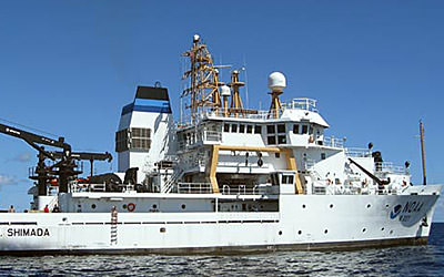
Throughout April and May, a team of NOAA-led researchers will explore the sanctuary's deep seafloor environment. Deep-sea environments like those in Channel Islands National Marine Sanctuary provide nurseries and habitat for commercially-important species such as squid and sea urchins. Some deep coral reefs may also produce chemicals that could be key to the next generation of medicines. However, these habitats are under threat. The two-week cruise on board the NOAA Ship Bell M. Shimada will shine a light on how these ecosystems are impacted by a variety of stresses facing them, such as ocean acidification.
When we burn fossil fuels like oil and gas, we release carbon dioxide into the atmosphere. When the ocean absorbs this carbon dioxide, chemical reactions occur that reduce seawater pH and the amounts of available calcium carbonate minerals. This is known as ocean acidification. Calcium carbonate minerals are the building blocks for the skeletons and shells of many marine organisms, including deep-sea corals.
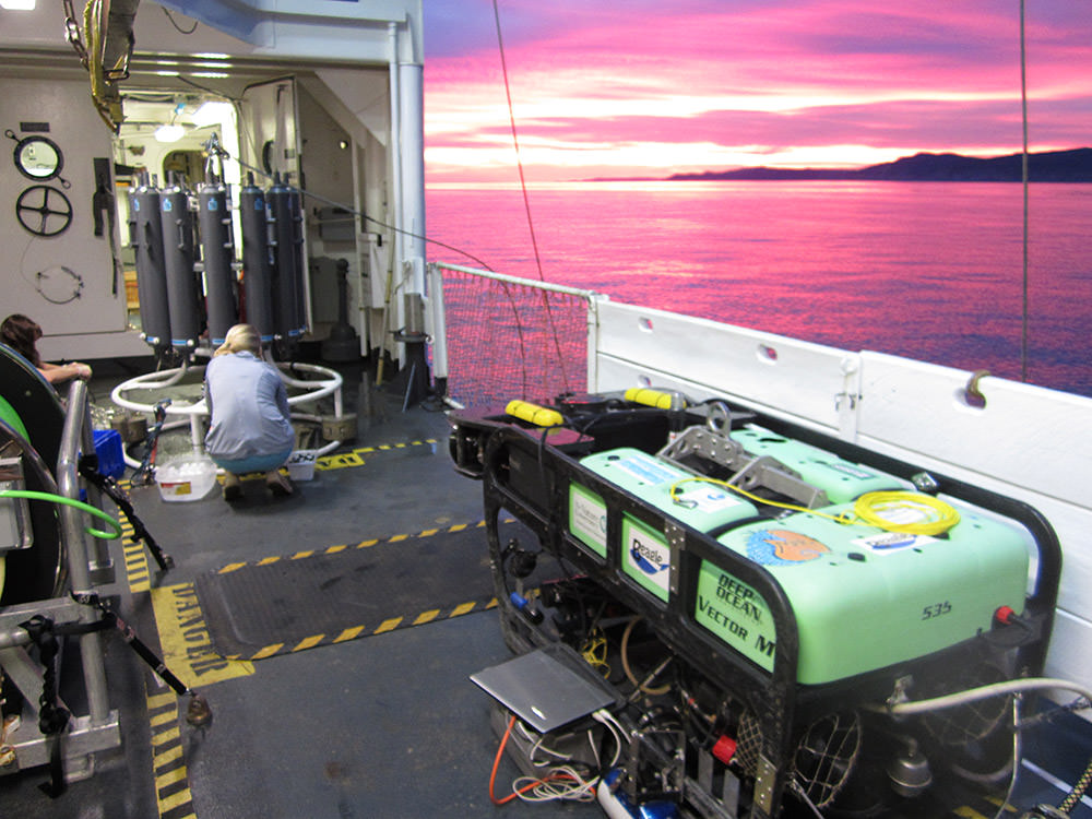
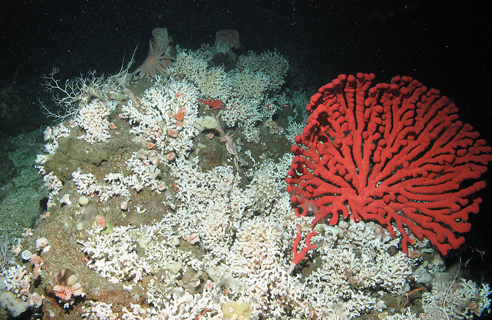
2014 survey results indicate that corals in Channel Islands National Marine Sanctuary are already experiencing effects from ocean acidification, and waters in this area are projected to become even more acidic. Corals support extensive fish and invertebrate populations, including commercially-fished species, so it is important to monitor the potentially harmful effects ocean acidification has on deep-sea corals. Using a remotely operated vehicle (ROV), the ocean acidification team will collect samples of Lophelia pertusa, a stony reef-building deep-sea coral found in the sanctuary. Researchers will also monitor water chemistry in and around reefs to help measure local effects of increased carbon dioxide emissions and to assess this ecosystem's overall vulnerability to ocean acidification.
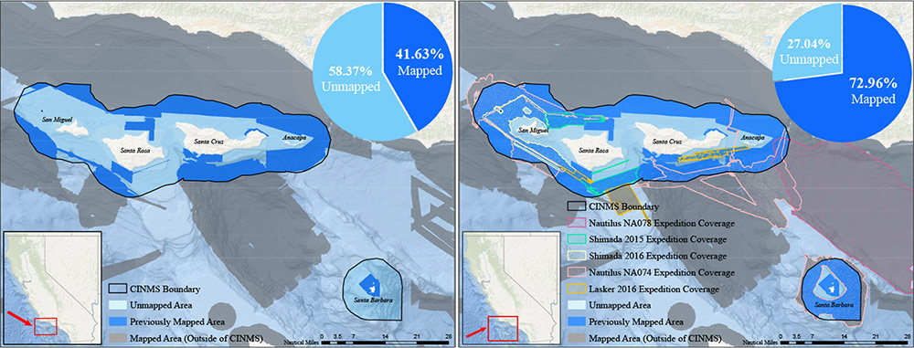
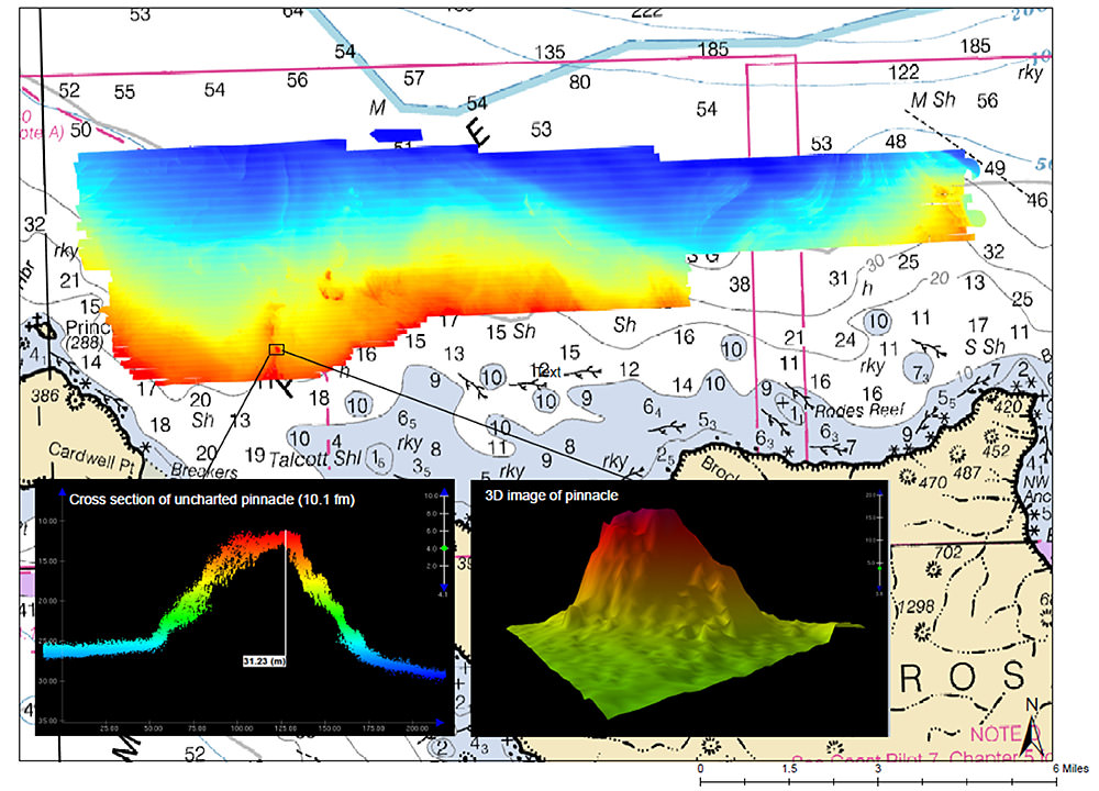
In addition to revisiting newly-discovered deep-sea coral gardens, the expedition will document previously unmapped areas of the sanctuary's deep seafloor and search for historic shipwrecks. As recently as 2014, 58 percent of Channel Islands National Marine Sanctuary was poorly charted, with seafloor maps created by single beam and lead line data from the 1930s. Over the past two years, the NOAA ship Bell M. Shimada has played an important role in enabling the sanctuary to reduce this knowledge gap to only 27 percent unmapped. These sanctuary waters are home to large populations of commercially-important species, including fish and lobster, as well as fragile ecosystem components such as deep-sea corals.
Researchers will use an ROV to explore and capture video of fish and deep-sea coral communities. In addition, the ship's ME70 and EK60 high-resolution sonars will be used to map the seafloor and fish distributions in areas around San Miguel, Santa Rosa, Santa Cruz, Anacapa, and Santa Barbara islands. New technology on the cruise will include the Office of Coast Survey's REMUS-600 mapping AUV (Autonomous Underwater Vehicle), which will have capabilities to obtain detailed images up to 1300 feet (400 meters) deep. This technology may also help researchers identify historic shipwreck sites.
Higher resolution maps and better understanding of the health of deep-sea coral gardens will help sanctuary managers protect these rare corals and the refuge they provide for marine life like rockfish. With a mandate to preserve and maintain this special place, sanctuary management requires a detailed understanding of the distribution, abundance, and condition of the resources at the site. Insights gained from the cruise surveys and collections will provide new information about the extent of deep-sea coral in the region and a baseline for possible climate change impacts to coral both within the sanctuary and worldwide.
NOAA Ship Bell M. Shimada is operated, managed and maintained by NOAA's Office of Marine and Aviation Operations, which includes commissioned officers of the NOAA Corps and civilian wage mariners. NOAA's Office of Ocean Exploration and Research operates, manages and maintains the cutting-edge ocean exploration systems on the vessel and ashore. The research team includes scientists from Channel Islands National Marine Sanctuary, Office of Coast Survey (OCS), and National Centers for Coastal Ocean Science (NCCOS), National Marine Fisheries' Deep-Sea Coral Research and Technology Program, University of New Hampshire, and Marine Applied Research and Exploration (MARE).
Shauna Bingham is the outreach coordinator for Channel Islands National Marine Sanctuary.