Exploring the Deep Waters of National Marine Sanctuary of American Samoa
By Elizabeth Weinberg
February 2017
What lies in the deep waters of National Marine Sanctuary of American Samoa? Over the next several months, you'll be able to watch dives in these unexplored waters in real time to find out.
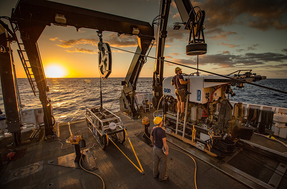
From February 16 through March 2, and from April 4 through 21, the NOAA ship Okeanos Explorer will be exploring in and around National Marine Sanctuary of American Samoa and Rose Atoll Marine National Monument. In February, using the remotely operated vehicle (ROV) Deep Discoverer, scientists will be able to get up close with some of the deep-sea environments that make this sanctuary so unique. And in April, 24-hour mapping operations will help scientists better understand the geography of the region.
But it's not just scientists who will be able to experience these amazing environments! Okeanos Explorer is equipped with real-time broadband satellite communications that provide the ship with telepresence -- meaning the videos and photos collected with ROVs can be shared on the internet in real time. That means scientists on shore, teachers, students, and you can watch the dives as they happen!
Tune in here from February 16 through March 2 to watch the dives:
Known as "America's Ship for Ocean Exploration," Okeanos is the only federally-funded U.S. ship specifically assigned to systematically explore our largely unknown ocean for the purpose of discovery and advancement of knowledge. The Okeanos crew -- and all the scientists joining via video feed in exploration command centers around the country -- is out in American Samoa with the specific mission of finding out what's out there.
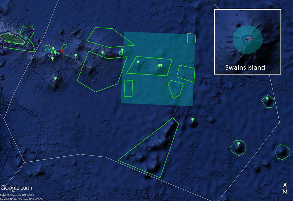
National Marine Sanctuary of American Samoa protects more than 13,000 square miles of nearshore coral reefs, deep water reefs, hydrothermal vent communities, and rare marine archaeological resources. Porites coral heads in the sanctuary's Ta'u unit are among the oldest and largest in the world: the sanctuary's largest coral head, known as Big Momma, has a circumference of 134.5 feet, stands 21 feet tall, and is more than 500 years old. The sanctuary also encompasses fishing grounds that Samoans have depended on for generations for their livelihoods.
The sanctuary's Muliāva unit overlays the marine waters of Rose Atoll Marine National Monument. The easternmost Samoan island, Rose Atoll remains one of the most pristine atolls in the world. The marine environment around the atoll supports a dynamic reef ecosystem that is home to a diverse assemblage of marine species, several of which are threatened or endangered.
The area around Rose Atoll in the sanctuary's Muliāva unit contains coral reefs, deep-water pelagic habitat, and the Vailulu'u Seamount. Within the Vailulu'u crater is a 330-meter volcanic cone, known as Nafanua, that has been growing in recent years and is likely to breach the sea surface within decades. On the seamount cone are several types of hydrothermal vents that are biological hotspots for invertebrate communities, providing habitat for an unusual group of organisms, ranging from microbial mats to polychaete worms.
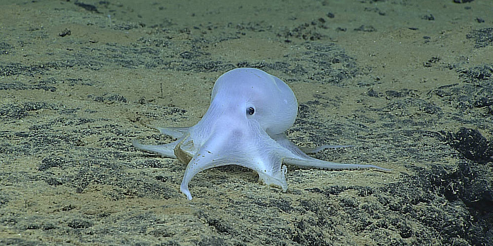
Little is known about the deep ocean habitats of American Samoa, so the scientists are in for some incredible views and new discoveries. Data from this expedition will help improve our understanding of the geologic history and deep-sea habitats of American Samoa, the connection between deep-water and shallow-water ecosystems, and the connections among communities at different seamounts. By studying these regions, too, we can better inform the management plans for marine protected areas like National Marine Sanctuary of American Samoa and Rose Atoll Marine National Monument.
The research team is sure to come across some spectacular sights, so don't miss out! You can watch live video feeds from the expedition at the top of this page from February 16 through March 2 and April 4 through 21, and on the Okeanos Explorer website. Plus, visit the expedition webpage for a mission plan, background essays, and an Ocean Explorer Expedition Education Module that includes an expedition purpose, standards-based lessons, interactive multimedia activities for students, career connections, and much more!