Getting a Clear View of the USS Monitor
How do you map a shipwreck that's 230 feet beneath the turbulent waves of the Atlantic Ocean?
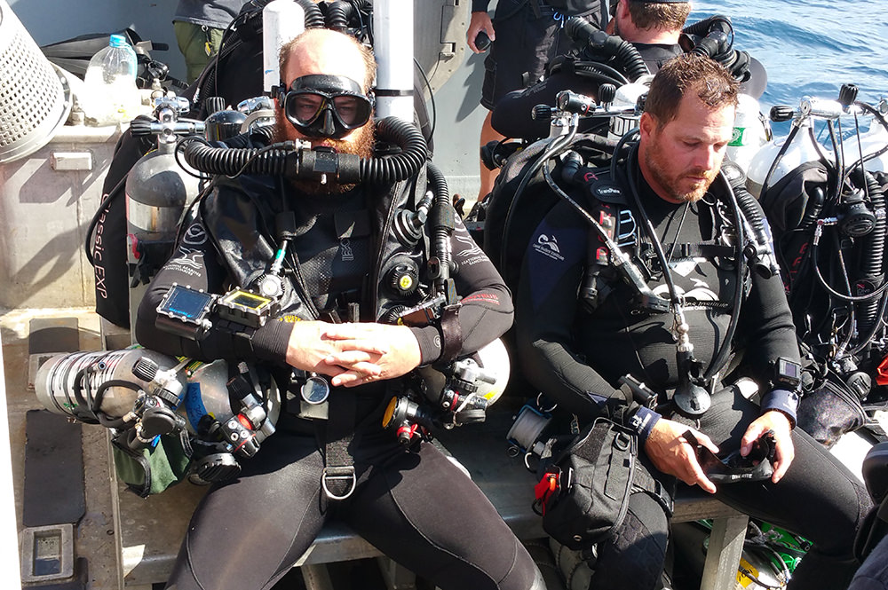
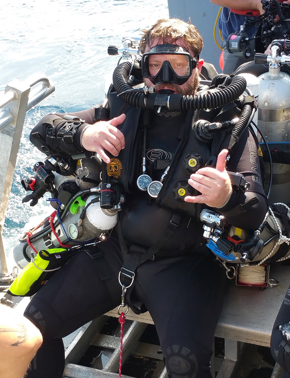
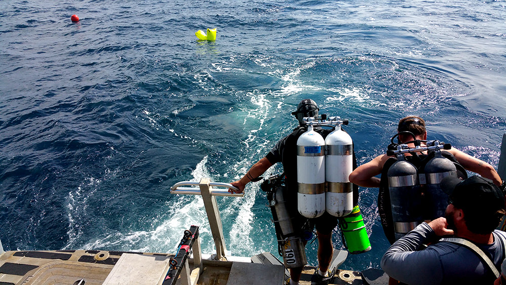
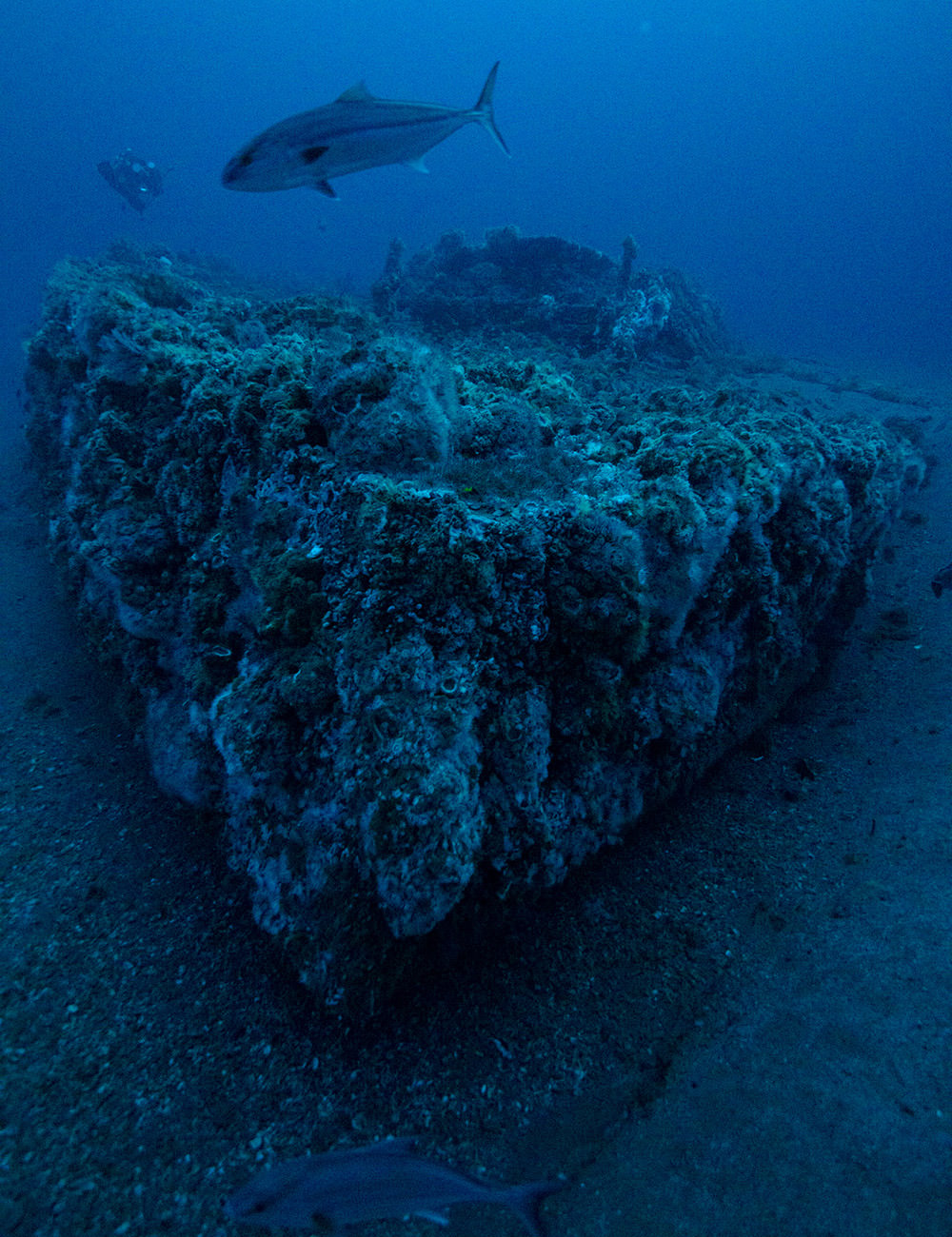
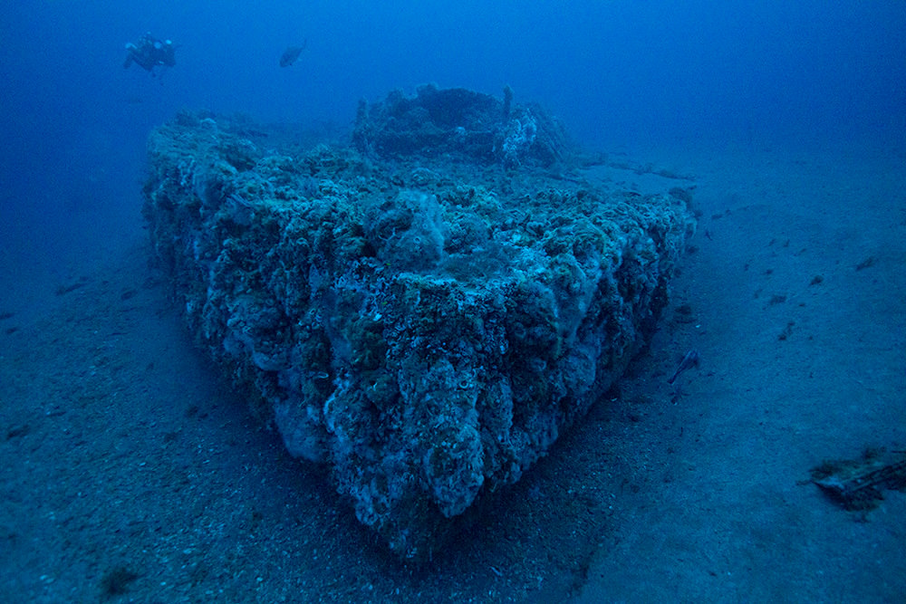
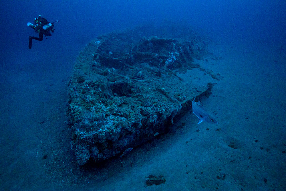
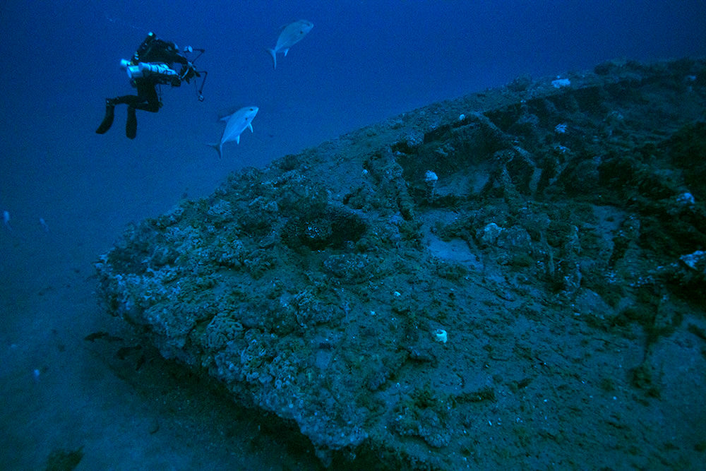
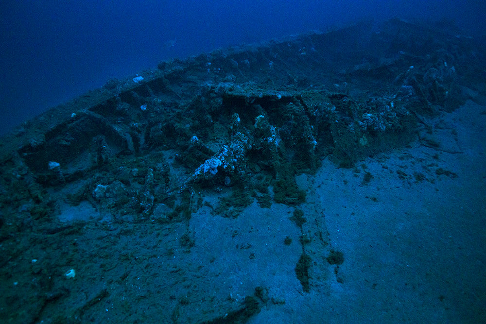
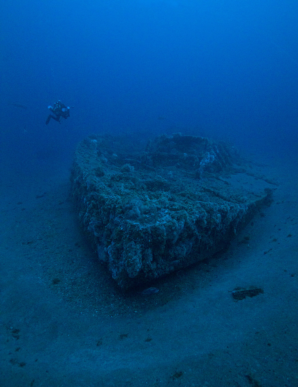
Faced with the challenge of creating the first detailed and accurate site plan of the USS Monitor, this August NOAA divers turned to photogrammetry, a 3D digital method of making measurements from photographs. While diving on the wreck, NOAA divers used still cameras to take high quality photos of the Monitor. Then, using special software, these images were combined to create a 3D model that can be manipulated and used to make precise measurements. This represents a huge leap forward from the previous sonar images, videos and photomosaics that have been used to study the shipwreck.
Monitor researchers had a bonus treat: amazing visibility! On the day of the expedition, the NOAA divers were able to see up to 100 feet -- an almost unheard of clarity for this site. As a result, we now have some of the best images we've ever captured of the USS Monitor.
But why are we diving so far to get photos of one ship on the bottom of the ocean? What's so special about the USS Monitor?
Our nation's first national marine sanctuary
The resting place of the USS Monitor became our nation's first national marine sanctuary on January 30, 1975 -- but its story began long before that, more than 150 years ago during the Civil War.
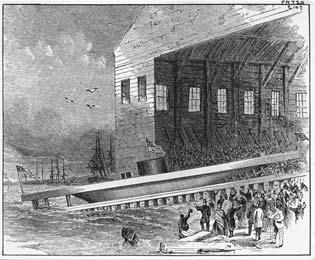
The Monitor was born in a nation in turmoil. Aware that an ironclad called the CSS Virginia was being built in Hampton Roads, Virginia, the Union decided it was time to build its own. Construction began at the Continental Ironworks in Greenpoint, Brooklyn, N.Y., and within less than 100 days on January 30, 1862, the USS Monitor launched into the East River.
Iron meets iron at the battle of Hampton Roads
It wasn't long before the Monitor and the Virginia went head-to-head. On March 9, 1862, the two ships fired upon each other for hours at Hampton Roads.
Almost four hours into the battle, a shot from the Virginia exploded against the Monitor's pilot house and Captain Worden was temporarily blinded. The Monitor's Executive Officer, Samuel Dana Green, assumed command and ordered the Monitor into shallow water, where the Virginia could not follow, to assess the captain's wounds and damage to the ship. The Virginia's captain, assuming the Monitor was withdrawing from battle, withdrew in supposed victory. When the Monitor returned to resume the engagement and found the Virginia gone, its crew also assumed victory. The crews of the two ships didn't realize that the battle was, in effect, a draw, with neither vessel inflicting serious damage to the other.
Regardless of a decisive victor in the battle, one outcome was distinctly clear: the era of the wooden warship was at an end and from that day forth, iron would forever rule the seas.
The end of the Monitor
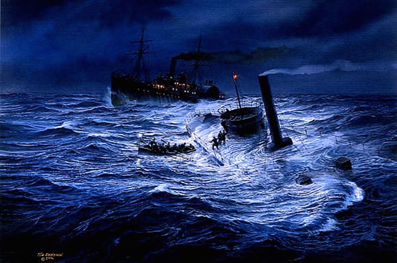
On Dec. 29, 1862, the Monitor left Hampton Roads under tow by USS Rhode Island and headed to Beaufort, North Carolina, where it was needed following the Union capture of Norfolk, Virginia.
All was well until New Year's Eve. Off the coast of Cape Hatteras, North Carolina, the waves grew and the wind howled. Leaks developed in the Monitor's hull, flooding the engines. The crew tried using pumps and even bailing with buckets, but to no avail.
A distress signal was raised -- a single red lantern -- and the Rhode Island deployed lifeboats in an effort to rescue the crew. The Monitor's turret was the only escape hatch, and as the men attempted to dash across the deck to safety, many of them were swept into the unknown by the treacherous waves.
In the end, 16 of the brave men of the Monitor never met the year of 1863, and the Monitor sank to the sea floor, where it was lost for more than a century.
A shipwreck rediscovered
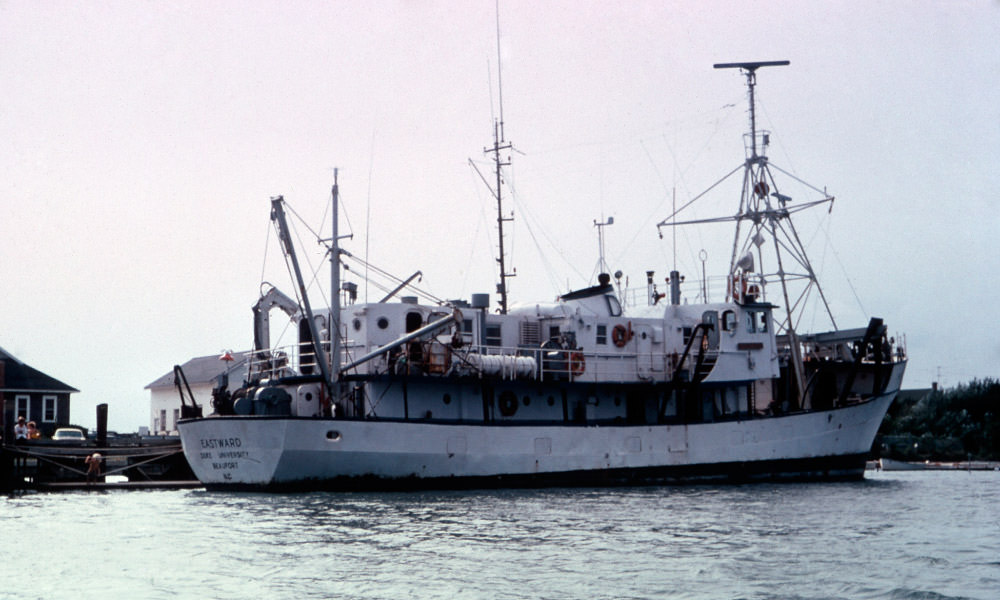
In 1973, a team of scientists aboard Duke University Research Vessel Eastward located the shipwreck remains of what they believed to be the USS Monitor lying upside down in 230 feet of water, approximately 16 miles off Cape Hatteras, North Carolina. A 1974 expedition utilizing the U.S. Navy's R/V Alcoa Seaprobe confirmed that the shipwreck was in fact the Monitor.
After the discovery, government officials faced the challenge of finding an applicable law to protect this important heritage artifact. While some proposed creating a new law specific to the Monitor, Congressman Walter B. Jones, Sr., of North Carolina's Outer Banks, recommended the use of the recently-passed National Marine Sanctuary Act (which was originally enacted as Title III of the Marine Protection, Research, and Sanctuaries Act of 1972).

The sanctuary was designated on January 30, 1975, as the first sanctuary created under the National Marine Sanctuaries Act. In many ways, the designation set the tone for the future of the Act, both in its recognition of the importance of our maritime heritage, and in its emergence as a way to protect the nation's underwater treasures.
Conserving the Monitor
The Monitor has now been on the ocean floor for more than 150 years, and those years have led to the ship's deterioration as a result of both natural processes and human activities. In 1996, NOAA was given a mandate by Congress to develop a plan to preserve the shipwreck, and in 1998, NOAA released a long-range plan that outlined a six-step proposal for stabilizing portions of the Monitor's hull and recovering the vessel's steam engine and rotating gun turret.
The Mariners' Museum in Newport News, Virginia, was first designated in 1987 as the repository for Monitor artifacts. In 2006, the Batten Conservation Laboratory Complex at The Mariners' Museum opened, housing thousands of small and large Monitor artifacts, and a year later, the USS Monitor Center opened to tell the incredible Monitor story.
A new look at the Monitor
Due to the Monitor's depth (~230 ft.), strong currents, and the often adverse weather conditions, it is not an easy task to fully document and survey the shipwreck site. Since its discovery, the Monitor has been documented with sonar images, video, and photographs. Photomosaics and line drawings have also been created from the images, but a full detailed site plan has not yet been done…until now.
This August, NOAA divers descended on the Monitor to take high resolution images of the shipwreck. When they dove, they were astonished by the clarity of the water. With visibility at about 100 feet, the divers took some of the most stunning images of the Monitor to date. From the measurements, an accurate and detailed Monitor site plan will be made for the first time using photogrammetry.