ALA ʻAUMOANA KAI ULI:
E/V Nautilus Brings Papahānaumokuākea Marine National Monument to People Around the World
By Sarah Marquis
November 2023
What do historic sunken warships and a charming dumbo octopus have in common?
These exciting deep-sea discoveries brought global attention to the remote Papahānaumokuākea Marine National Monument, not once, but twice in a single month.
During September of 2023, Ocean Exploration Trust (OET) and partners broadcasted an expedition live, allowing viewers to join along in witnessing unseen deep-sea habitats. The expedition took place aboard E/V Nautilus with remotely operated vehicle (ROV) and seafloor mapping operations in the largely unexplored northwestern section of Papahānaumokuākea Marine National Monument. While the expedition's main focus was the geology and biology of unexplored seamounts, the operating area included several historically-significant shipwrecks associated with the World War II Battle of Midway.
The Name: Ala
ʻAumoana Kai Uli
Papahānaumokuākea is a sacred place, a realm of the gods, from which Kānaka ʻŌiwi (Native
Hawaiians) believe life evolved, and to which souls return after death. With this
understanding,
the expedition name Ala ʻAumoana Kai Uli (Path of the Deep Sea Traveler) was crafted with
members of Papahānaumokuākea’s Native Hawaiian Cultural Working Group, OET, and monument
staff.
The name speaks to the respectful deep-sea research that was conducted on the expedition
while
also affirming our collective kuleana, or
responsibility and accountability, in protecting our
shared ocean.
“Ala ʻAumoana Kai Uli speaks to the work done on this expedition, but also speaks to the responsibility and accountability that we have to each other in protecting our shared ocean,” says Malia Evans, Oʻahu education and outreach coordinator for Papahānaumokuākea Marine National Monument.
“The name is a reflection of our collective experiences as people who love and protect the ocean, inciting images of physical and metaphoric paths, connecting ocean people to each other and various spaces within the ocean,” Evans says. “These paths have been meticulously tended over time, but the name also reminds us of our continued shared responsibility to care for these paths and our ever-developing relationships.”
Native Hawaiian language, worldview, knowledge, and protocols were incorporated throughout expedition activities, conducted in close collaboration with the Native Hawaiian Cultural Working Group facilitated by the Office of Hawaiian Affairs.
Mapping
Seafloor mapping focused on finding information not known about the northwestern section of
the
monument, and also took place during transits to and from Honolulu. This included filling
mapping gaps over five different seamounts, or underwater mountains.
ROV Dives
The expedition used E/V Nautilus’ ROVs to complete 12 successful dives focused on
deep
environments like seamounts, ridges, and underwater cultural heritage sites from the Battle
of
Midway.
The live stream on NautilusLive.org offered opportunities for scientists, students, educators, and the public to participate remotely from shore. Scientists onshore connected with personnel aboard E/V Nautilus via high-speed satellite-connected streaming and helped plan and execute science operations on the ship. People around the world experienced discoveries in Papahānaumokuākea and heard observations by the researchers in real time.
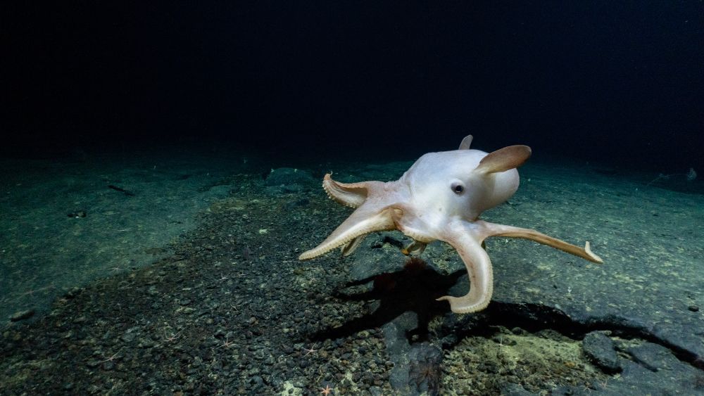
Deep-Sea Exploration
Researchers explored the deep-sea biodiversity and geological history of the northwestern
part
of Papahānaumokuākea, which is a more than five-day transit from Honolulu. Eight seamounts
were
explored, six for the first time. Samples were collected that will support studies to find
out
about biodiversity, geological age, and volcanic history of the region. Hundreds of species
were
observed, including some new to science.
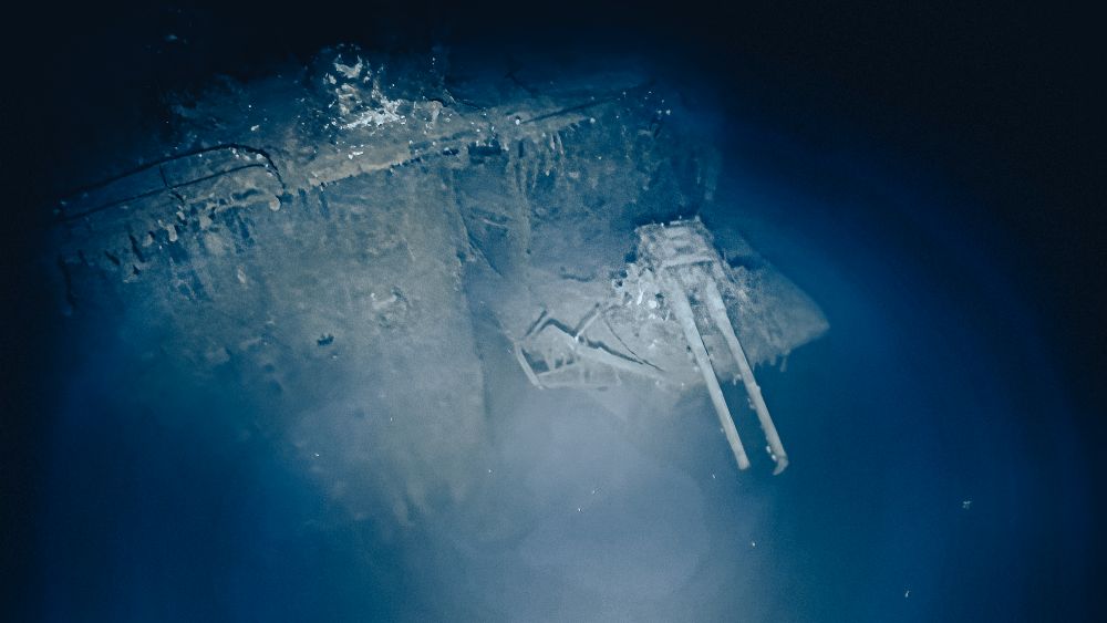
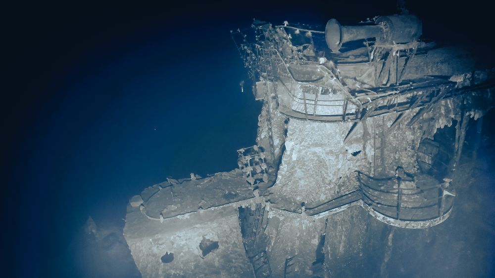
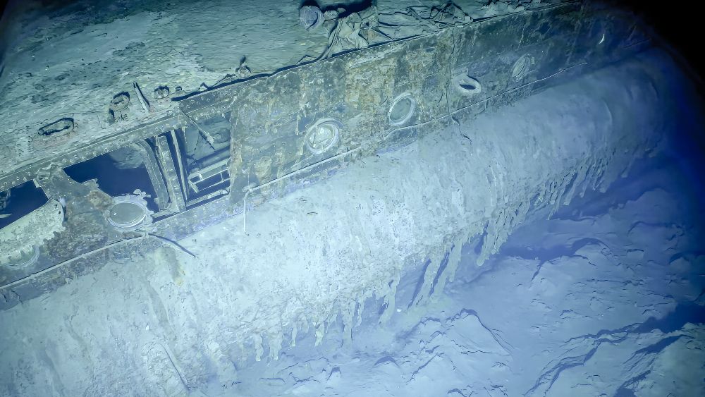
Maritime Archaeology
A highlight of the mission were the ROV-based surveys of three historically significant
aircraft
carriers lost during the Battle of Midway in World War II. Assessments included the first
visual
survey of the Imperial Japanese Navy’s Akagi, a complete visual survey of IJN Kaga, and the first
detailed views of USS Yorktown in 25 years.
The dives were launched and closed with protocol ceremonies to honor the location and all who lost their lives in ways that reflected their significance to Kānaka ʻOiwi, Japanese, and U.S. military families and communities.
This outstanding expedition reached widely across the world with over 1.6 million views of the 18 highlight videos produced during the month and over 11 million people interacting with the expedition on social media. The team connected with 172 classrooms and community events with over 40% of these programs reaching communities in Moananuiākea (the Pacific Ocean).
The expedition advanced NOAA priorities such as understanding ocean changes, sharing that knowledge with others, and conserving marine ecosystems. The mission also advanced priorities on diversity and inclusion by providing opportunities for individuals from historically marginalized groups to participate in expedition activities.
Papahānaumokuākea Marine National Monument and World Heritage Site is the largest contiguous fully-protected conservation area under the U.S. flag, encompassing an area of 582,578 square miles of the Pacific Ocean — an area larger than all the country's national parks combined. NOAA is conducting a process to designate the waters of Papahānaumokuākea as a national marine sanctuary.
The E/V Nautilus expedition was funded by NOAA Ocean Exploration via the Ocean Exploration Cooperative Institute, and executed under Permit PMNM-2023-003 approved by the State of Hawaiʻi, Office of Hawaiian Affairs, NOAA, and U.S. Fish and Wildlife Service.
Sarah Marquis is the West Coast/Pacific Islands media coordinator for NOAA Office of National Marine Sanctuaries.