|
|
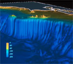
Computer imagery
shows the topography of the seafloor of
the Gulf of the Farallones National Marine
Sanctuary and the steep drop-off of the
continental slope past the Farallon
Islands. (photo: USGS Woods
Hole)
|
|

|
Just beyond the
Golden Gate of San Francisco lies an ocean
wilderness awaiting discovery. (photo:
Gulf of the Farallones NMS)
|
|
|
Drake's Beach in the
Point Reyes National Seashore provides a
meeting place for land and sea. Elephant
seals have just recently started to
recolonize this area. (photo: National
Park Service)
|
|
|
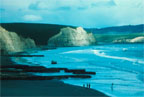
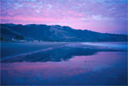
Sunrise at Stinson
Beach in Marin County is a sight to behold
in the early glow of morning. Twenty
minutes from San Francisco, this is a
popular weekend destination. (photo: Patty
Gaffney)
|
|
|
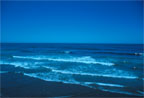
Sanctuary waves lap
on the shores of many sandy beaches up and
down the California coast. Public access
is readily available in many locations.
(photo: Gulf of the Farallones
NMS)
|
|
|
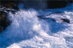
The Sanctuary meets
the land with force in the rocky
intertidal zone. High energy waves are
often present along shoreline areas of the
Gulf of the Farallones. (photo Dan
Howard)
|
|
|
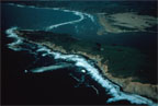
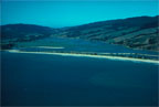
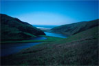
An aerial view of
Tomales Point and the entrance to Tomales
Bay also offers a perspective of the San
Andreas fault and two converging plates
photo: Gulf of the Farallones
NMS)
|
|

|
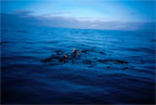
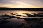
Sunset over the
waters of the Sanctuary during a tranquil
evening at sea. (photo: Sylvia
Earle)
|
|
|
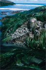
The rocky intertidal
comprises a narrow ribbon of habitat along
the coast of the Gulf of the Farallones.
Many species of invertebrates and algae
thrive in this unique habitat which is
exposed and submerged twice a day. (photo:
Joe Heath)
|
|
|
In the open waters
of the Sanctuary, kelp rafts form an
important floating habitat for
congregations of fish, sea lions, and
birds. (photo: Karina Racz)
|
|
|
Schools of rockfish
congregate in forests of nearshore kelp.
(photo: Tony Chess)
|
|
|
Bolinas Lagoon,
buffered by Stinson Beach and the Sea
Drift spit, is an important haul out site
for harbor seals in the Sanctuary. (photo:
Gulf of the Farallones NMS)
|
|
|
The picturesque
wetlands of Tomales Bay stretch inshore
and provide important habitat for birds on
the Pacific flyway. (photo: Dan
Howard)
|
|
|
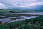
Nutrient-rich
mudflats reflect the evening glow at
Tomales Bay. (photo Dan Howard)
|
|
|
The Estero de San
Antonio and the Estero Americano are
unique brackish rivers that are within the
Gulf of the Farallones National Marine
Sanctuary. (photo: Dan Howard)
|
|
|
An aerial
perspective shows the South Farallon
Islands, surrounded by the Gulf of the
Farallones National Marine Sanctuary.
(photo: Jan Roletto)
|
|
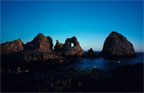
Arch Rock and the
rugged landscape of Southeast Farallon.
(photo: Amber Mace)
|
|
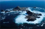
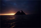
A lone fragment of
the South Farallones juts from the sea in
a dramatic close to another day in the
Sanctuary. Likely the same view that
inspired a Franciscan friar to name the
desolate rocks "Farallon," meaning "jagged
rock." (photo: Karina Racz)
|