National Marine Sanctuary System and System-Wide Monitoring
The National Marine Sanctuary System manages marine areas in both nearshore and open ocean waters that range in size from less than one to almost 140,000 square miles. Each area has its own concerns and requirements for environmental monitoring, but ecosystem structure and function in all these areas have similarities and are influenced by common factors that interact in comparable ways. Furthermore, the human influences that affect the structure and function of these sites are similar in a number of ways. For these reasons, in 2001 the program began to implement System-Wide Monitoring (SWiM). The monitoring framework (National Marine Sanctuary Program, 2004 pdf, 1.7MB) facilitates the development of effective, ecosystem-based monitoring programs that address management information needs using a design process that can be applied in a consistent way at multiple spatial scales and to multiple resource types. It identifies four primary components common among marine ecosystems: water, habitats, living resources and maritime archaeological resources.
By assuming that a common marine ecosystem framework can be applied to all places, the National Marine Sanctuary System developed a series of questions that are posed to every sanctuary and used as evaluation criteria to assess resource condition and trends. The questions, which are shown on page iii and explained in Appendix A, are derived from both a generalized ecosystem framework and from the National Marine Sanctuary System’s mission. They are widely applicable across the system of areas managed by the sanctuary program and provide a tool with which the program can measure its progress toward maintaining and improving natural and archaeological resource quality throughout the system.
Similar reports summarizing resource status and trends will be prepared for each marine sanctuary approximately every five years and updated as new information allows. Although this report follows a new Gray’s Reef sanctuary management plan, the information is intended to help set the stage for management plan reviews at each site. The report also helps sanctuary staff identify monitoring, characterization and research priorities to address gaps, day-to-day information needs and new threats.
Gray's Reef National Marine Sanctuary
- 17 square miles (16.68 square nautical miles)
- Designated a national marine sanctuary in 1981 by President Jimmy Carter
- One of the largest nearshore rocky reefs in the southeastern United States
- The only marine protected area in federal waters in the South Atlantic Bight
- Named for University of Georgia taxonomist Milton B. Gray, who studied the area in the 1960s
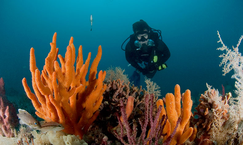
- Contains rocky ridges with associated attached organisms known as a "live-bottom habitat"
- A complex habitat of caves, troughs, burrows and overhangs attracts sea turtles, an estimated 180 species of fish, and other important marine organisms