Response to Pressures
The Office of National Marine Sanctuaries has a mandate to maintain biological communities and protect and restore native habitats, populations and ecological processes within its boundaries, while allowing compatible uses. A sanctuary management plan establishes research, monitoring and resource protection priorities and programs to address key threats or pressures. In addition to guidance provided through the management plan, sanctuary regulations specific to each site establish a range of activities that are prohibited or are authorized through a sanctuary permit if it can be demonstrated that the activity supports a sanctuary management objective and it will not substantially injure sanctuary resources. Olympic Coast sanctuary staff have worked with others in the sanctuary system to review concerns and develop consistent policies associated with activities common to multiple sanctuaries, such as submarine cable installation, alternative energy development, and anchoring of research buoys.
In addition to sanctuary authorities, other federal, state and tribal authorities, regulations and policies govern the conduct of specific activities within the sanctuary. The nature of overlapping jurisdictions and authorities requires coordination and collaboration between resource managers to achieve marine conservation objectives. The sanctuary superintendent must balance the diverse interests of citizens, organizations and partner agencies and make informed decisions that protect resources without inappropriately constraining sanctuary users and stakeholders. To better understand those interests and enlist help from those we serve, the sanctuary superintendent meets regularly with an Advisory Council that is comprised of representatives of Indian tribes, state and local governments, other federal agencies, industry, conservation organizations, and citizens. In 2007, the coastal treaty Indian tribes, the state of Washington and the sanctuary established an Intergovernmental Policy Council to provide a forum for the tribal, state and federal governments to coordinate activities within the sanctuary.
This section describes current responses and research and resource protection initiatives addressing selected pressures. Current responses are based on implementation of the 1994 sanctuary management plan and regulations, as well as specific programs to address threats which have emerged since the 1994 management plan. Strategies to address prioritized threats or pressures will be further evaluated and adapted during the management plan review process, scheduled to begin in September 2008.
Water Quality

Water Quality Monitoring
The sanctuary strives to understand, maintain and improve water quality within the sanctuary (Figure 29), and regulations prohibit discharges into sanctuary waters. Since 2000, nearshore oceanographic moorings have been deployed to measure water temperature and, as funding has allowed, the program has been expanded to cover a greater area and include additional sensors to measure salinity, dissolved oxygen, currents, plankton density and other standard environmental parameters (Figure 30). Information from these moorings, as well as data collected from periodic surveys from NOAA vessels, will lead to a better understanding of the links between the physical, chemical, and biological processes in productive nearshore waters and the connections with offshore and deeper waters. In turn, these data are useful to federal, tribal, university and state-sponsored studies of harmful algal blooms, helping to assess potential threats to human health and the health of birds and other marine mammals.These data are also used to correlate with intertidal invertebrate and algae studies, assist in oil spill response and improve our understanding of hypoxic conditions that have been measured off the Washington and Oregon coasts in recent years.

In an effort to establish baseline levels of persistent organic pollutants (industrial contaminants that remain for decades and can accumulate in organisms) in the ecosystem, the sanctuary has led and collaborated on several projects to measure contaminant levels in sediments, invertebrates and sea otters, against which future data can be compared.
Vessel Discharges
Sewage and graywater discharges from large vessels (300 gross registered tons or more), including cruise ships and container ships, are a concern in state and sanctuary waters. In 2004, a Memorandum of Understanding between Washington state, the Port of Seattle, and the cruise ship industry included an agreement to avoid dumping of biosolids (sewage sludge or solids from wastewater treatment systems) within 12 nautical miles (22 kilometers) of shore. In 2007, this agreement was expanded to avoid such discharge in all sanctuary waters. According to Port of Seattle statistics, approximately 150 cruise ship trips between Seattle and Alaska occurred in 2007, and each week-long trip generated about 106,000 liters (28,000 gallons) of sewage sludge. Cruise ships transiting the sanctuary are currently not prohibited from discharging minimally treated sewage, graywater and blackwater, in accordance with state and federal law. Consequently, the rapidly expanding cruise ship industry in the Pacific Northwest may have growing potential to impact sanctuary waters if not properly managed.Area To Be Avoided Monitoring and Compliance

A catastrophic discharge of oil from a maritime accident poses the single greatest risk to the sanctuary. Olympic Coast sanctuary staff worked with the U.S. Coast Guard and the International Maritime Organization to establish an Area To Be Avoided as a buffer and provide greater response time for assistance to foundering vessels along this rocky and environmentally sensitive coast (Figure 31). All ships transiting the area and carrying cargoes of oil or hazardous materials and all ships 1,600 gross tons and larger are requested to avoid this area. In addition, sanctuary staff participated in multi-party discussions that led to modifications to the vessel traffic lanes at the western entrance to the Strait of Juan de Fuca in an effort to increase the safety of commercial vessel transits through this busy area.
Since 1998, the sanctuary has been obtaining monthly vessel position files from the Canadian Coast Guard's radar site on Vancouver Island (Galasso 2000). This information is displayed as tracklines on a geographic information system. The data also includes vessel attributes that allow spatial and temporal analysis of behavior and trends, based on vessel characteristics. The Marine Exchange of Seattle has also been providing the sanctuary with data from the Automated Identification System to augment vessel transit monitoring. The sanctuary uses this information to create monthly transit plots of non-complying vessels, which are used as part of an outreach effort to the marine industry. Letters are sent out under signature of the sanctuary superintendent and the Coast Guard Captain of the Port to non-complying vessels observed within the Area To Be Avoided. The response by the maritime industry has been very favorable, with an approximated compliance rate of 98.8 percent in 2007.
Oil Spill Prevention
The sanctuary works closely with the U.S. Coast Guard, Washington Department of Ecology, Makah Office of Marine Safety and other organizations on oil spill response and preparedness by participating in oil spill drills, supporting a rescue tug stationed in Neah Bay, participating in discussions of alternative response technologies, prioritizing allocation of oil spill restoration funds, and reviewing proposed legislation, regulations and documentation. Since1999, Washington state has funded a seasonal rescue tug stationed at Neah Bay to quickly respond to vessels that may need assistance. As of February 2008, the tug has escorted, stood by or assisted 40 ships that were disabled or had reduced maneuvering or propulsion capability while fishing or transporting oil and other cargo through the sanctuary and along the Strait of Juan de Fuca.The sanctuary also has developed a site-specific Sanctuaries Hazardous Incident Emergency Logistics Database System (SHIELDS), which is designed to aid in spill response by providing a comprehensive reference and resource data tool.
Washington State Department of Ecology – Spill Response Rescue Tug at Neah Bay, Washington.
- Since 1999, a standby rescue tug has been stationed seasonally, generally October through March, in Neah Bay.
- The rescue tug has responded to 40 incidents of vessels in distress on the outer coast and in the western Strait of Juan de Fuca.
- Vessels in distress required a tow in eight instances; 27 incidents involved a tug escort of the distressed vessel.
- Reasons for tug responses include reduced or lost propulsion or steerage (30 incidents) and broken tow wires between tugs and fuel barges (three incidents).
- During the winter of 2007-08, the rescue tug was called out in response to six vessels in distress.
- Because of the high volume of shipping traffic, the remoteness of the outer coast and difficulty with implementing effective on-water response to a spill, and the potential devastating effects of an oil spill on tribal and federally protected shores, advocates have strongly supported permanent, year-round funding for a rescue tug in Neah Bay.
- In March 2008, the Washington state legislature for the first time approved funding for year-round rescue tug contract services, anticipated to extend through June 2009.
- A future funding source for the rescue tug is being sought but currently is uncertain.
- Federal legislation requiring the shipping industry to pay for year-round, standby rescue tug service at Neah Bay has been introduced by Senator Maria Cantwell.
Habitat
Habitat Mapping
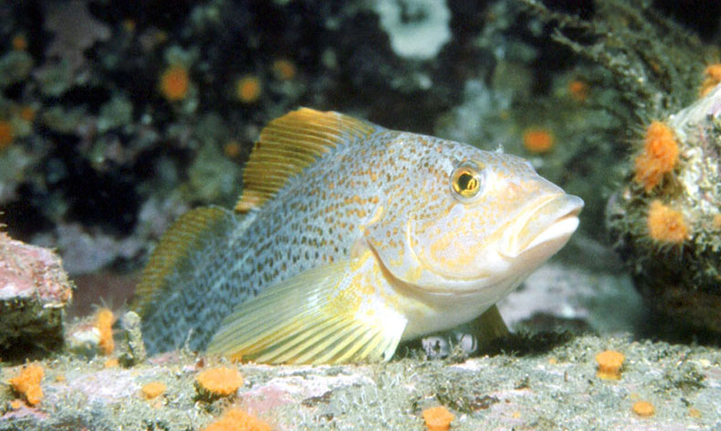
The sanctuary does not directly manage fisheries within sanctuary waters; however, sanctuary research informs fisheries management entities, particularly on habitats within sanctuary boundaries. Starting in 2000, the sanctuary embarked on a project to characterize seafloor habitats within the sanctuary, using advanced acoustic and optical technologies to create digital images, and verifying those images using remotely operated vehicles and drop-cameras (Figure 32). The imagery helps to characterize the types, distribution and abundance of seafloor habitats, and groundtruthing helps to verify classification results, as well as to provide new habitat information. Furthering this research was a key recommendation of Washington's Ocean Action Plan (The Office of the Governor 2006) and is a priority for the Intergovernmental Policy Council. These efforts can support crucial management issues, such as protecting critical habitats, identifying areas of undisturbed deep-sea coral and sponge communities, or examining fishing regulations to aid in the recovery of declining fish populations.

Deep Sea Coral Research and Conservation
In 2004 and 2006, sanctuary staff, in partnership with the National Centers of Coastal Ocean Science conducted side-scan and video surveys of offshore habitats. The focus of this initiative was to document the presence of hard-bottom habitats in deepwater areas of the sanctuary and video survey any associated living communities. Hard substrates often harbor diverse assemblages of invertebrates and fish, including corals, sponges and other extremely slow-growing fauna that are particularly sensitive to human disturbances. Several species of corals and sponges were documented at 14 of the 15 sites surveyed in 2006; sites located both inside and outside of the protective Essential Fish Habitat conservation area (Olympic 2). Numerous gorgonians, two stony coral species (Lophelia pertusa andDesmophyllum dianthus) and small patches of the reef-building sponge (Farrea occa) were found (Figure 33). Some anthropogenic disturbance to these seafloor communities was also documented. Future explorations will continue to improve our understanding of deep coral and sponge habitat, its distribution and ecosystem functions, and potential pressures on that system (Brancato et al. 2007).
Derelict Fishing Gear and Marine Debris
In 2005, the sanctuary was awarded funds from NOAA's Marine Debris Program for a pilot project to identify and remove derelict fishing gear in the northern part of the sanctuary, as well as to develop safe operating protocols for gear removal operations while working in the open ocean environment. This pilot project was a partnership with the Makah Tribe with a goal to build capacity in an affected community to conduct future derelict gear removal projects. Fishery managers and fishermen were interviewed and multiple target areas over a few kilometers of nearshore waters near Cape Flattery were surveyed by sonar and divers. Three abandoned fishing nets and several crab pots were located and recovered, along with evidence of ghost fishing (Figure 34). The extent of the problem over many kilometers of the outer coast and deeper waters of the sanctuary remains unclear.Another grant the sanctuary received from NOAA's Marine Debris program in 2007 supported collaborative development of a long-term strategy to remove accumulated marine debris from the outer coast of Washington state, beaches adjacent to the sanctuary and beyond. State and federal agency representatives joined with Native American tribes and non-government organizations to outline a strategy that addresses both the remote wilderness shores of Olympic National Park and tribal reservations and the more accessible areas where beach driving facilitates removal of marine debris. Partner agencies formed a new organization, Washington Clean Coast Alliance, to coordinate public outreach, volunteer coordination, and event planning, as a successor to the private citizen who was largely responsible for cleanup efforts dating back to 2000. The alliance's first event in April 2008, scheduled to coincide with Earth Day, was a great success. More than 1,100 volunteers joined the effort and enjoyed the beach while removing nearly 23 tons of debris.
Fiber-Optic Cable Permit Compliance and Monitoring
In 2006, the Pacific Crossing responded to sanctuary and tribal concerns over improper burial of the Pacific Crossing PC-1 fiber-optic submarine telecommunication cables by reinstalling the cable through the sanctuary. The goal of this effort was to minimize risks of interactions with fishing gear, reduce cable damage, and to minimize ongoing impacts to seafloor habitats. Sanctuary regulations generally prohibit seafloor disturbances. Post-installation assessment revealed improved cable burial, yet the cable remained unburied and suspended in limited areas, which confirms the difficulty of cable burial where the seafloor has boulders, compacted subsurface deposits, and bedrock (Tyco 2006). Under conditions in its sanctuary-issued permit, Pacific Crossing will mitigate risks to fisherman utilizing bottom contact gear through directed outreach concerning cable locations and burial states. The sanctuary has also implemented a monitoring program that has provided important information on the rate of seafloor habitat recovery following disturbance associated with cable installation, and which will inform future decision-making on similar proposals.Living Resources
Groundfish Protection/Designation of Essential Fish Habitat
Recent significant conservation actions applied to the sanctuary area include the establishment of conservation areas to protect groundfish habitat and minimize the bycatch of overfished species. In 2000, the state of Washington prohibited bottom trawling in state waters (Figure 35). More recently, the Pacific Fishery Management Commission and NOAA Fisheries Service designated multiple areas along the West Coast as Essential Fish Habitat (EFH) areas with specific fishing restrictions. Five EFH areas were adopted off the coast of Washington that are closed to non-tribal bottom trawl fishing. One unit, the Olympic 2 EFH Conservation Area closure, is located within the boundary of the sanctuary (Figure 35) and is closed to all types of non-tribal bottom trawl fishing gear, but not all types of bottom-contact gear, such as longline gear. Olympic 2 EFH covers 7 percent of the sanctuary area. The EFH measures also included a prohibition of bottom trawl activity deeper than 700 fathoms West Coast-wide. The EFH areas were implemented through amendment 19 to the Pacific Coast Groundfish Fisheries Management Plan and went into effect in 2006. In addition, Trawl Rockfish Conservation Areas (RCA) are temporary, large-scale closed areas that extend along the entire length of the U.S. West Coast that are expected to be in place until key overfished rockfish species recover, potentially for more than 80 years. Commercial trawl RCA boundaries approximate particular depth contours that can change during the year (Figure 35) and are designed to minimize opportunities for vessels to incidentally take overfished rockfish by eliminating fishing in areas where and when those overfished species are likely to co-occur with more healthy stocks of groundfish. In 2008, this Trawl RCA covers between 40 and 48 percent of the sanctuary. A Non-trawl RCA (i.e., the RCA for gears other than trawl, such as longline and pot gear for fish) is closed from the shore seaward to 100 fathoms year-round (Figure 35). This Non-trawl RCA applies to 81 percent of the sanctuary. In addition, there are specific area closures within the sanctuary that are permanent in nature and pertain to specific fisheries — the North Coast Commercial Yelloweye RCA that applies to fixed gear (e.g., longlines and pots) and recreational groundfish and halibut fisheries, the North Coast Recreational RCA, and a small Salmon Troll RCA that lies within the North Coast Recreational RCA (Figure 35). It will be important to monitor the EFH and RCAs to detect changes in physical habitat and groundfish populations.
Intertidal Habitats
In response to growing concerns about impacts of increased visitation to the shores, sanctuary and Olympic National Park staff cooperated in an effort to examine the threats and opportunities to protect intertidal resources along the Olympic Coast. Science experts and citizen representatives outlined activities that are potentially degrading to intertidal areas and disturbing to wildlife, and identified a set of ecologically significant habitats and a range of potential management actions, including possible establishment of no-harvest areas, or intertidal reserves. These sites would provide long-term protection of the federally owned shores as human use increases. Intertidal reserves covering roughly 30 percent of the park's shore were incorporated into the park's Final General Management Plan released in March 2008 and will be subject to existing tribal treaty use of such zones.Monitoring Programs
A variety of monitoring programs have been established in the sanctuary to assess various aspects of population levels, distribution and health of living resources. Seabirds can be considered sentinel species, or indicators of ocean health, because they depend on forage fish and invertebrates for their food. Seabirds, whales and dolphins are monitored during ship-based observations along established transect lines. The sanctuary supports monitoring of pinniped species (seals and sea lions) by state, federal and tribal biologists. The sea otter population size is assessed annually during coordinated aerial and land-based observations in collaboration with the U.S. Geological Survey, U.S. Fish and Wildlife Service, Washington Department of Fish and Wildlife, and the Seattle Aquarium. Olympic Coast sanctuary staff also partner with the University of Washington on the Coastal Observation and Seabird Survey Team (COASST) to monitor seabird mortality on beaches along the Olympic Coast and the Strait of Juan de Fuca. The kelp canopy is monitored annually in collaboration with the Washington State Department of Natural Resources. These surveys are conducted with aerial imaging systems to assess total area of kelp coverage. Volunteer organizations also monitor living resources in the sanctuary, such as the Reef Environmental Education Foundation, which conducts visual fish surveys in subtidal habitats.Sea Otter Health Study
In 2001 and 2002, the sanctuary joined with the U.S. Fish and Wildlife Service and U.S. Geological Survey to conduct focused research on the health of sea otters off Washington state (Brancato et al. 2006). This study was a response to suspicions that increased disease susceptibility resulting from contaminant-induced immunosuppression may be responsible for the decline of the California sea otter population, where infectious disease and cardiac disease have been significant mortality factors. With range expansion possible to the south along the Washington coast and east into the Strait of Juan de Fuca, the Washington sea otter population is facing new or additional risks due to increased anthropogenic influences and a different ecosystem. Unlike other marine mammals that migrate extensively, sea otters provide an unusual opportunity to study a mid- to high-trophic level marine consumer inhabiting highly industrial to extremely remote habitats throughout its occurrence in the Northeast Pacific. Because both the sea otters and their principal prey are relatively sedentary, their contaminant burdens should reflect localized contamination. In 2001 and 2002, 32 sea otters were captured, of which 28 were implanted with transmitters to track their movements, and liver and blood samples were collected to evaluate contaminant and pathogen exposure. The results indicate low levels of contaminants in general, but high levels of exposure to morbillivirus and Toxoplasma, the latter of which has been a significant cause of mortality in southern sea otters in California.Wildlife Disturbance
To protect seabirds, migratory waterfowl, endangered species, and marine mammals from disturbance and harassment, a sanctuary regulation prohibits flights of motorized aircraft at less than 2,000 feet (610 meters) within 1 nautical mile (1.9 kilometers) of national wildlife refuge islands or the shore, with exceptions for tribal timber operations on reservation lands. To improve familiarity and compliance with this regulation in the recreational pilot community, the sanctuary implemented an outreach program that focused on small aircraft at regional air strips. Sanctuary representatives have attended regional air shows to meet local pilots, talk about the sanctuary's resource protection concerns, and distribute fliers and posters that explain the regulation and its purpose.Invasive Species Mitigation and Monitoring
As mentioned above, Washington state has implemented regulations to minimize the risk of invasive species introductions, which require all vessels 300 gross tons or more travelling from foreign ports to exchange of ballast water in the open ocean or to treat the ballast water before discharging in state waters, and to submit ballast water reports. In addition, ships considered U.S. coastal traffic, including Canadian waters, must exchange ballast water no closer than 50 nautical miles (93 kilometers) offshore. The Marine Exchange of Puget Sound reports very high compliance rates with these requirements. Washington Department of Fish and Wildlife and the Washington State Invasive Species Council foster active management to reduce impacts from invasive species.The sanctuary has sponsored two seasons of rapid assessment (2001 and 2002) of intertidal areas, bringing together a team of taxonomic experts to survey and identify non-indigenous species, as well as to inventory native species. Those surveys documented 10 non-indigenous invertebrate and algal species and, in a joint study with the Smithsonian Environmental Research Center in 2003, two invasive ascidians and one invasive barnacle were also documented (deRivera et al. 2005). A third rapid assessment to cover additional areas of the coastline will be conducted when funding is available. Rigorous monitoring and early detection of non-indigenous species are important tools in minimizing the harmful effects of non-native invaders.
The Olympic National Park and sanctuary staff also conduct long-term intertidal monitoring of both sandy and rocky habitats in order to inventory invertebrates and identify trends in populations. This monitoring program, though not specifically designed to address non-indigenous species, serves as an early warning detection program for non-native species that may become invasive (rapidly reproducing, aggressive or highly competitive with native species) within the region.
The sanctuary also partners with the Washington State Department of Fish and Wildlife and the Makah Tribe in monitoring for the invasive European green crab at sites in Neah Bay and Makah Bay. This non-native crab competes with native species for habitat and food and has proved quite destructive in other areas of the country. To date, no European green crabs have been detected along the sanctuary coast or in Neah Bay, although green crabs have been found just south of the sanctuary boundary in Willapa Bay and also north of the sanctuary along Vancouver Island, B.C.
Military Activities
The Navy is currently developing two environmental impact assessments for proposed federal actions — one to extend the Quinault Underwater Tracking Range and another to address current, emerging and future fleet training activities in the Northwest Training Range Complex. These multi-year assessments will include opportunities for public input and comment, and are expected to be completed in 2009. Sanctuary staff will be active participants in the environmental assessment process to evaluate potential impacts to sanctuary resources and develop appropriate protection measures. The proposed extension of the Quinault Underwater Tracking Range site could involve the continued testing of non-weaponized equipment in and near the sanctuary.Maritime Heritage
Coastal archaeological resources may be negatively impacted by rising sea levels and environmental forces. Under the National Historic Preservation Act, federal agencies are required to inventory and assess resources to determine what, if any, management actions could be taken in an effort to preserve critical sites and material. While programmatic funding has been limited, the sanctuary has participated in individual projects, using small grant funding and staff time as available. Examples of shipwreck studies include Office of National Marine Sanctuaries nationally funded shipwreck surveys of Destruction Island, Quillayute Needles, La Push and Cape Flattery vicinities and intertidal surveys of the wreckAustria conducted with community members and graduate students. Examples involving prehistoric resources include a surface survey of Tatoosh Island, conducted by the Makah Tribal Historic Preservation Officer with sanctuary staff assistance, test pit excavation led by the Makah on paleoshoreline sites on the Makah Reserveration (including one excavation funded by a NOAA Maritime Heritage Program minigrant), and periodic visual assessments of known prehistoric sites undertaken cooperatively with the Makah and archaeologists from Olympic National Park. In addition to these activities, sanctuary staff frequently consults with partner organizations as incidents or specific threats arise.
Climate Change
Changing climatic conditions can not be managed at the level of the sanctuary. However, the sanctuary can assist in documenting the direct effects of climatic changes by recording oceanographic properties such as water temperature and dissolved oxygen levels over time. Using remote moorings, the sanctuary records ocean conditions continuously for the duration of the field season, and — with improved equipment and mooring apparatus — could extend monitoring efforts throughout the year. These data can be shared with other researchers, such as fisheries biologists, to better understand the effects of ocean conditions on these economically important resources. The sanctuary also indirectly assesses responses to climate change in living resources though long-term monitoring of marine birds and mammals, intertidal organisms and invasive species. Associations between ocean conditions, possibly driven by climate change, and the presence of harmful algal blooms or hypoxic conditions are explored through both sanctuary programs and collaborative efforts that include the Olympic Region Harmful Algal Bloom consortium, Ecology and Oceanography of Harmful Algal Blooms, and Partnership for Interdisciplinary Studies of Coastal Oceans.
Coastal archaeological resources may be negatively impacted by rising sea levels. These resources, most on national park and Indian reservation lands, should be inventoried and assessed in order to help managers interpret what, if any, management actions could be taken in an effort to preserve critical sites and material. The sanctuary recognizes this need and will continue to conduct and facilitate these inventories.