NOAA, partners, survey historic WWII-era aircraft carrier
Seventy years after its service in World War II, NOAA, working with private industry partners, has confirmed the location and condition of the USS Independence. Resting upright in 2,600 feet of water off California’s Farallon Islands, the aircraft carrier’s hull and flight deck are clearly visible in sonar images, with what appears to be a plane in the carrier’s hangar bay. Independence (CVL 22) was the lead ship of its class of light aircraft carriers that were critical during the American naval offensive in the Pacific, and later was one of more than 90 vessels assembled as a target fleet for the Bikini Atoll atomic bomb tests in 1946. After returning to the United States, the blast-damaged carrier was scuttled in 1951.

Features on an historic photo of USS Independence CVL 22 are captured in a three-dimensional (3D) low-resolution sonar image of the shipwreck in Monterey Bay National Marine Sanctuary. The Coda Octopus Echoscope 3D sonar, integrated on the Boeing Autonomous Underwater Vehicle (AUV) Echo Ranger, imaged the shipwreck during the first maritime archaeological survey. The sonar image with oranges color tones (lower) shows an outline of a possible airplane in the forward aircraft elevator hatch opening.
Credit: NOAA, Boeing, and Coda Octopus
B-Roll video of Boeing's Autonomous Underwater Vehicles (AUV) Echo Ranger.
Credit: Boeing
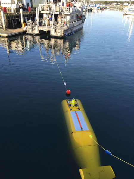
During the 2015 mission to survey the ex-USS Independence CVL 22, the Office of National Marine Sanctuaries' research vessel Fulmar served as the escort boat for Boeing’s Autonomous Underwater Vehicle (AUV) Echo Ranger. The 67-foot aluminum catamaran research vessel’s crew is preparing to tow Echo Ranger to sea.
Credit: Robert V. Schwemmer, NOAA

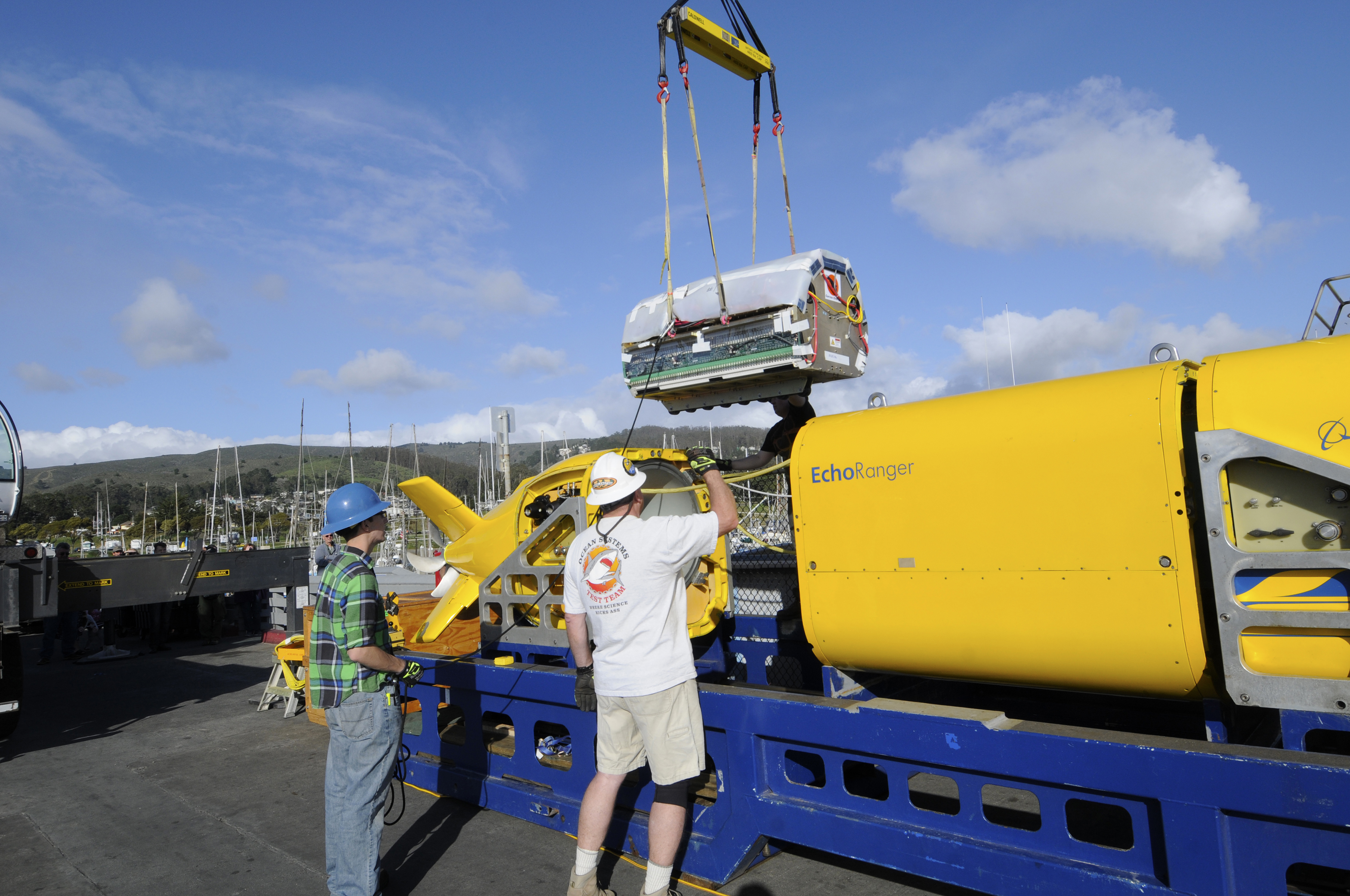
Boeing's project engineer, Ross Peterson, oversees the installation of the lithium polymer battery into Boeing's Autonomous Underwater Vehicle (AUV) Echo Ranger at Half Moon Bay. The battery is specifically designed for the AUV, providing the power needed for the 60 mile roundtrip mission in the Monterey Bay National Marine Sanctuary.
Credit: Robert V. Schwemmer, NOAA
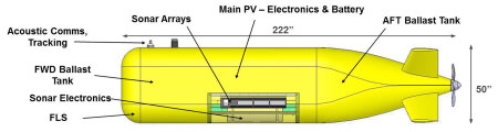
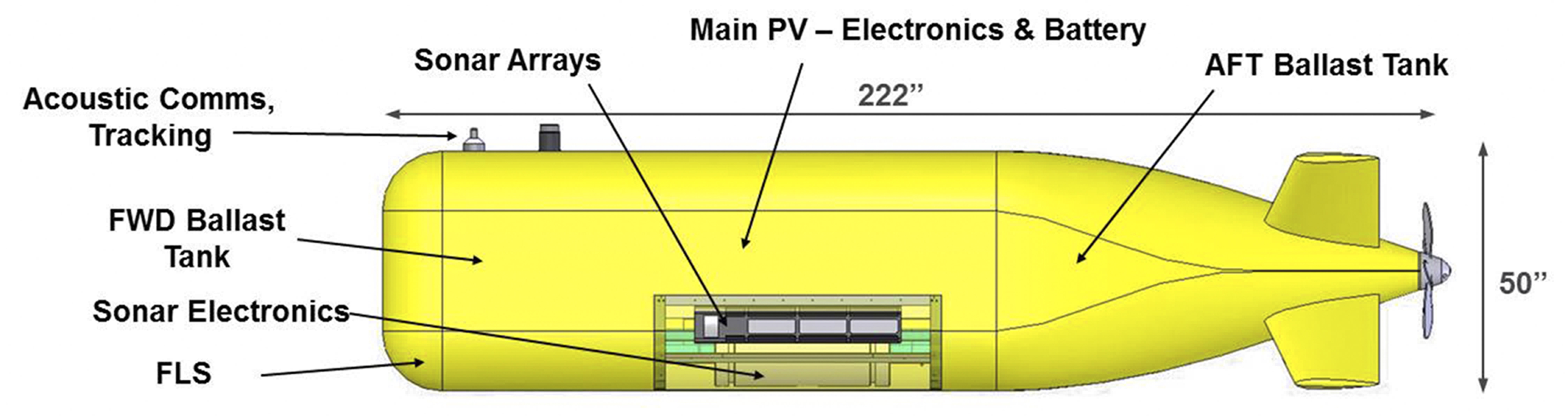
Illustration of Echo Ranger
Credit: Boeing

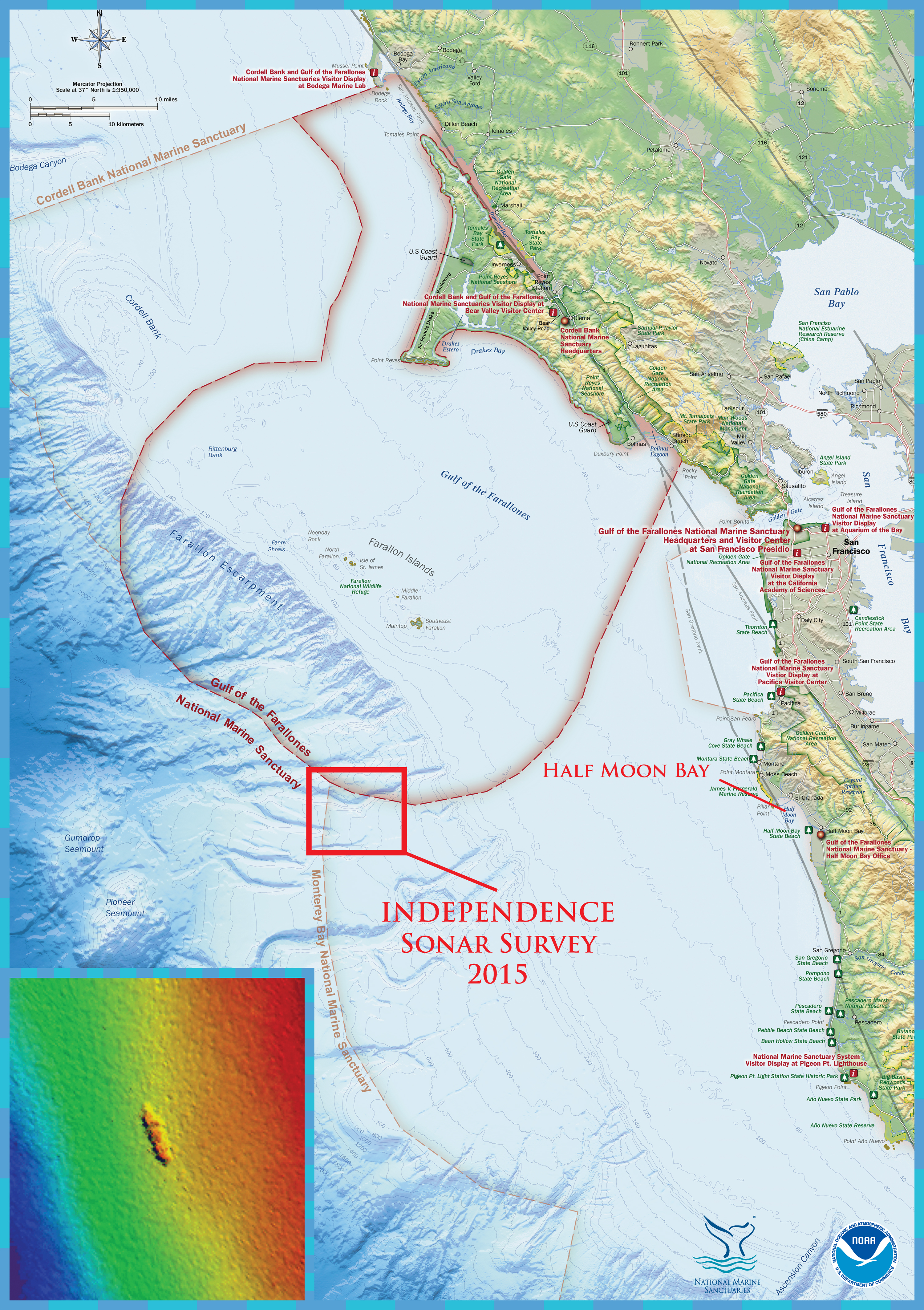
The shipwreck site of the former aircraft carrier, Independence, is located in the northern region of Monterey Bay National Marine Sanctuary. Half Moon Bay, California was the port of operations for the Independence survey mission. The first multibeam sonar survey of the Independence site was conducted by the NOAA ship Okeanos Explorer in 2009.
Credit: NOAA's Office of Ocean Exploration and Research and NOAA's Office of National Marine Sanctuaries
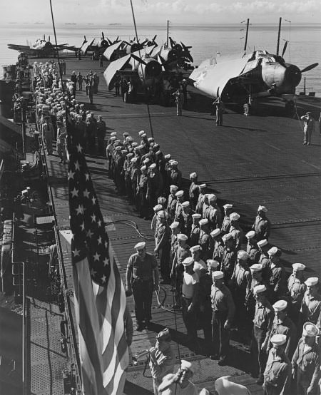
Muster on the flight deck of USS Independence (CVL 22), 1943. “Attention to Colors,” as the American flag is being hoisted aloft.
Credit: U.S. Navy, National Archives

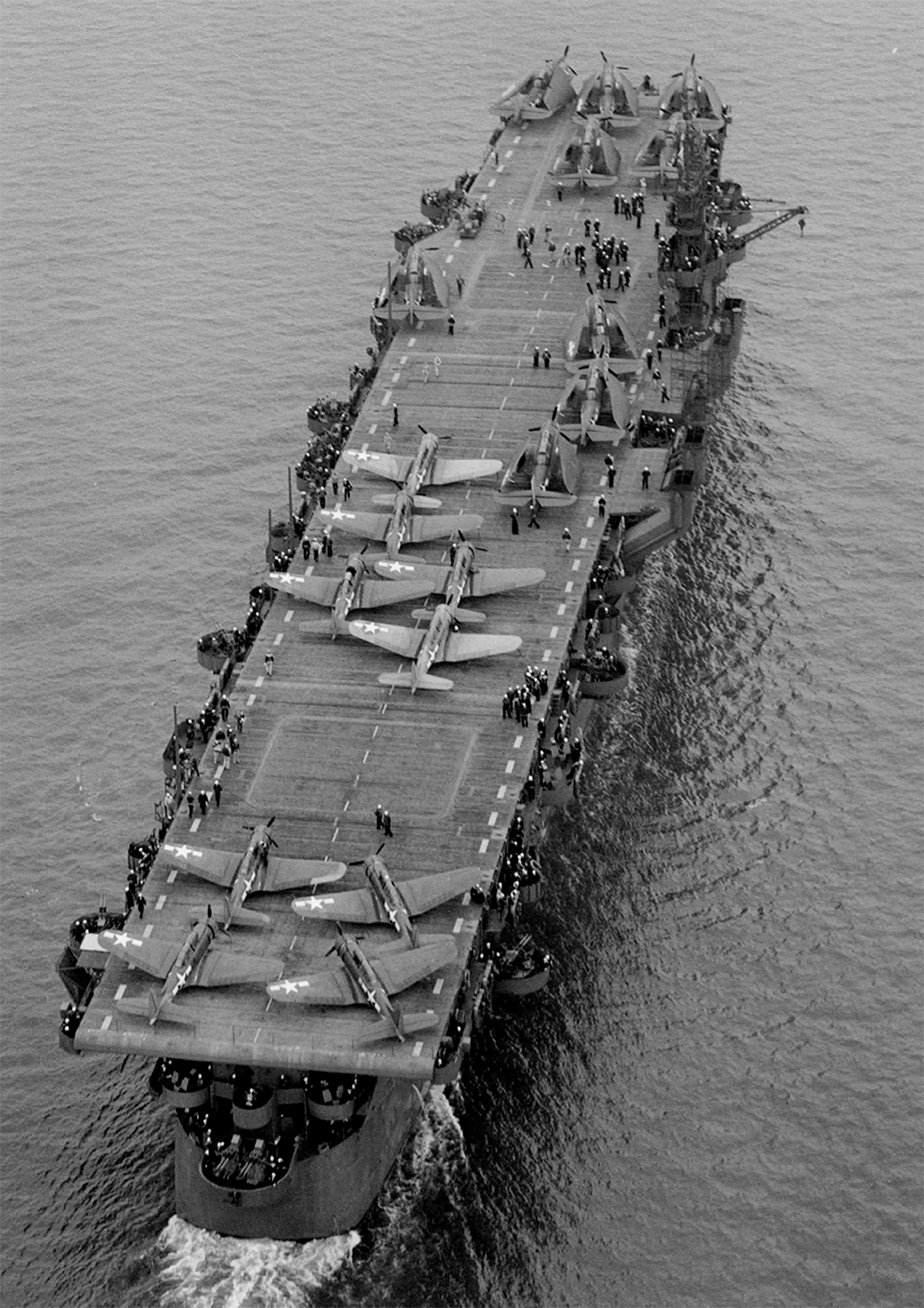
Aerial view of USS Independence (CVL 22) underway July 15, 1943 in San Francisco Bay, California. Before departing San Francisco, USS Independence’s hull classification changed from CV 22 “aircraft carrier” to CVL 22, “light aircraft carrier.”
Credit: U.S. Navy, National Archives, 80-74436
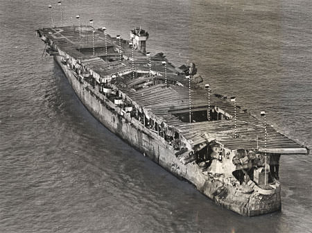
Aerial view of ex-USS Independence at anchor in San Francisco Bay, California, January 1951. There is visible damage from the atomic bomb tests at Bikini Atoll.
Credit: San Francisco Maritime National Historical Park, P82-019a.3090pl_SAFR 19106
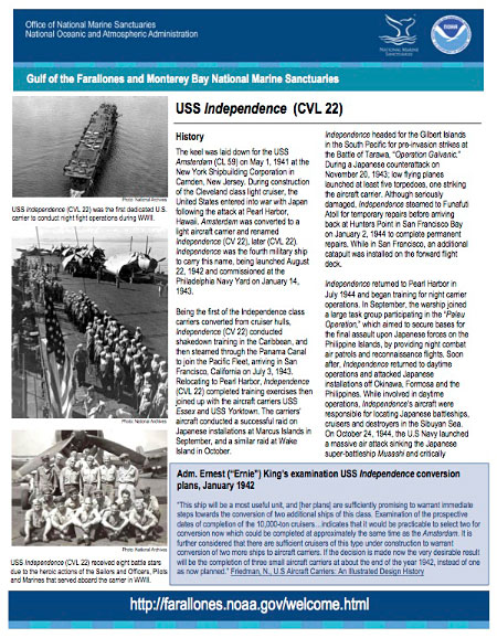
USS Independence fact sheet
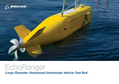
Echo Ranger fact sheet
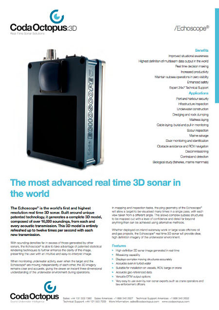
Coda Octopus 3-D Echoscope brochure. Coda Octopus and NOAA's previous collaboration.