Error processing SSI file

back button

100 dpi image

Error processing SSI file

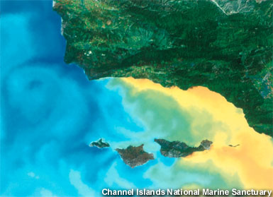
This satellite image illustrates the temperature variation in the Northern Channel Islands. Temperature ranges are represented as follows: blue = 44-52º F, green-yellow = 56-64º F, and orange-red = 65-72º F. The California current brings cold water down from the Gulf of Alaska, which influences the northwestern islands: San Miguel, Santa Rosa, and part of Santa Cruz. Warm currents affect Santa Barbara Island (not pictured), Anacapa and the eastern side of Santa Cruz. (photo: Channel Islands NMS)

Download/Display 300 dpi image
NOAA logo Revised September 12, 2023 by Sanctuaries Web Group
Many links leave the National Marine Sanctuary Web Site - please view our Link Disclaimer for more information
National Ocean Service | National Oceanic and Atmospheric Administration | Privacy Policy | Contact Us
http://sanctuaries.noaa.gov/includes/sancphotofoot.html