
Historical Ecology Within National Marine Sanctuaries
Archival data offers useful information about marine ecosystems in the past and helps us manage these fragile resources in the future.
How can we tell what the marine environment looked like underwater before the advent of modern science, before scuba diving, submarines or sonar? The fish kept no records. Can we somehow ask our forefathers if they knew about the variety and wealth of marine life underwater?
This, in effect, is what the National Oceanic and Atmospheric Administration (NOAA) and university partners are attempting to do: look at our changing marine environment through the eyes of people from as early as the 17th century.
Pouring over charts, fishing logs, explorer's narratives, naturalists journals, maps, letters, scientific surveys, and many other historical records, researchers are now painting a fascinating picture of past environments, the people that depended on them for their livelihood, and the changing nature of the interactions between the two. Much as historical research tells us about past cultures, marine historical ecology research reveals how marine ecosystems and their resources have been altered over the centuries.
By studying the history of the ocean environment through historical records, we hope to gain a better understanding of how best to sustain and enhance the ecological diversity of several of our national marine sanctuaries. Research efforts are currently underway in Stellwagen Bank National Marine Sanctuary, Florida Keys National Marine Sanctuary and soon in the Monterey Bay National Marine Sanctuary.
| Current Historical Ecology Projects |
Stellwagen Bank NMS
Florida Keys Coral Reef Ecoregion
Monterey Bay NMS
Historians and fisheries scientists from the University of New Hampshire are analyzing historical documents to estimate the size and extent of historical fish populations in the Stellwagen Bank National Marine Sanctuary.
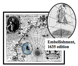 |
| John Smith's Map of New England, 1616, with Stellwagen Bank NMS superimposed, and indications of prolific abundance of fish in sanctuary waters. Courtesy Karen Alexander, GMCP (Library of Congress) |
This innovative approach provides NOAA scientists and managers with data that predates modern fisheries science, and extends their understanding of what the sanctuary ecosystem looked like before mechanized fishing fleets. NOAA is funding this effort to bring new sources of data and historical perspectives to marine resource management and conservation. This type of historical analysis is providing to be valuable in understanding the Stellwagen Bank National Marine Sanctuary. The methods are now being applied to look at historical changes in marine populations and the environment in other marine protected areas.
Facts and figures
- Massachusetts is the birthplace of commercial fishing and whaling in US waters.
- First shortage of cod in a Gulf of Maine fishery was documented by Massachusetts merchants in 1659.
- Atlantic grey whales were hunted in the Gulf of Maine in the 1600s. They were commercially extinct by 1700 and entirely gone by 1800.
- Maps and charts of Massachusetts Bay fishing grounds begin to appear in the 1600s and continue in the 1700s, and 1800s.
- Stellwagen Bank was charted officially in the 1850s. However, fishermen knew of the underwater plateau long before, because it was a good fishing ground. They called it Middle Bank in the 1760s. Many fishermen still call it that today.
- Biomass estimate for adult cod in the region in 1852 was 1.26 million metric tons, and derived from New England fishing logs (Rosenberg et al. 1995*)
(*Rosenberg A.A., W.J. Bolster, K.E. Alexander, W.B. Leavenworth, A.B. Cooper, and M.G. McKenzie. 2005. The history of ocean resources: modeling cod biomass using historical records. Frontiers in Ecology and the Environment 3(2): 84-90).
Return to Top
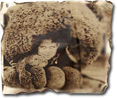 |
| Photo from Miami Herald, 1929 showing sponges taken from the Florida waters. |
The Florida Keys holds the largest and most diverse coral reef ecosystem in the continental United States, but reefs in the Florida Keys have been degraded by centuries of overfishing and habitat loss. Understanding the degree of change that has occurred over time and how the ecosystem functioned in a more pristine state is essential for management and restoration of Florida's ecologically and economically important reef communities. Historical ecology analyzes a variety of historical information sources-ranging from 18th century ship's logs to early fisheries reports and settler's journals-to describe the Keys' marine ecosystems and determine the degree of change that has occurred.
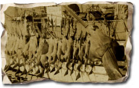 |
| SHARK FISHERY (Photos from Monroe County Library, Newspaper Clipping from US National Archives) |
Over 500 sources, including natural history descriptions, maps and charts, family and personal papers, and state and colonial records, have been collected from 18 archives in the U.S., United Kingdom, Spain, and the Bahamas. They are being analyzed by researchers at the Scripps Institute of Oceanography. These documents allow us to understand the timeline of events influencing the Florida Keys and surrounding coral reef ecosystems. Their descriptions can be used to form an historical narrative describing the ecological and human setting in the Florida Keys region, as well as the broader ecological and socioeconomic connections between the Keys and the Atlantic Ocean and Caribbean Sea and describe how these connections led to historical exploitation of marine animals.
Facts and Figures
- The Florida Keys is the third longest reef tract in the world.
- The Florida Keys has over 3 million visitors each year and these visitors contribute over $4 billion annually to Florida's economy.
- Two major groups of peoples, the Calusa and the Tequestra, occupied and fished in the Florida Keys before the Spanish arrived in 1513.
- Wreckers and pirates set up temporary camps throughout the Keys in the beginning of the 16th century, relying heavily on the marine resources of the islands for food while they were on ships sailing the channel between the Keys and the Bahamas.
- At the end of the Seven Years War, the territory of Florida became British. While the Keys remained under Spanish jurisdiction, Britain sent surveyors to produce charts of the region.
- Florida returned to Spanish control in 1763, and remained so until 1821, when Spain ceded Florida to the United States.
- Florida was granted statehood in 1845.
- The Key West green turtle cannery opened in 1849, and sponges began to be exported in the same year.
Return to Top
The Monterey Bay National Marine Sanctuary has some of the richest maritime history on the west coast of America due to its productive waters and related fisheries. People of varied ethnic backgrounds were brought together over hundreds of year in the Monterey area attracted by its rich ocean resources. However, much of the historical data relating to this history is scattered around California and national archives.
In 2008, the Sanctuary program and its partners undertook a project to understand the historical ecology of this region. The first step is to collect and digitize archived historical sources such as state and federal records, natural history descriptions, photos, maps and charts for the region. These materials are compiled with an annotated bibliography of sources and timeline of events that describe the maritime history of the Monterey Bay area. These archival materials represent a window to the past Monterey Bay ecosystem and the unique local cultural heritage that utilized its resources. The executive summary of this research and a pdf of the source survey report can be found here.
Return to Top
|


 of original research records from the US Fish Commission