 |
|
|
 |
Error processing SSI file
|
Mission Plan
During the cruise, researchers will address the following objectives:
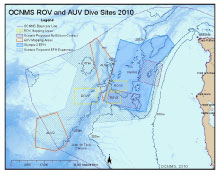 |
| ROV and AUV Dive sites in the Leg 1, Olympic Coast National Marine Sanctuary. Click here for a larger image. (OCNMS) |
The McArthur II will survey deep sea coral and sponge communities from Washington to southern California in three legs to 1) locate and characterize deep-sea coral and sponge habitats and to make this information available to support related fisheries and sanctuary management needs, 2) to generate information to help understand the value of deep-sea coral as habitat for other associated species, including commercially important fishes and invertebrates, and in providing other important ecosystem functions (e.g., potential reservoirs of biodiversity); and 3) to assess the condition of deep-sea coral communities in relation to commercial fishing activities and other potential human-caused or environmental disturbances.
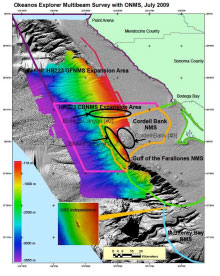 |
| Dive sites for Leg 2 Cordell Bank National Marine Sanctuary (CBNMS): Bodega Canyon, CBNMS slope (west of Cordell Bank), hard bottom habitat on shelf between Bodega Canyon and Cordell Bank. Click here for a larger image. |
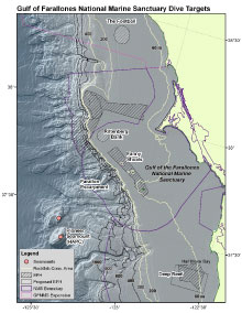 |
| Dive sites for Leg 2, Gulf of the Farallones National Marine Sanctuary (GFNMS): GFNMS slope (west of Farallon Islands; Farallon Escarpment), Rittenburg Bank, and the Football.
Click here for a larger image. |
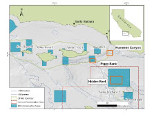 |
| Dive sites for Leg 3 Channel Islands National Marine Sanctuary (CINMS) and Southern California Bight: Piggy Bank, with Hueneme Canyon as weather backup plan. Hidden Reef study site will be surveyed in Fall 2010. Click here for a larger image. |
|
|
|


