Mapping a Wreck with a Little Help from our Friends
When it comes to studying a 150-year-old, nationally significant shipwreck, NOAA knows that often the best resources are the people who’ve already been diving there for decades.
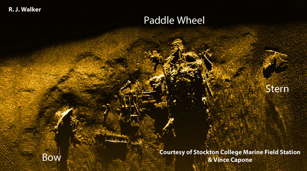
Earlier this year, that idea sparked a full-fledged mapping expedition when the Office of National Marine Sanctuaries enlisted the help of a group of New Jersey divers to survey the wreck of the steamer Robert J. Walker, which sank off the New Jersey coast in 1860. The Walker has been largely forgotten today, but played a vital role in charting the Gulf Coast in the years leading up to the Civil War for the U.S. Coast Survey, a predecessor of NOAA.
Starting in June, the nonprofit New Jersey Historical Divers Association provided a team of scuba divers trained as amateur archeologists who measured, mapped and drew the wreck of the Walker over the span of about 10 weeks. Expedition co-leaders Steve Nagiewicz and Dan Lieb worked with NOAA to create a detailed drawing of the wreck outlining its history and key features, which will be distributed among local divers to make their diving experience even more enjoyable and informative. The data collected will also provide NOAA with a benchmark that will let marine archeologists and other scientists monitor the shipwreck’s deterioration over time.
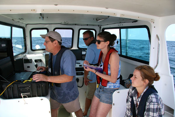
Playing a major role in this effort were several partners, in particular the Richard Stockton College Marine Science Field Station, which used state-of-the-art side-scan and multi-beam sonar and remotely operated vehicles (ROVs) to map and record video of the wreck. The exercise provided an opportunity for students interested in marine archaeology to get hands-on experience using this equipment in the field.
Other expedition partners included Black Laser Learning, which teaches clients including the U.S. Navy how to use and interpret sonar data; Revel Resorts of Atlantic City, which provided lodging and food for the divers; the National Marine Sanctuary Foundation, which funded the cost of the dive boat and mooring; and the Office of National Marine Sanctuaries, which provided several marine archeology advisors. Other NOAA staff also contributed knowledge and historical information on the wreck.
The Walker’s historical significance makes this unique partnership all the more valuable, especially since the wreck was placed on the National Register of Historic Places in April 2014. NOAA does not plan to make the wreck a sanctuary or limit diving there in any way, and will continue to work with New Jersey’s recreational diving community in the future to better understand the history of this remarkable ship and share its stories with the nation.
|