Pressures on the Sanctuary
Human activities and natural processes both affect the condition of natural and archaeological resources in marine sanctuaries. This section describes the nature and extent of the most prominent human impacts on Gray's Reef National Marine Sanctuary.
Anchoring
Anchor damage can pose a serious threat to sanctuary marine resources as anchors and anchor chains can damage or destroy hard bottom and the marine organisms that are dependent on the substrate (Figure 12). Some visitors to Gray's Reef sanctuary once used anchors to secure their boats for fishing, diving, and research. Given the nature of hard substrate in the sanctuary, it is difficult to secure anchorage unless anchors snag crevices or overhanging ledges. Boats would also typically anchor over live-bottom substrate because it is the habitat of interest for fishing and diving. Anchor contact can physically damage or modify habitat by scraping, cracking, displacing, breaking or removing substrate, or otherwise harming marine life attached to this substrate.

Anchoring may also adversely affect biodiversity by changing live-bottom composition through damage to either the habitat or the marine organisms of the reef. For example, coral that inhabits the hard-bottom areas of the reef provide either food or shelter to many species of fish and other invertebrates upon which larger reef and pelagic species of fishes feed. Any negative impact on this "foundation" of the reef can be passed along the food chain and may adversely affect the overall integrity of the reef ecosystem (NMSP 2006).
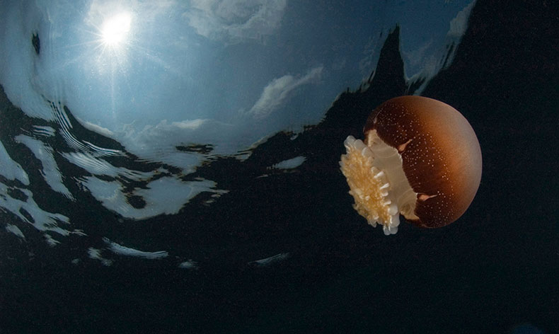
Diver Impacts
Weather, sea conditions and diver proficiency tend to limit the number of people who dive at the Gray's Reef sanctuary. However, recent surveys show increases in visits for both fishing and diving in the sanctuary since its designation in 1981 (Figure 13). Coastal population increases, new diving and navigation technologies and the public's enhanced awareness of Gray's Reef as a diving destination may continue to increase diving activities and the probability of inadvertent damage or disturbance to reef communities.

Studies have been conducted that show the impacts of dive activities. For example, divers in Australia were followed for 30 minutes and all direct contacts with the reef were recorded. Most divers damaged no coral while a small minority damaged between 10 and 15 corals each per 30-minute dive; fins caused the most damage (Harriott et al. 1997). A similar study in the Florida Keys showed that "...divers with gloves have significantly higher numbers of interactions with corals than divers without gloves..." (Talge 1990). Data also indicate that contacts may not change the percent of coral coverage, but may change composition from slower growing, older species, to faster growing, "weedy," opportunistic species. Other evidence indicates that most diving contacts may be tolerable and sustainable. In combination with other environmental stresses, such as poor water quality from sedimentation, improperly treated organic wastes, or nutrient pollution from terrestrial runoff, diving contacts can be part of a significant deleterious cumulative effect in reef communities (Ponder et al. 2002, NMSP 2006).
Recreational Fishing
Based on socioeconomic studies from Georgia coastal counties and sanctuary surveys of visitor use, recreational fishing activities have increased significantly at Gray's Reef in the past 20 years. The data also indicate that the majority of users in the sanctuary are fishing with rod and reel fishing gear. Recreational fishing with spearguns is also a growing concern, although powerheads have been prohibited in the sanctuary since 1981. The trends in use are expected to continue as population increases along the Georgia coast (Figures 14 and 15) and the popularity of recreational fishing and diving grows. Increases in use, coupled with declines in fish populations and degradation of coastal habitats could result in adverse impacts on fish populations and sanctuary habitat (Ehler and Leeworthy 2002, NMSP 2006).


Research by Kendall et al. (2007) indicates that ledges within the sanctuary are often targeted by fishermen due to the association of recreationally important fish species with this bottom type (Figure 16); ledges are structurally complex and are often densely colonized by biota.

Marine Debris

Marine debris may be any object of wood, metal, glass, rubber, plastic, cloth or paper that has been lost or discarded in the marine environment (Figure 17). Marine debris is a direct result of human activities on land and at sea, either intentional or accidental dumping within the sanctuary, or indirectly deposited from areas outside the sanctuary. Debris can pose serious threats to marine wildlife via entanglement or ingestion of plastics, cause impairment of navigation by obstructing propellers and clogging cooling intakes, and negatively impact the aesthetic qualities of the sanctuary. The abundance and spatial distribution of marine debris is dependent upon several factors, including its origin (terrestrial or maritime), ocean currents, wind patterns and physiographic characteristics. Depending upon their composition, individual debris items may persist for a long time in the marine environment. Plastics, which are the dominant debris type in numerous marine systems, are of particular concern because they break down slower in the ocean than items on land due to lower temperatures and fouling by marine organisms.

Use of the Gray's Reef sanctuary and surrounding areas has increased since the designation of the sanctuary in 1981. There has been a substantial increase in the human population within the coastal region of Georgia in recent years. As coastal populations rise and boating, fishing and offshore shipping increases in the region, an increase in the volume of refuse materials entering the waters of the sanctuary from coastal and offshore areas can be anticipated (Ehler and Leeworthy 2002, NMSP 2006).
A recent study by Kendall et al. (2007) showed that approximately two-thirds of all observed debris items found during field surveys were fishing gear, and about half of the fishing-related debris was monofilament fishing line (Figure 18). Other fishing-related debris included leaders and spear gun parts, and non-gear debris included cans, bottles and rope.

The distribution and abundance of marine debris in the Gray's Reef sanctuary is related to the bottom type (Figure 19), the level of boating and fishing activity (Figure 20), and local characteristics of benthic features. The spatial distribution of debris is concentrated in the center of the sanctuary and is most frequently associated with ledges rather than other bottom types (Figure 21). On ledges, the presence and abundance of debris is significantly related to observed boat density and physiographic features including ledge height and ledge area. While it is likely that most fishing-related debris originates from boats inside the sanctuary, preliminary investigation of ocean current data indicate that currents may influence the distribution and local retention of more mobile items (Kendall et al. 2007).


Research Activities
The sanctuary is actively promoting research activities by university and government scientists. Current studies are mapping the sanctuary, quantifying fish and invertebrate populations on various temporal and spatial scales, documenting the presence of marine debris and monitoring physical factors. In some cases, these research activities involve extensive diving operations, manipulative experiments and long-term deployment of monitoring equipment. While these research programs are providing valuable information to the sanctuary, some habitat damage invariably occurs. Studies being conducted on the benthos appear to present additional threats to habitat quality due to diver impacts and alteration of the bottom via deployment of experimental apparatus. The impacts of research activities tend to be localized and concentrated on portions of the sanctuary with densely and sparsely colonized live bottom.
Invasive Species
Introduced non-indigenous species can be invasive if they become common and have significant ecosystem impacts, like assuming a keystone species role. The Indo-Pacific red lionfishes (Pterois volitans and P. miles) have become well established along the eastern coast (Whitfield et al. 2002), and in September 2007 two specimens of red lionfish were sighted within Gray’s Reef sanctuary boundaries (however, because very few physical characteristics distinguish these two species it is unknown which species was actually sighted). In January 2008, three barnacles of the invasive species Megabalanus coccopoma (titan acorn barnacle) were found in Gray's Reef attached to the data buoy. This species is not native to the Atlantic but now occurs along the U.S. Atlantic coast and in the Gulf of Mexico. Potential impacts as a result of establishments of these and other organisms include competition with native species for food and space, predation, and disease.
Coastal Development
Human population growth and use of the coastal zone have increased dramatically in recent years, particularly along the U.S. southeastern coast. In coastal Georgia, populations have increased 62% from 1970-2000 and are projected to increase by another 51% to 844,161 by 2030 (Georgia Institute of Technology 2006). Human activities associated with such growth bring ensuing pressures on the coastal zone, including pollutant impacts arising from a variety of sources. Chemical contaminants may enter from industrial point-source discharges, oil spills, and nonpoint-source agricultural and urban runoff. Microbial contaminants may arrive from leaking septic tanks, sewage treatment plant overflows and wildlife and pet wastes. Chemical contaminants can cause toxicity in resident biota and pose a risk to human consumers of fish and shellfish. Microbial contamination can also lead to contamination of shellfish consumed by humans. In addition, eutrophication of our coastal waters from over-enrichment of nutrients and organic matter can lead to harmful effects from oxygen reduction, buildup of toxic levels of ammonia and sulfide, and other adverse conditions (such as high turbidity and reduced light penetration). Such pollutants, in addition to affecting estuarine and inland systems, may in some cases ultimately reach the offshore sanctuary environment by various mechanisms, including atmospheric deposition and underwater cross-shelf transport of materials outwelled through coastal sounds (Cooksey et al. 2004, Hyland et al. 2006).
Climate Change
Over the next century, climate change is projected to profoundly impact coastal and marine ecosystems. Climate change is having significant effects on sea temperature, sea level, storm intensity and currents. This could result in more damaging storms and more extreme floods and droughts. Sea level rise can cause beach erosion, dune and bank erosion, wetland loss, alteration of species assemblages, impacts on infrastructure flooding and island re-sizing, and can have groundwater implications (Ocean Management Task Force 2004).