|
 Water Quality Program Wins Award Water Quality Program Wins Award
The Agriculture Water Quality Program was awarded the State of California’s Governor’s Environmental and Economic Leadership Award in the category of Ecosystem and Watershed Stewardship. This award recognized the efforts of the program’s cooperative work with numerous agencies and individuals to prevent 450 thousand tons of sediment runoff to the sanctuary annually
Kayak Outreach Program Reaches Thousands
The sanctuary’s Team OCEAN Kayaker Outreach Program (Team OCEAN) completed another successful summer on the water. Volunteers logged 1,716 hours on the water and reached 5,957 kayakers. The program provides face-to-face interpretation of sanctuary natural history and programs, as well as guidelines on how to enjoy marine wildlife without disturbing it. The target audience is primarily ocean kayakers, but includes other sanctuary resource users who may be encountered on the water, such as boaters and divers. In the past six years, more than 23,000 people have encountered Team OCEAN volunteers and staff on the water.
Emergency Response Key To Protecting Marine Life
A flurry of groundings and sinkings occurred along the central California coast, ranging from parted mooring lines to catastrophic events. More than a dozen incidents required extensive sanctuary staff oversight. Early coordinated response and salvage prevented potentially serious fuel leakage in the majority of incidents. During the past six months, increased reports of oiled cormorants in northern Monterey Bay resulted in the discovery that a large historic cement barge was leaking oil. The 200-foot barge (formerly the Palo Alto) is positioned approximately 400 yards offshore and in a state of accelerated deterioration. California Office of Spill Prevention and Response is coordinating a response to this threat, which may include potential demolition and removing the remaining oil in the barge
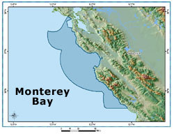
Coastal Erosion in Southern Monterey Bay
A graduate student working for the site completed a technical report, The Impacts of Coastal Protection Structures in California’s Monterey National Marine Sanctuary, in response to information needs identified in the draft Coastal Armoring Action Plan. The report provides background information on the geomorphic history of the area, summarizes the results of regional erosion studies, documents coastal developments potentially threatened by erosion and lays the groundwork for an investigation of alternatives to coastal armoring. The report also outlined the potential impacts of coastal protection structures on sanctuary marine life and habitats. Click here for a link to the report.
Volunteers Turn Out to Monitor Water Quality
More than 150 volunteers monitored the water quality of 167 sites on streams and creeks flowing into the sanctuary during the 6th Annual Snapshot Day event. The data collected provide a baseline for sanctuary efforts and identifies potential problem areas to study over the next year. Links to Snapshot Day reports are available are available on the Monitoring Network Web page.
Exclusive Stories for the Web
Sanctuary Currents Symposium March 12, 2005
The sanctuary co-hosted the 13th Annual Sanctuary Currents Symposium. The theme of the symposium was "Tracking the Health of Our Sanctuary." The program highlighted monitoring efforts within the sanctuary, modeled the use of interactive maps and how decision makers throughout the sanctuary could use the Sanctuary Integrated Monitoring Network Web pages in their resource planning efforts. More than 300 attendees, 60 researchers with scientific posters and 22 exhibitors participated in the event. The symposium report will be available on the Monterey Bay National Marine Sanctuary Web site in June.
Water Quality Map Updated
An update to the interactive map focusing on water quality monitoring stations within the Monterey Bay National Marine Sanctuary occurred on November 2004. There are currently over 3,500 water quality monitoring stations representing 19 organizations or institutions. Some of these sites link to live water quality data. To access this map, click here and launch the map viewer under the "SIMoN Water Quality Viewer."
 Plans for 2006 Plans for 2006
Sanctuary staff completed planning and has initiated development of a joint interpretive facility located in San Simeon at Hearst State Beach with the California Department of Parks and Recreation. The Coastal Discovery Center will open in summer 2006 and expects to educate more than 50,000 visitors annually. The building also serves as the sanctuary’s San Simeon office, which is already open.
|