Error processing SSI file
Research and Monitoring
 | | Scripps researcher Erin Oleson deploys a tag on a blue whale in the Santa Barbara Channel with Cascadia Research Collective. (Photo: A. Calambokidis/Cascadia Research) |
West coast sanctuaries will continue to collaborate with NMFS and other partners to address the issue of whale ship strikes. Sanctuaries will continue to monitor and conduct further research on ship-whale interactions in order to develop more informed policy and management decisions. Learn about new and continuing initiatives, research and monitoring below.
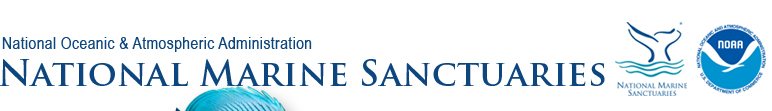
 | Cordell Bank sanctuary staff work with PRBO Conservation Science to conduct a mid-water trawl during an ACCESS research cruise. (Photo: A. Dransfield/NOAA) research cruise. (Photo: A. Dransfield/NOAA) |
Whale Spotter Application
A new tool that uses mobile application technology to record marine mammal sightings, "Spotter," has been released. Spotter was developed in partnership with EarthNC (a private technology company), west coast marine sanctuaries, NMFS, Point Blue (formerly Point Reyes Bird Observatory (PRBO) Conservation Science), and the Pacific Merchant's Shipping Association (PMSA). The Spotter app will streamline collection of marine mammal sightings from commercial, whale watching, and recreational vessels using smart phone and tablet technology. Special thanks are extended to PMSA and Cordell Marine Sanctuary Foundation for their generous support and contribution.
Learn more about EarthNC and view their presentation: Demonstration of Spotter App  , 788KB Learn more about how "Spotter" works by viewing this video. , 788KB Learn more about how "Spotter" works by viewing this video.
Sanctuary Research and Monitoring Activities on the West Coast
| National Marine Sanctuary |
Partners & Programs |
Research and Monitoring |
| Cordell Bank |
PRBO Conservation Science through the Applied California Current Ecosystem Monitoring (ACCESS) cruises |
Collect data on physical conditions, prey availability, whale distribution and abundance. |
| Coast Guard |
Enforcement overflights of the sanctuaries. |
| Stellwagen Bank sanctuary and Coast Guard |
Record and process AIS data to understand lane use by vessels within and outside shipping lanes. |
| National Marine Fisheries Service (NMFS) |
Central California ship strike risk analysis examining shipping activities and habitat use by whales within the Gulf of the Farallones, Cordell Bank and Monterey Bay sanctuaries. |
| Gulf of the Farallones |
Point Blue Conservation Science through the Applied California Current Ecosystem Monitoring (ACCESS) cruises |
Collect data on physical conditions, prey availability, whale distribution and abundance. |
| Coast Guard |
Enforcement overflights of the sanctuaries. |
| Whale watching industry and Cascadia Research Collective |
Working with the whale watching industry and other partners to track whale presence. |
| Monterey Bay |
Coast Guard |
Enforcement overflights of the sanctuaries. |
| Naval Postgraduate School |
Completed a report on the monthly distribution of shipping vessels within the sanctuary. |
| PRBO Conservation Science and Cascadia Research Collective |
Completed a whale distribution base map on which to add GIS layers and krill data. |
| Channel Islands |
Channel Islands Naturalist Corps and Cascadia Research |
Working with the whale watching industry and other partners to track whale presence. |
| U.S. Navy and Coast Guard |
Overflights to monitor whale presence in the shipping lanes. |
| Graduate students from Bren School, UCSB |
Researching the effects of strategies to reduce the risk of ship strikes: 1) speed reduction, 2) shifting the shipping lanes south of the islands, 3) narrow existing shipping lanes. |
| Sanctuary research coordinator and partners |
Evaluating ship speeds using AIS data in the channel before, during and after NOAA's recommended slow-speed advisory. |
| Cascadia Research Collective |
Sanctuary has provided R/V Shearwater support to Cascadia Research Collective since 2009 to conduct tagging and photo ID of blue, fin and humpback whales. |
| Marine Mammal Stranding Network and NMFS Stranding Network Coordinator |
Collecting and analyzing data on whale strandings along the California coast. |
| Sanctuary staff |
Developed and maintain a complete data acquisition system from AIS stations on the mainland and Santa Cruz Island. Collect, process and analyze data from ships. |
NOAA's National Marine Fisheries Service
The Southwest Regional Office is collecting and compiling whale sightings data from citizen science, industry, sanctuaries, and others along the entire west coast. This information can help with the conservation of these species. If you see whales, please collect the following: GPS location, species and number of whales; and email to whales@noaa.gov.
Sanctuary Research and Monitoring Activities on the East Coast
East coast sanctuaries are also working to prevent ship strikes to endangered whales. To protect North Atlantic Right whales, Stellwagen Bank National Marine Sanctuary has developed the App "Whale Alert" to inform mariners of the safest route to avoid whales. Learn more about Stellwagen Bank's efforts such as the Right Whale Advisory, and the Whale Sense program for responsible whale watching on their website.
 | | Sanctuary staff conduct overflights with USCG to monitor whale presence in the sanctuaries. (Photos: Plane: J. E. Sequeira; Helicopter: J. Phillips) |
|