Sub-bottom profiling in Gray's Reef National Marine Sanctuary
Dr. Paul Gayes
Coastal Carolina University
One of the primary goals of the mission will be to help characterize the sediment and rock layers that are found within the sanctuary and surrounding areas to help understand the geologic history of the area; the ship will be used to map subsurface layers in the seafloor.
To do this, we will tow seismic instruments behind the Nancy Foster while the officers drive the ship along pre-determined track lines. These instruments, one called a sub-bottom profiler and the other a side-scanning sonar, emit sounds which, when reflected back to the instruments, provide information on the sediment layers below.
 |
|
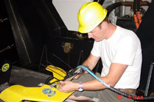
Tech with sub-bottom profiler. (Photo: Gray's Reef National Marine Sanctuary)
|
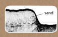
The sub-bottom profiler provides information on rock formations and strata that are below the sand and the side-scanning sonar gives information on areas that lie above the sand. The data from these instruments tells scientists something about how these layers were formed and provides indications of how they may change over time. This effort will occur at night, and the team will attempt to map the entire sanctuary in order to fully characterize the geologic strata.
Additional mapping activities will be conducted during the cruise to collect valuable habitat information. Last year, the Nancy Foster had a multibeam system installed on the ship. This system utilizes sound, like the sidescan sonar and sub-bottom profiler, to give scientists information about the seafloor. The difference is that in the case of multibeam, the data generated are of the difference in depth (bathymetry) from the multibeam sensor to the sea floor but it does not include the subsurface layers. Unlike side-scan data, the multibeam does not indicate where there are potential ledges but only where there are differences in depth. During the cruise, scientists will continue to collect multibeam data at a site outside the sanctuary boundary (called J-Reef) that is used as a control site because it is considered to be representative of biology and geology of Gray’s Reef. Prior to this mission, scientists did not have an accurate map of the area, so these data will provide much-needed habitat information for J-Reef.
Sediment Sampling
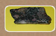
If weather conditions do not allow for geophysical surveys or if significant features are identified during the survey, a series of Shipek bottom grabs may be requested in order to sample surface sediments. Specific grab locations will be identified from the geophysical imagery during the cruise
The Shipek grab is normally operated from the port A-Frame using the ship’s trawl winch. The grab weighs around 100 lbs. Operation requires the grab to be lifted off the deck and held while personnel prep and cock the grab, then the grab is lowered over the side to the bottom. Once at the bottom the grab will trigger and can be immediately returned to deck. Once on deck, the grab is again supported around 2-3 feet off the deck while personnel remove the sample. This is a secondary operation and most likely to be requested to ground truth geophysical survey lines in the event of weather conditions beyond tolerance for geophysical survey.
|