Summary Log Information
Monitoring
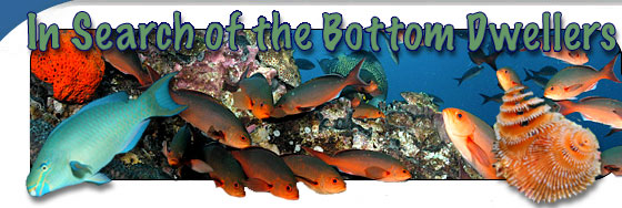
While the mission was shortened due to the development of Hurricane Humberto, the scientists still managed to survey 32 locations around the East Bank of the Flower Garden Banks National Marine Sanctuary. Information was collected to describe the health of the coral reefs located on top of the Bank. Scientists made notes on the presence of any discoloration on the corals that would indicate loss of a microscopic algae that live inside the corals and help them survive. These algae called zooxanthellae are what give the corals their different colors. Information was also collected describing the fish communities at each site. The different types of fish were identified, counted, and sized. The scientists recorded information on all the fish from the tiny ones (approximately 3 cm long) that live on the corals known as gobies and blennies to the large ones (up to 2 m long) that swim around the big coral heads like groupers and snappers.
The information collected will be utilized for many different purposes. Scientists hope to be able to understand what types of corals are homes to each type of fish and each size of fish. Some parts of the coral reef environment may provide protection to fish when they are young and other parts may be more important when they are older. The information will also be made available to Sanctuary managers as they are determining how well the fishes and corals in their Sanctuary are doing and if the current rules they have in place are enough to ensure continued protection of the animals they manage.
Mapping
In order to get a better understanding of the ocean floor’s structure, bathymetry (or information about depth) was collected northwest of the coral caps in the Sanctuary. In total, 94 square kilometers of bathymetry were collected at depths ranging from 48 meters to 108 meters (i.e., 158 feet to 354 feet). To map this area, the NOAA ship Nancy Foster traveled 462 kilometers. Several prominent ridges and depressions were discovered approximately 18 kilometers northwest of the West Flower Garden Bank Sanctuary boundary. These features may prove to be important habitat for fish and other marine organisms.
The bathymetry for the Flower Gardens region was collected using SONAR (or SOund Navigation And Ranging), which calculates depth by measuring how long a pulse of sound takes to travel from the ship to the ocean floor and back again. The specific type of SONAR used on this mission simultaneously sent out and received 111 pulses of sound at different angles from the ship. These multiple pulses of sound allowed scientists to create seamless, detailed images of the ocean floor.
High resolution images of the seafloor help scientists to better understand the environment in which fish and corals live. Understanding this relationship is important as some organisms distribute themselves around features on the seafloor (e.g., peaks, valleys, pits and crevices). Thus by mapping the ocean floor, scientists and resource managers are better able to protect and conserve marine animals.
|