Photo Gallery header graphic
National Marine Sanctuary Maps

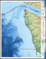
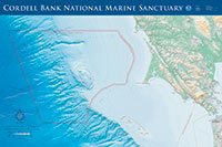
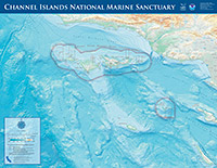
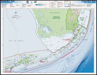
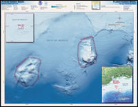
Click here for a globe-view map representing all of the sanctuaries. For site specific boundary representation maps, please visit the National Marine Sanctuary regional pages.

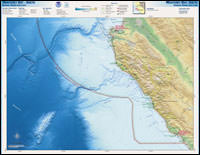
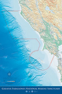
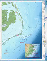
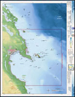
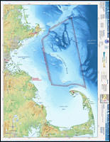
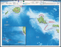
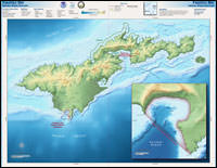
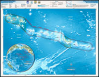
For atlas style maps, click on the images below to view larger 420 pixel wide versions. From those pages, larger 2000 pixel wide versions are available.

west coast divider
Monterey Bay North map Monterey Bay South map
Monterey Bay North
(Monterey_Bay_N.kmz)

Monterey Bay South
(Monterey_Bay_S.kmz)

Gulf of the Farallones map Olympic Coast map
Gulf of the Farallones
(Gulf_Farallones.kmz)

Olympic Coast
(Olympic_Coast.kmz)

Cordell Bank map Channel Islands map
Cordell Bank
(Cordell_Bank.kmz)

Channel Islands
(Channel_Islands.kmz)

southeast divider
Florida Keys West map Florida Keys East map
Florida Keys West
(Florida_Keys_W.kmz)

Florida Keys East
(Florida_Keys_E.kmz)

Flower Garden Banks map Gray's Reef map
Flower Garden Banks
(Flower_Garden.kmz)

Gray's Reef
(Grays_Reef.kmz)

northeast divider
Monitor mapMonitor map
Monitor
(Monitor.kmz)

Thunder Bay
(Thunder_Bay.kmz)
Stellwagen Bank map 
Stellwagen Bank
(Stellwagen_Bank.kmz)

 
pacific islands divider
Hawaii Humpback Whale North map Hawaii Humpback Whale South map
Hawaiian Islands Humpback Whale North
(Humpback_Whale_N.kmz)

Hawaiian Islands Humpback Whale South
(Humpback_Whale_S.kmz)

fagatele bay map Papahanaumokuakea map
Fagatele Bay
(Fagatele_Bay.kmz)

Papahānaumokuākea Marine National Monument
(pmnm_atlas.kmz)

leaving site indicates a link leaves the site. Please view our Link Disclaimer for more information.
Revised September 12, 2023 by Sanctuaries Web Team | Contact Us | Web Site Owner: National Ocean Service
National Ocean Service | National Oceanic and Atmospheric Administration | Privacy Policy | For Employees | User Survey
http://sanctuaries.noaa.gov/includes/np_footer.html