|
|
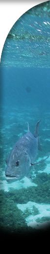
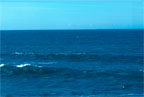
Open water over
Cordell Bank belies nothing of what lies
below. (photo: Gulf of the Farallones
NMS)
|
|
|
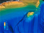
Computer imagery
shows the topography of Cordell Bank, the
proximity of Farallon Islands, and the
steep drop-off of the continental shelf to
the west of the Bank. (photo: USGS Woods
Hole)
|
|
|
Computer imagery
showing one of the pinnacles of Cordell
Bank. (photo: Cordell Bank
Expeditions)
|
|
|
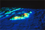
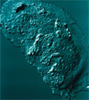
A computer-generated
sonar image of the entirety of Cordell
Bank. (photo: Cordell Bank
Expeditions)
|
|
|
Surveying the
submerged habitat of Cordell Bank. (photo:
Cordell Bank Expeditions)
|
|
|
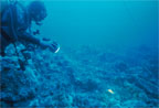
A diver from Cordell
Bank Expeditions discovers a small
sediment pocket on the Bank. (photo:
Cordell Bank Expeditions)
|
|
|
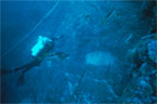
The same diver
pictured amid the granitic pinnacles of
the Bank. (photo: Cordell Bank
Expeditions)
|
|
|
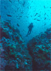
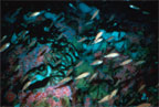
Juvenile rockfish
hang out above the lush invertebrate cover
on Cordell Bank. (photo: Cordell Bank
Expeditions)
|