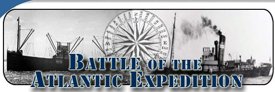
NEW FIND: Researchers have located and identified the final resting place of the YP-389, a U.S. Navy patrol boat sunk approximately 20 miles off the coast of Cape Hatteras, NC, by a German submarine during World War II. View the underwater video of the YP-389 (80MB Quicktime). Press release here.
The darkness of a moonless night, churning seas, a flash of light on the horizon, flames shooting skyward from the ocean waters, and then the muffled sound of a distant explosion drifting onshore...these were once the sights and sounds of Torpedo Junction.
The turbulent waters, once referred to as Torpedo Junction, now lap at tranquil shores crowded with visitors from around the world. Visitors to the Outer Banks of North Carolina are often surprised to learn that these shores were once witness to an arena of death and destruction in the 1940's due to rampaging German U-boats. In those dark days of early 1942, enemy submarines descended upon the local waters in full view of the Outer Banks and wreaked havoc on defenseless merchant ships. The pivotal naval campaign that followed, one marked by conspicuous instances of ignorance, frustration, and heroism, came perilously close to our nation's shores!
These devastating losses off the coast of North Carolina were a part of a much larger battle of WWII known as the Battle of the Atlantic, a term coined by Winston Churchill. It was the longest and one of the most decisive campaigns of WWII. The final toll for Torpedo Junction included more than 80 sunken ships and hundreds of lives lost in the waters off North Carolina.
Today, crashing waves, sandy beaches, seagulls soaring, and laughter floating on the wind are the sights and sounds of Torpedo Junction. But a visitor to Outer Banks has to only look out across that vast expanse of ocean and use their imagination to visualize what it might have been like standing on the beach in those early years of WWII. And if you stand there long enough, you might even be able to feel the terror that the people must have had. After all, in 1942 the war was not thousands of miles away, as most Americans thought, in reality it was just a few miles off our coast!
Come join the expedition, as we learn more about the Battle of the Atlantic and the historic shipwrecks that litter the ocean floor along the coast of the Outer Banks.
Expedition Summary
The 2009 summer expedition is the second part of a larger multi-year project to research and document a number of historically significant shipwrecks tragically lost in the Battle of the Atlantic during WWII. The project is dedicated to raising awareness of the war that was fought so close to the American coastline and to preserving our nation's maritime history. Ships include American, British and German naval vessels, as well as merchant vessels all located in an area known as the Graveyard of the Atlantic.
Consistent with U.S. and international policy, the expedition will not disturb the wreck sites and will treat them as war graves and with respect. Visible sections of the vessels, as well as the biological characteristics of marine life found at the sites, will be surveyed, photographed and documented using non-invasive methods. NOAA also ensures that exploration of any foreign vessel sites meets the provisions outlined by their government.
NOAA’s Office of National Marine Sanctuaries, in collaboration with the National Park Service, Minerals Management Service, East Carolina University, the University of North Carolina Coastal Studies Institute, and the State of North Carolina, conducted an archaeological expedition to survey ships sunk off the coast of North Carolina during the WWII Battle of the Atlantic. The 2009 expedition is lead by the Monitor National Marine Sanctuary and conducted in two parts that begin on August 1 and run through August 24. Additional support is provided by Gray’s Reef National Marine Sanctuary, and NOAA’s National Centers for Coastal Ocean Science.
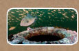
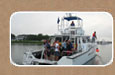
The first leg of the expedition will be conducted off the coast of Virginia and North Carolina from Aug. 1-9. During the first segment, while onboard the NOAA ship Nancy Foster, researchers will attempt to locate several significant shipwrecks sunk in deep water during battle by using side scan sonar and a Remotely Operated Vehicle (ROV).
Expedition Leg 2:
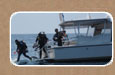
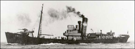
During the second segment, divers will survey and photograph visible sections of a British merchant ship, HMT Bedfordshire, using non-invasive methods. The survey team will also study marine life found at the sites. Consistent with U.S. and international policy, the shipwreck site is considered a war grave and will not be disturbed during the expedition.


 . The 2009 expedition is lead by the
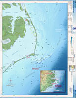