Maritime Cultural Landscapes
Archival Resources
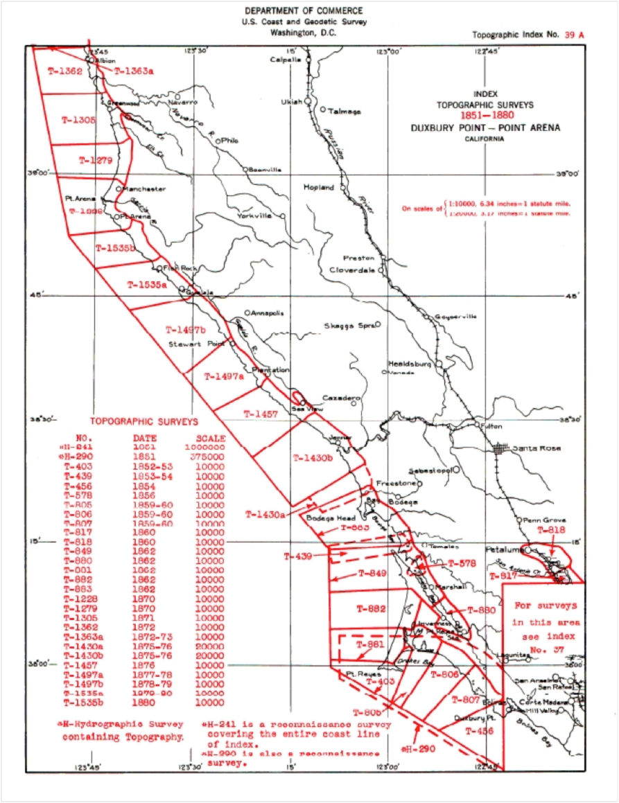
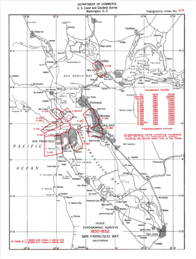
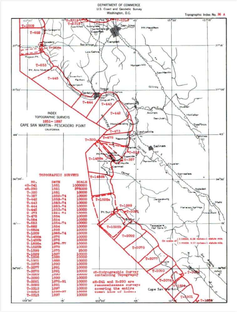
Finding T-Sheets through the Red Footprint Maps
The Coast Survey created a variety of aids and lists to access all their maps, both internally and externally. For both T-Sheets and published charts, one of the most effective tools is the sets of "footprint" maps. Here are the T-Sheet Red Footprint Maps for the original surveys of the coast of what is now the Gulf of the Farallones National Marine Sanctuary.
 | | The Northern End of the Gulf of the Farallones Sanctuary. Click on the image for a larger view. |
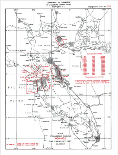 | | The Middle of the Gulf of the Farallones Sanctuary. Click on the image for a larger view. |
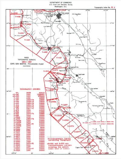 | | The Southern End of the Gulf of the Farallones Sanctuary. Click on the image for a larger view. |
Click on the state names for pdfs of the red maps covering all the historic T-Sheets for the coasts of the states of California, Oregon, and Washington, and soon covering all other American coasts.
|