Exploring World War II's Battle of the Atlantic
By Elizabeth Weinberg
August 2016
How can archaeologists chart a World War II battlefield resting 700 feet down on the bottom of the Atlantic Ocean?
A team of maritime archaeologists from Monitor National Marine Sanctuary is up to the task. Using manned submersibles and underwater robots in partnership with NOAA's Office of Exploration and Research, Project Baseline, the Bureau of Ocean Energy and Management, the University of North Carolina Coastal Studies Institute and SRI International, the team is currently surveying shipwrecks from a World War II battlefield off the coast of Cape Hatteras, North Carolina.
Throughout 1942, war raged off the shores of North Carolina. Explosions were seen and heard from shore, oil washed up on beaches, and dozens of Allied warships, merchant vessels and German U-boats were sent to the bottom.
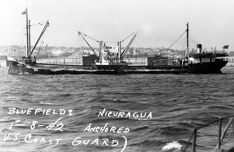
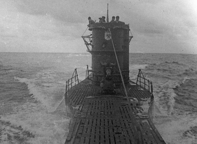
Two of these ships were the German U-boat U-576 and the freighter SS Bluefields. On July 15, 1942, the convoy KS-520 was intercepted by U-576. The convoy's Coast Guard escort dropped eight depth charges -- but none hit their target. Just minutes later, U-576's torpedos rocketed through the convoy. One torpedo hit J.A. Mowinckel, while a second struck Bluefields, sinking the ship in a matter of minutes.
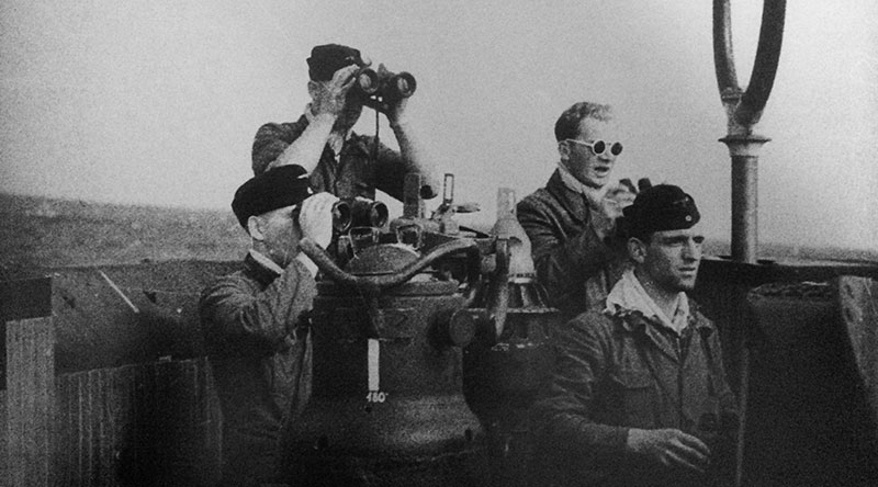
But sometime before the attack, U-576 seems to have sustained damage to one of its ballast tanks, and after firing its torpedoes the U-boat suddenly surfaced in the middle of the convoy. Immediately, the merchant ship Unicoi opened fire and struck the submarine, while two U.S. Navy Kingfisher aircraft dropped depth charges. U-576 sank with all 45 crew members still aboard.
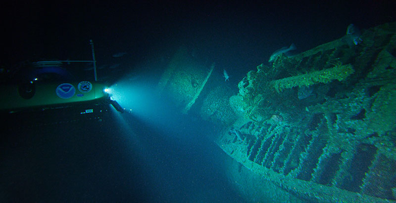
For more than 70 years, U-576 and Bluefields were lost to history. But in 2014, maritime archaeologists used sonar imaging technology to locate these vessels 35 miles off the coast of Cape Hatteras. The vessels sit in approximately 700 feet of water, just 200 yards apart.
This battlefield site not only represents one of the most historically significant naval engagements that occurred along the East Coast of the United States during World War II, but is also a microcosm of the entire battlefield. Now, using manned submersibles, maritime archaeologists are collecting data to visualize this underwater battlefield.
"This discovery is the only known location in U.S. waters that contains archaeologically preserved remains of a convoy battle where both sides are so close together," explains Joe Hoyt, Monitor National Marine Sanctuary archaeologist and chief scientist for the expedition. "By studying this site for the first time, we hope to learn more about the battle, as well as the natural habitats surrounding the shipwrecks."
Through early September, NOAA maritime archaeologists and marine biologists are using Project Baseline’s two submersibles to survey and document Bluefields and U-576 to acquire laser scans, high resolution multibeam sonar images, and high definition video and still photography that will be used for photogrammetric modeling. These data will provide the first real glimpse of these vessels since their sinking on July 15, 1942.
While maritime archaeologists document the site, NOAA marine biologists plan to study the habitat and the natural resources associated with the shipwrecks and surrounding seafloor. By combining archaeological and biological data, scientists can establish a more complete picture of the battlefield and the current condition of the shipwrecks.
NOAA is currently considering an expansion of Monitor National Marine Sanctuary’s boundaries to increase protection of Bluefields, U-576 and other historic shipwrecks in the Graveyard of the Atlantic. "The significance of these sites cannot be overstated," says David Alberg, superintendent of Monitor National Marine Sanctuary. "This area off North Carolina is the best representation of a World War II battlefield off the East Coast. Now, working with our partners, we have an opportunity to study it, characterize it, and, like other historic battlefields in this country, hopefully protect it."
Follow the expedition online and learn more at http://oceanexplorer.noaa.gov/explorations/16battlefield/.
Updated on the expedition: Exploring World War II's Battle of the Atlantic: PART 2