Proposed Designation of Pacific Remote Islands National Marine Sanctuary
On March 24, 2023, President Biden directed the Secretary of Commerce to consider initiating the designation process for a proposed national marine sanctuary in the Pacific Remote Islands area. On April 17, 2023, NOAA's Office of National Marine Sanctuaries issued a Notice of Intent to Conduct Scoping and to Prepare an Environmental Impact Statement for the Proposed Designation of a National Marine Sanctuary for the Pacific Remote Islands, launching the designation process.
Sanctuary designation would allow NOAA to augment the existing protections for the Pacific Remote Islands Marine National Monument with additional regulatory and non-regulatory tools, and to conserve additional areas outside the monument's existing boundary. The proposed sanctuary would not include terrestrial areas or diminish the protections of the existing monument designations.

Area proposed for Pacific Remote Islands National Marine Sanctuary.
Credit: NOAA
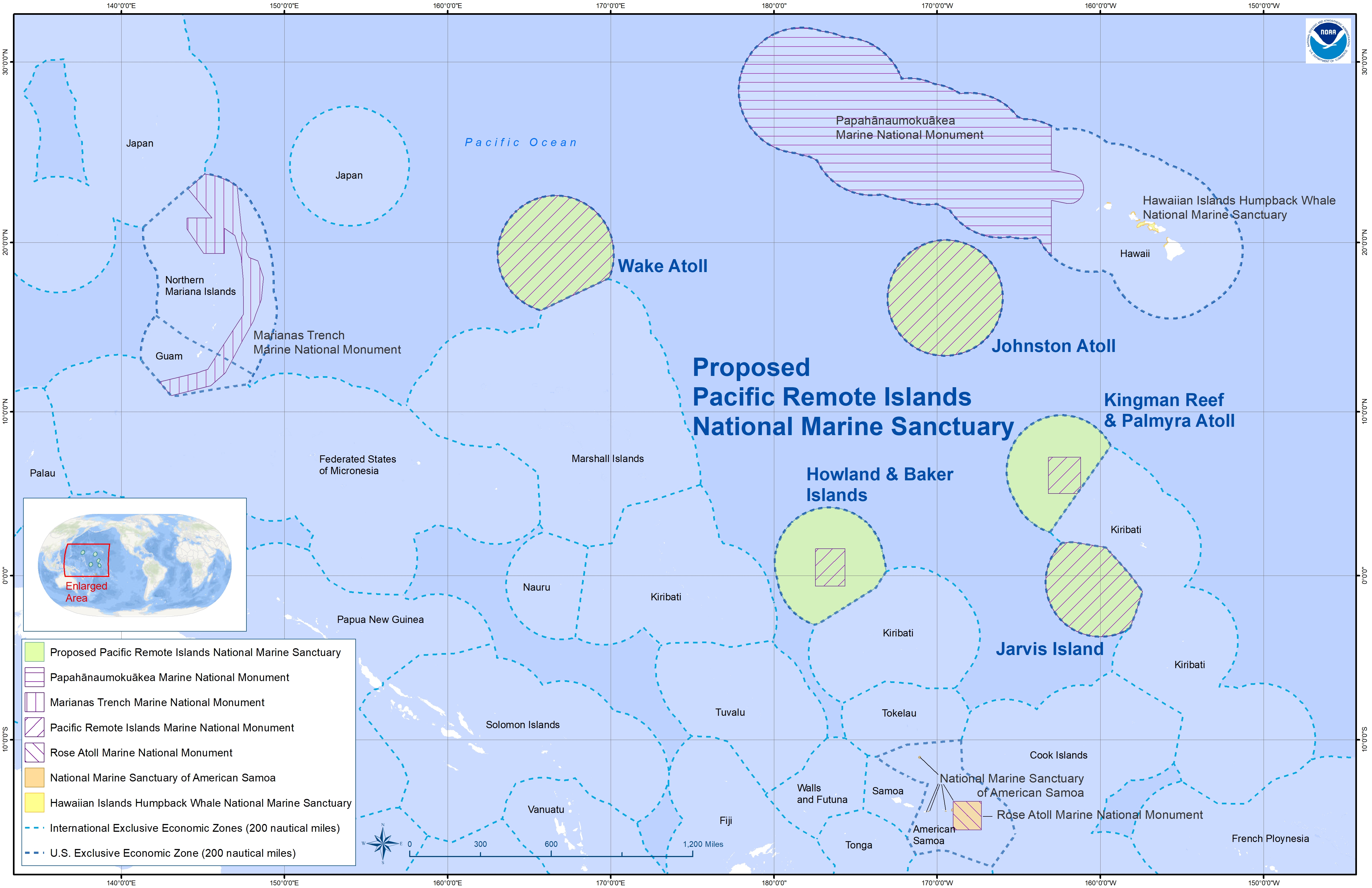
Area proposed for Pacific Remote Islands National Marine Sanctuary shown with other nation's 200 miles Exclusive Economic Zones.
Credit: NOAA

Proposed Designation of Pacific Remote Islands National Marine Sanctuary Fact Sheet
NOAA
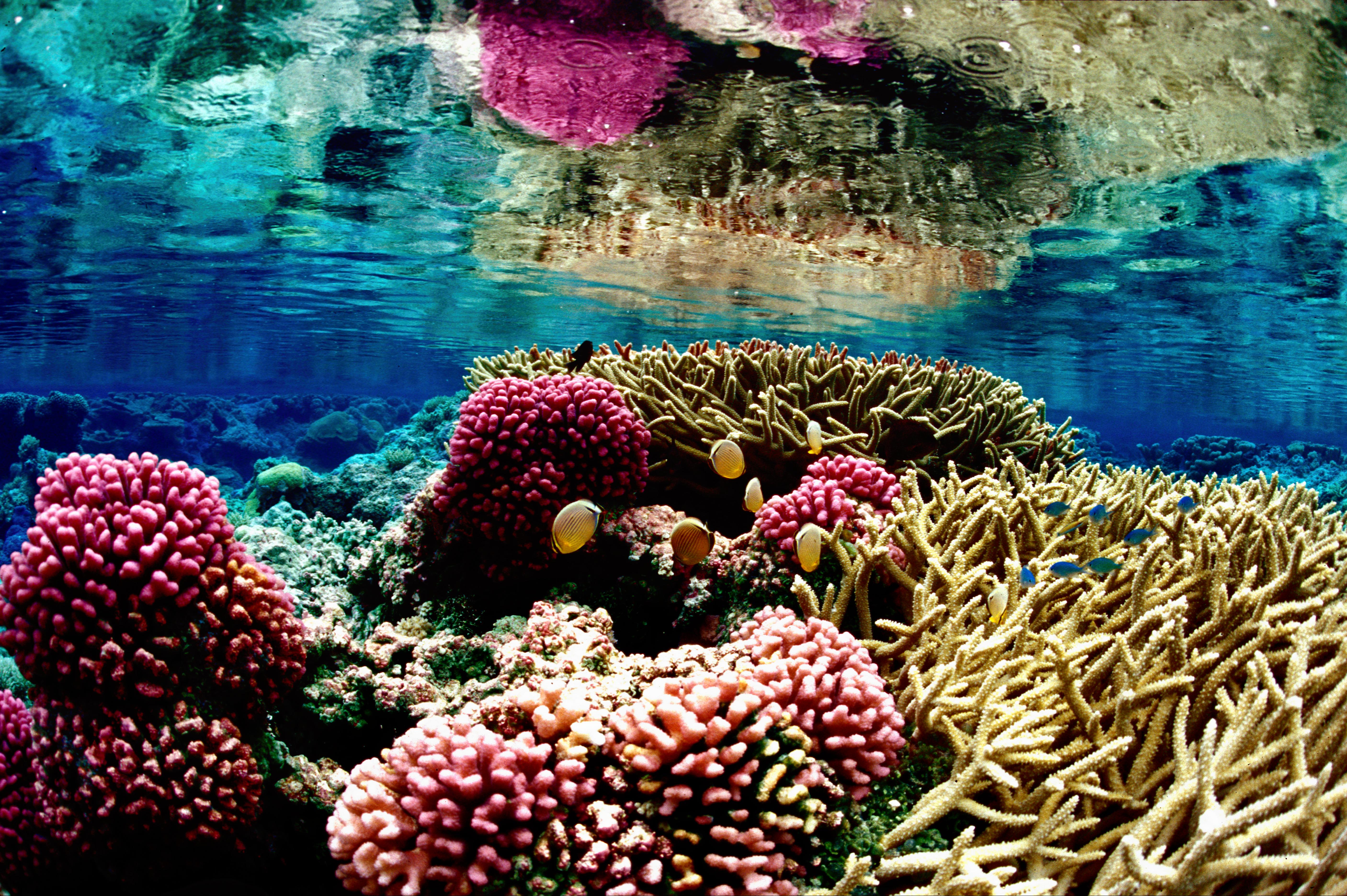
Branching corals grow on a vibrant shallow coral reef at Palmyra Atoll National Wildlife Refuge.
Credit: Jim Maragos/USFWS
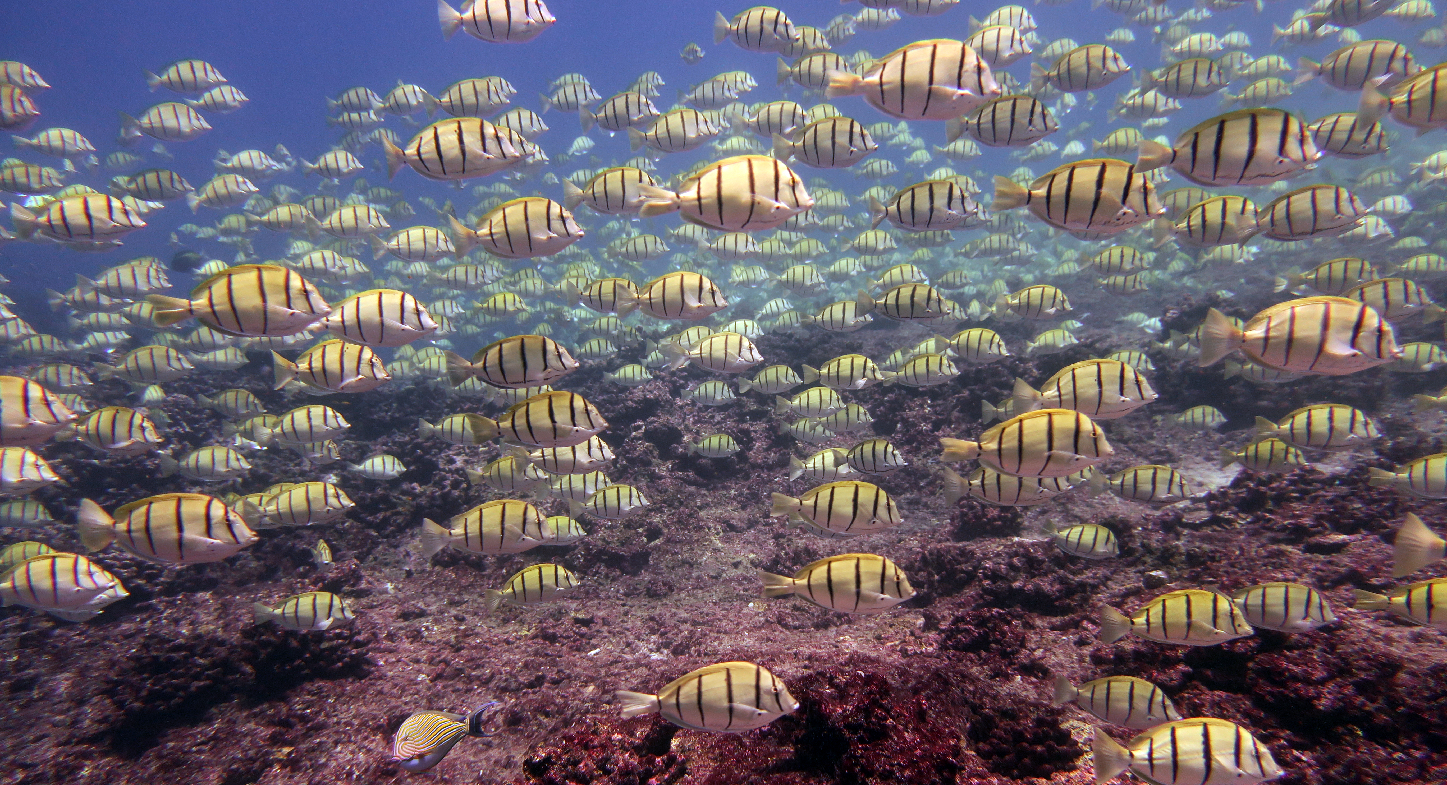
Thousands of convict tangs school in the shallows off Jarvis Island.
Credit: Courtney Couch/NOAA
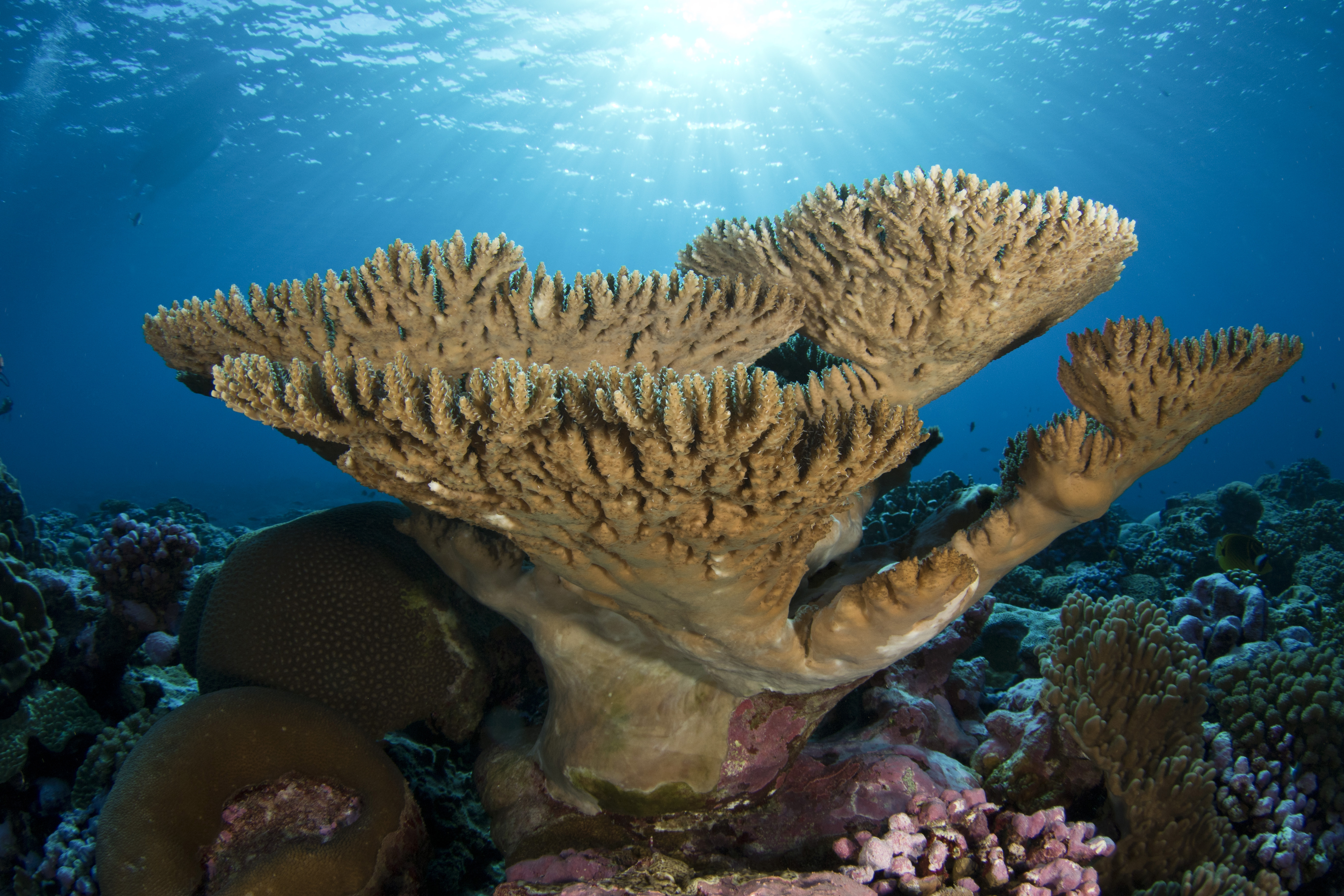
Acropora corals grow toward the sunlight to form beautiful, massive tables at Palmyra Atoll.
Credit: Jeff Milisen/NOAA

A sebae anemone (Heteractis crispa) makes its home among the coral on Kingman Reef.
Credit: USFWS
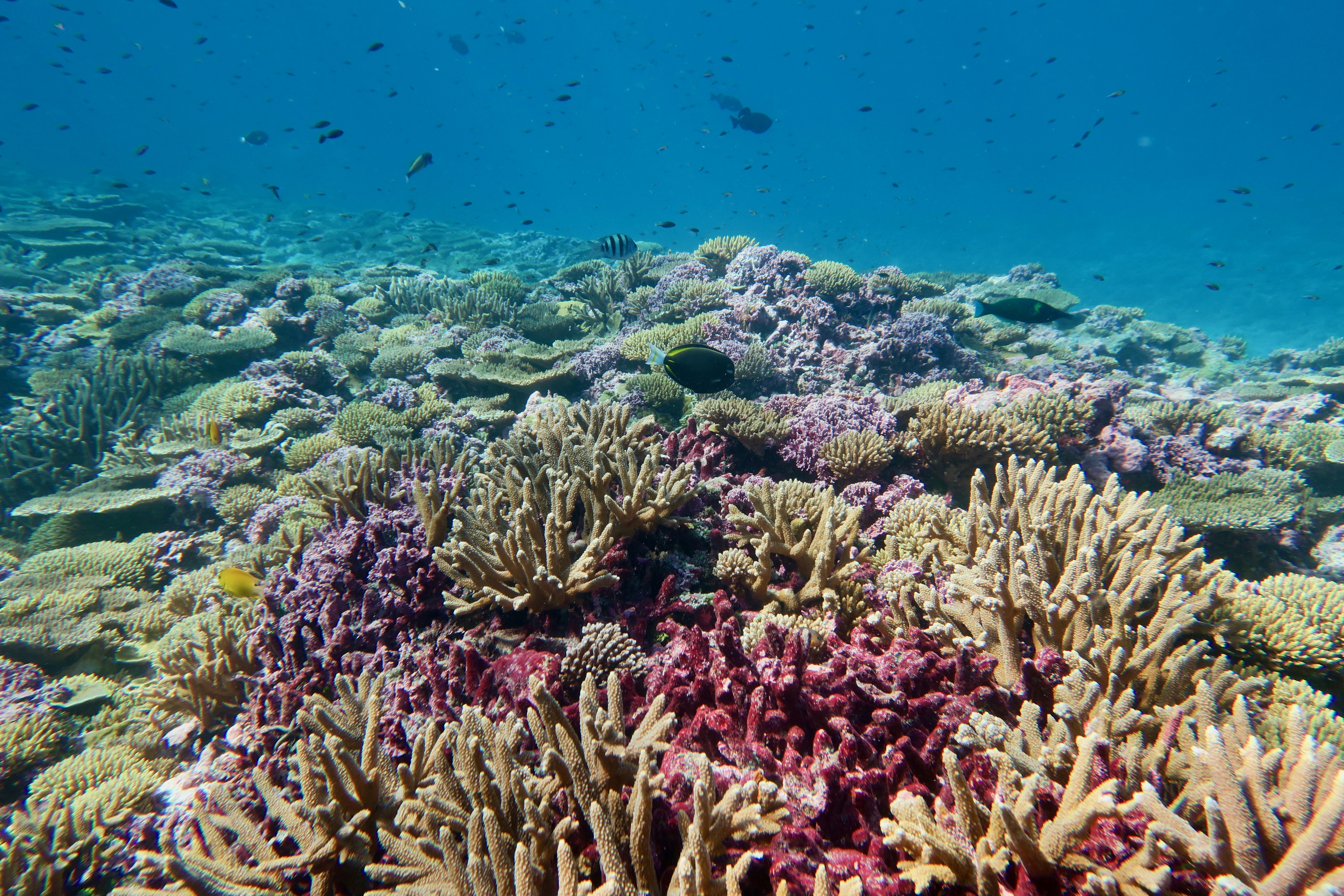
Corals thrive and support a wide diversity of reef fish in the shallows of Baker Island.
Credit: Morgan Winston/NOAA
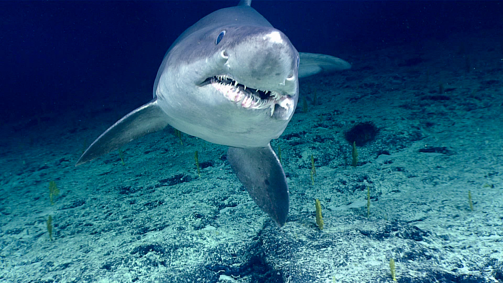
The waters of the proposed Pacific Remote Islands National Marine Sanctuary are home to 10 endangered or critically endangered species of sharks and rays, and five vulnerable species such as this smalltooth sand tiger shark in Kingman Reef.
Credit: NOAA
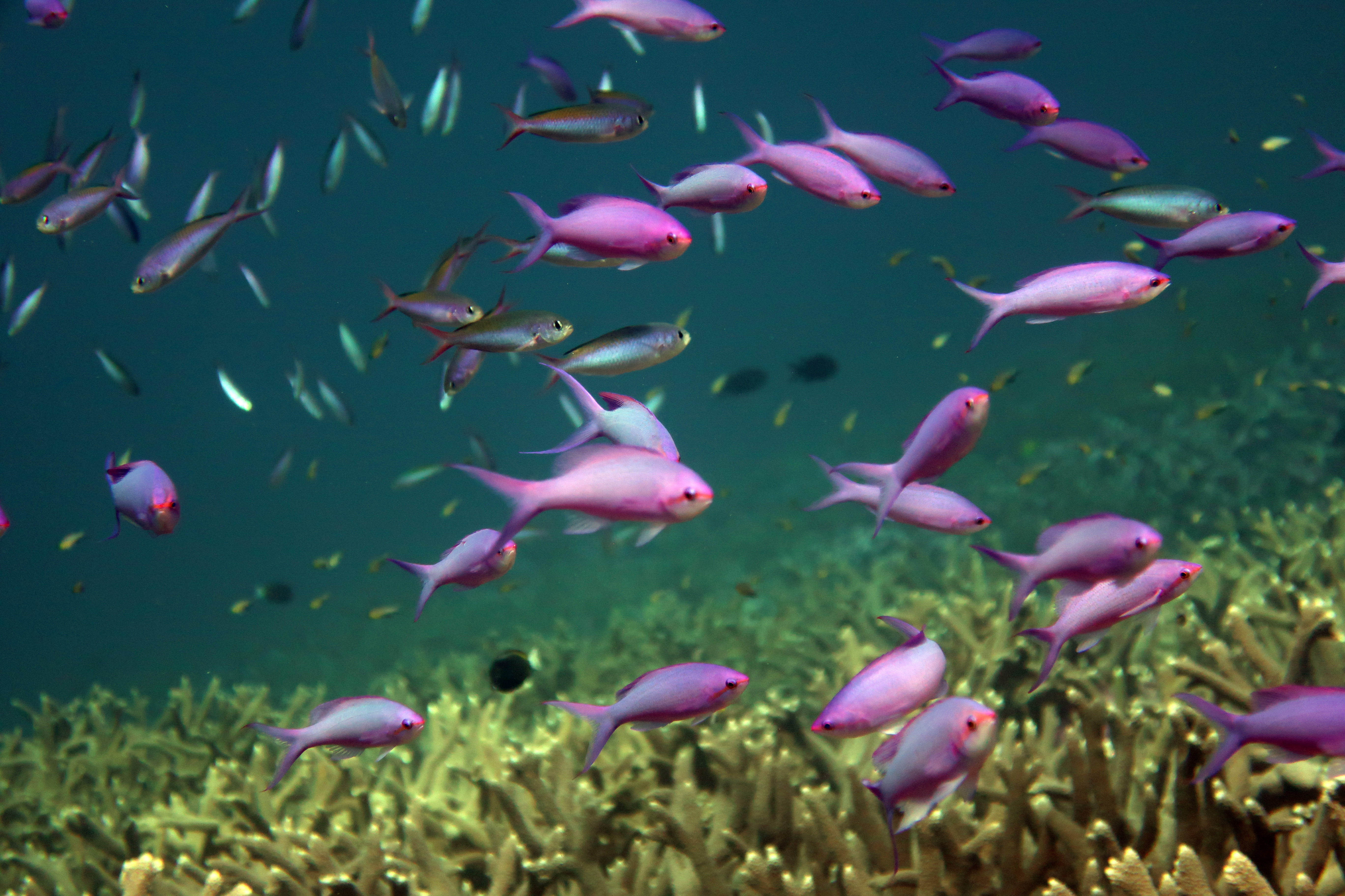
A school of purple anthias hover above the coral at Howland Island.
Credit: Jeffrey Milisen/NOAA
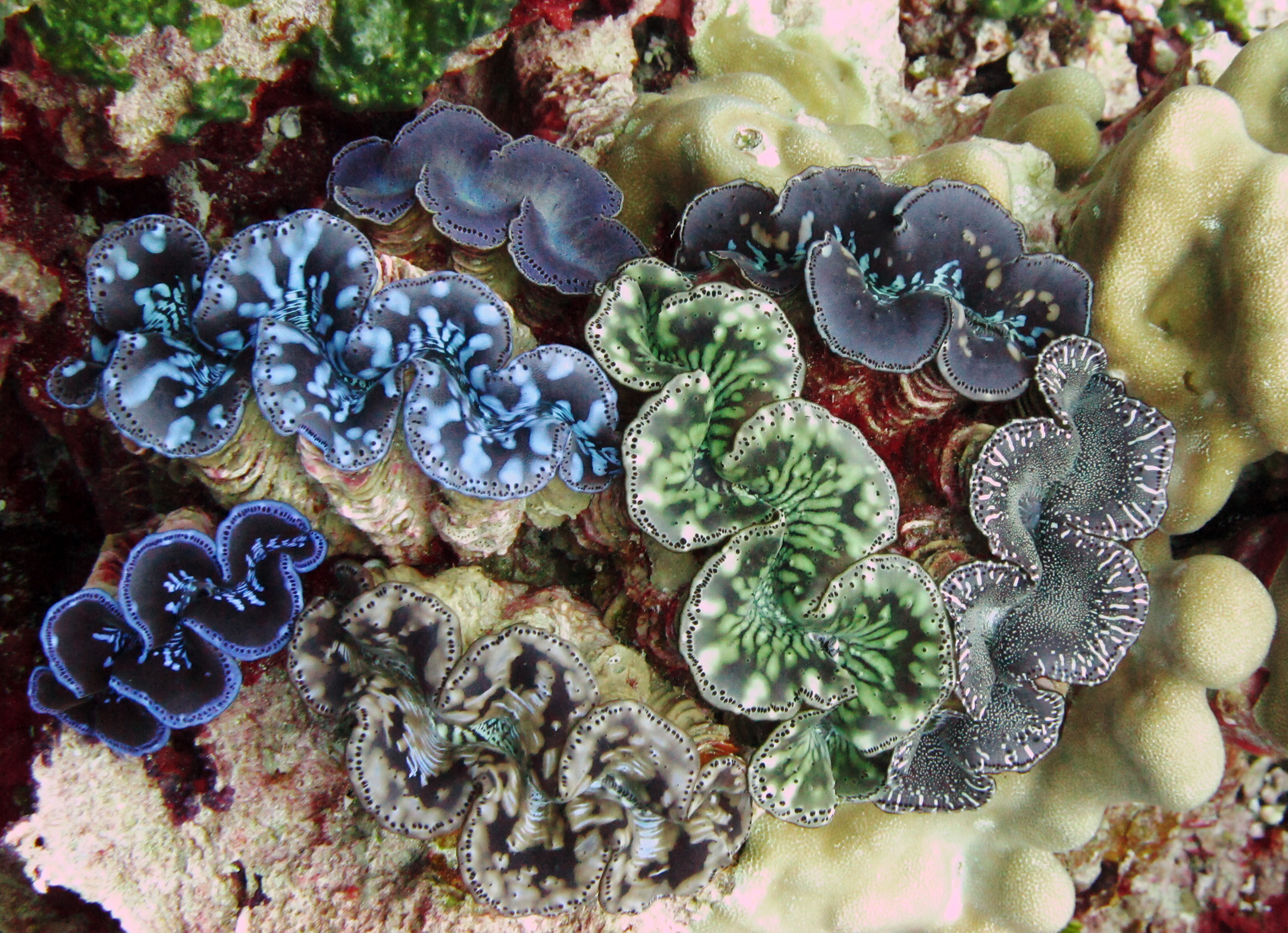
Closeup of rare giant clams at Kingman Reef National Wildlife Refuge.
Credit: Amanda Pollock/USFWS

An aerial view of Palmyra Atoll which lies about halfway between Hawai‘i and American Samoa. Palmyra consists of a circular string of about 26 islets nestled among several lagoons and encircled by 15,000 acres of shallow turquoise reefs and deep blue submerged reefs. It is the northernmost atoll in the Line Islands in the equatorial Pacific.
Credit: USCG

Bathymetric map of Titov Seamount within the Howland and Baker Islands Unit of Pacific Remote Islands National Marine Monument. Undersea mountains, or seamounts, serve as ecological hotspots for biodiversity and habitat complexity between large swaths of mostly barren deep ocean seascapes far from land. Bathymetric maps use color to indicate water depth. Colors on the "warm" end of the spectrum (red, orange, and yellow) represent shallower water.
Credit: NOAA
B-Roll video
Credit: USFWS/NOAA