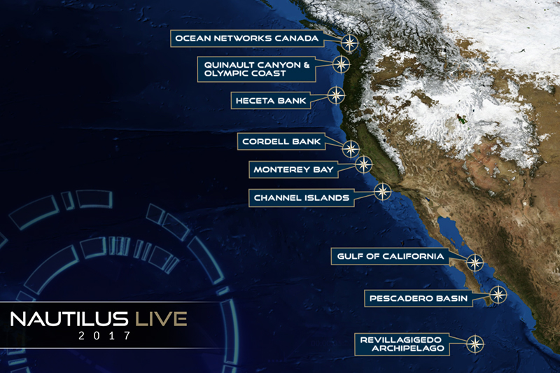
Throughout the summer of 2017, NOAA's Office of National Marine Sanctuaries teamed up with Ocean Exploration Trust to explore the marine ecosystems of the West Coast. Working aboard the Exploration Vessel (E/V) Nautilus, scientists mapped and explored targets throughout the U.S. West Coast from Canada to Mexico. They investigated Channel Islands, Cordell Bank, and Olympic Coast national marine sanctuaries using remotely operated vehicles (ROVs), and conducted mapping operations throughout all five West Coast national marine sanctuaries. Details and photos from the expedition can be found below, and the expedition archive is available on nautiluslive.org.
The NOAA Office of Ocean Exploration and Research provides support for the complementary ocean exploration program of the E/V Nautilus, which operates under a similar paradigm as the NOAA Ship Okeanos Explorer.
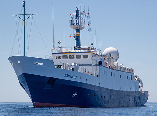
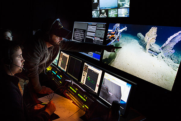
The E/V Nautilus is equipped with telepresence, which will allow scientists from around the world to participate and contribute to the success of this mission. Plus, telepresence will bring national marine sanctuaries and ocean science to the classroom, as students across the country will directly engage with mission staff and operations.
For a full run-down of Nautilus' 2017 expedition plan and to watch live video, visit nautiluslive.org. Read on for details on the expedition's voyages into your national marine sanctuaries. You can follow the expedition on the NOAA Office of National Marine Sanctuaries social media channels


 , and check back here for updates, photos, and video as the expedition continues.
Dates: July 7-29, 2017
Lead Scientists: Dr. Robert Ballard, Ocean Exploration Trust; Dr. Larry Mayer, UNH-Center for Coastal Ocean Mapping; Julie Bursek, Channel Islands National Marine Sanctuary; Chris Caldow, Channel Islands National Marine Sanctuary
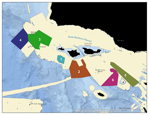
Area of Exploration: Channel Islands National Marine Sanctuary
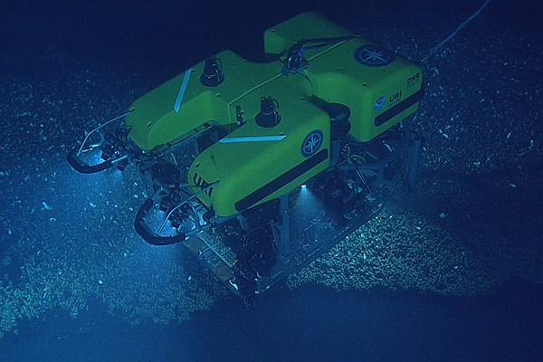
In this part of the expedition, researchers will map areas of Channel Islands National Marine Sanctuary and explore habitats in uncharacterized regions of the sanctuary seafloor using an ROV. The sanctuary is home to large populations of commercially-important species like fish and lobster, and protects fragile ecosystems like deep sea coral habitats. However, as of 2014 more than half of the sanctuary was poorly mapped and characterized.
Last year, the sanctuary teamed up with Ocean Exploration Trust and the NOAA Office of Ocean Exploration and Research to cut the knowledge gap nearly in half. This year’s expedition will continue that work. Better maps and habitat characterization will help guide the management of Channel Islands National Marine Sanctuary.
The Channel Islands region was initially formed by a submarine volcano 19-15 million years ago, and since then has undergone extraordinary changes. Researchers plan to collect data that will shed light on sea level changes and shifting shorelines throughout the area’s geologic history.
Dates: August 6-14, 2017
Lead Scientists: Danielle Lipski, Cordell Bank National Marine Sanctuary
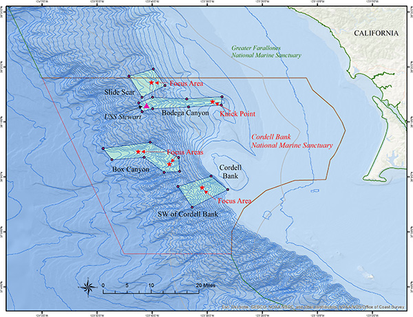
Area of Exploration: Cordell Bank National Marine Sanctuary
In August, researchers aboard Nautilus will turn their focus to Cordell Bank National Marine Sanctuary, located six miles off the coast of Northern California. In June 2015, the sanctuary was expanded from 529 to 1,286 square miles. This summer, researchers will visually survey unexplored deep-water habitat in the newly expanded areas of the sanctuary to characterize habitat, species, and communities.
Using high-resolution multibeam sonar, researchers will identify hard substrate areas that may harbor rich invertebrate communities. Then they will use ROVs to complete initial visual surveys and collect biological specimens and environmental data.
Additionally, researchers will investigate the deep sea habitat in the sanctuary to document corals, sponges, other invertebrates, and fish living at depths from approximately 500-1500 meters. Researchers will also be studying the physical and chemical environment of these communities to understand the conditions these species live in and to their vulnerability to stressors such as ocean acidification. This information will help inform management decisions and future research expeditions within the sanctuary.

Dates: August 18 - September 3, 2017
Lead Scientists: Jenny Waddell, Olympic Coast National Marine Sanctuary; Elizabeth Clarke, NOAA Northwest Fisheries Science Center; Joe Schumacker, Quinault Indian Nation
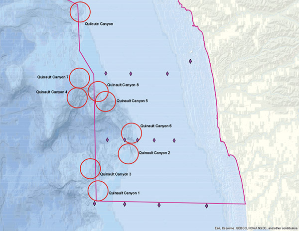
Area of Exploration: Olympic Coast National Marine Sanctuary
In this part of the expedition, researchers will explore and characterize seafloor ecosystems and features within Olympic Coast National Marine Sanctuary, specifically in and around Quinault, Quileute, and Juan de Fuca canyons. Using ROVs and an autonomous underwater vehicle (AUV), scientists will investigate persistent rocky reef habitats that may harbor deep-sea coral and sponge communities and possibly methane seeps, hundreds of which were discovered off this coast in 2016.
Olympic Coast National Marine Sanctuary also serves as a sentinel site for ocean acidification, a phenomenon associated with changes in the chemistry of seawater and marked by a decline in the pH of the ocean. Nearly 30 percent of the carbon dioxide released through burning fossil fuels is absorbed by the ocean, which alters the ocean’s chemistry, ultimately making it harder for shellfish and other organisms to maintain their skeletons and shells. Researchers will be using Nautilus as a platform to collect information about the ocean’s chemical and physical properties and associated biological communities. This information will complement other ocean acidification research, contribute to forecasting efforts based on regional ocean models, and further the objectives of the ocean acidification sentinel site. It will also help inform future management and research decisions by the sanctuary, coastal treaty tribes, state and federal agencies, and other partners.
One day of the mission will include a dive on a maritime heritage site within Olympic Coast National Marine Sanctuary: the wreck of the WWII-era submarine USS Bugara, which sank off Cape Flattery in 1971. For those interested in naval history and maritime heritage, the dive will be live-streamed on nautiluslive.org.
Just offshore the northwest corner of the Olympic Peninsula, a maritime heritage site lies 800 feet below the surface of Olympic Coast National Marine Sanctuary. Resting on the seafloor, USS Bugara is a U.S. Navy submarine that received three battle stars for its service in World War II and later served in the Korean War and Vietnam War before being decommissioned in 1970. While under tow to serve as a target vessel in 1971, the submarine began to take on water and foundered off Cape Flattery, Washington. NOAA’s Office of National Marine Sanctuaries and Ocean Exploration Trust are joining forces to conduct the first archaeological survey of the USS Bugara on August 25, 2017. Watch Live at NautilusLive.org
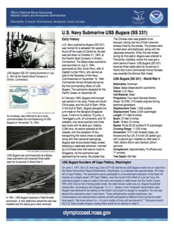
U.S. Navy Submarine USS Bugara (SS-331) fact sheet
In 1951, USS Bugara received a Fleet Snorkel conversion. A new distinctive streamline sail was installed and the decks guns were removed. Photo: Naval History and Heritage Command
USS Bugara main deck plan. Photo: National Archives and Records Administration
USS Bugara was commissioned as a Balao-class submarine and received three battle stars for its service in World War II. Photo: Naval History and Heritage Command
USS Bugara outboard profile. Photo: National Archives and Records Administration

USS Bugara in Panama Bay 1945. Courtesy: Robert Schwemmer Maritime Library
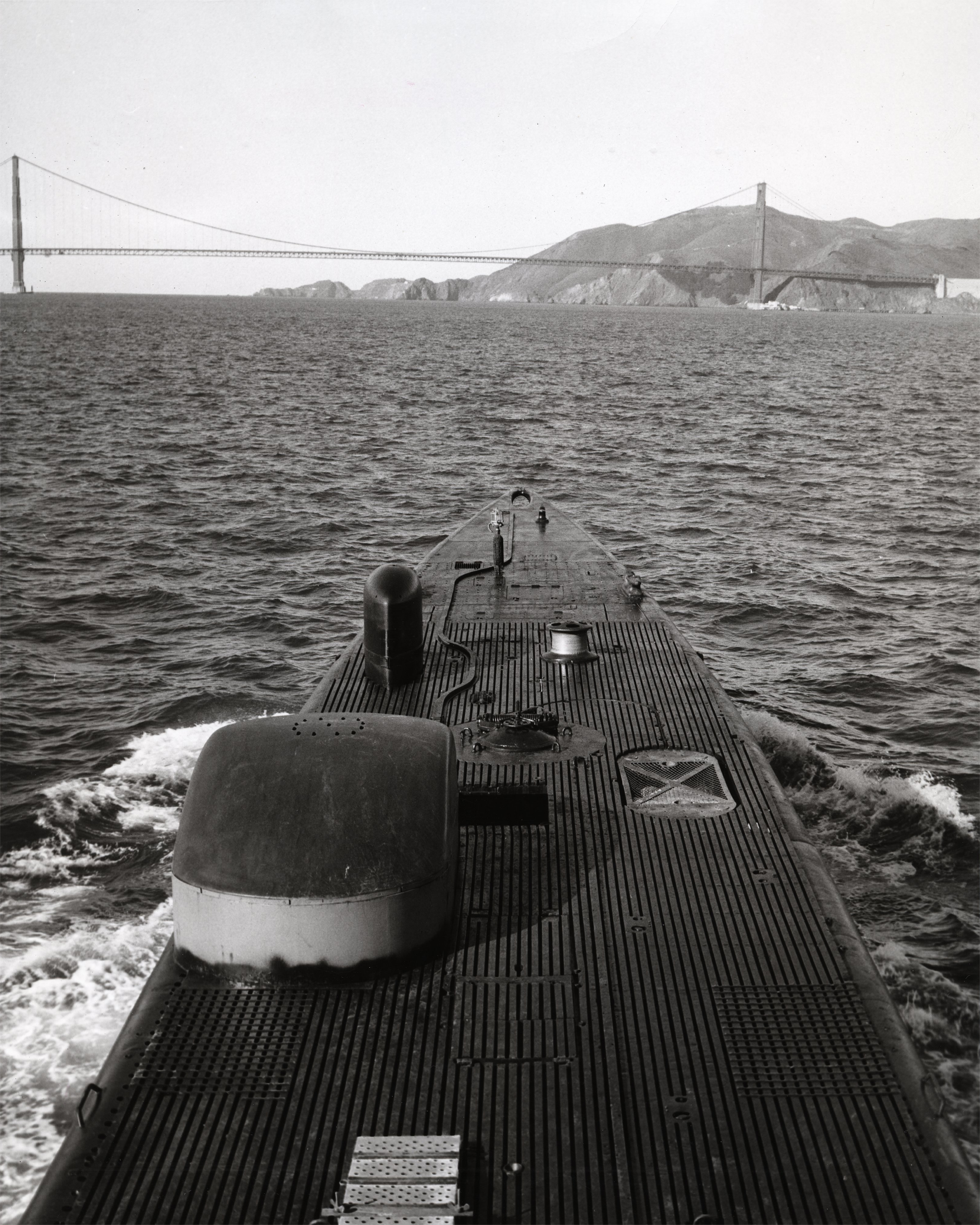
USS Bugara approaches Golden Gate Bridge. Photo: San Francisco Maritime National Historical Park
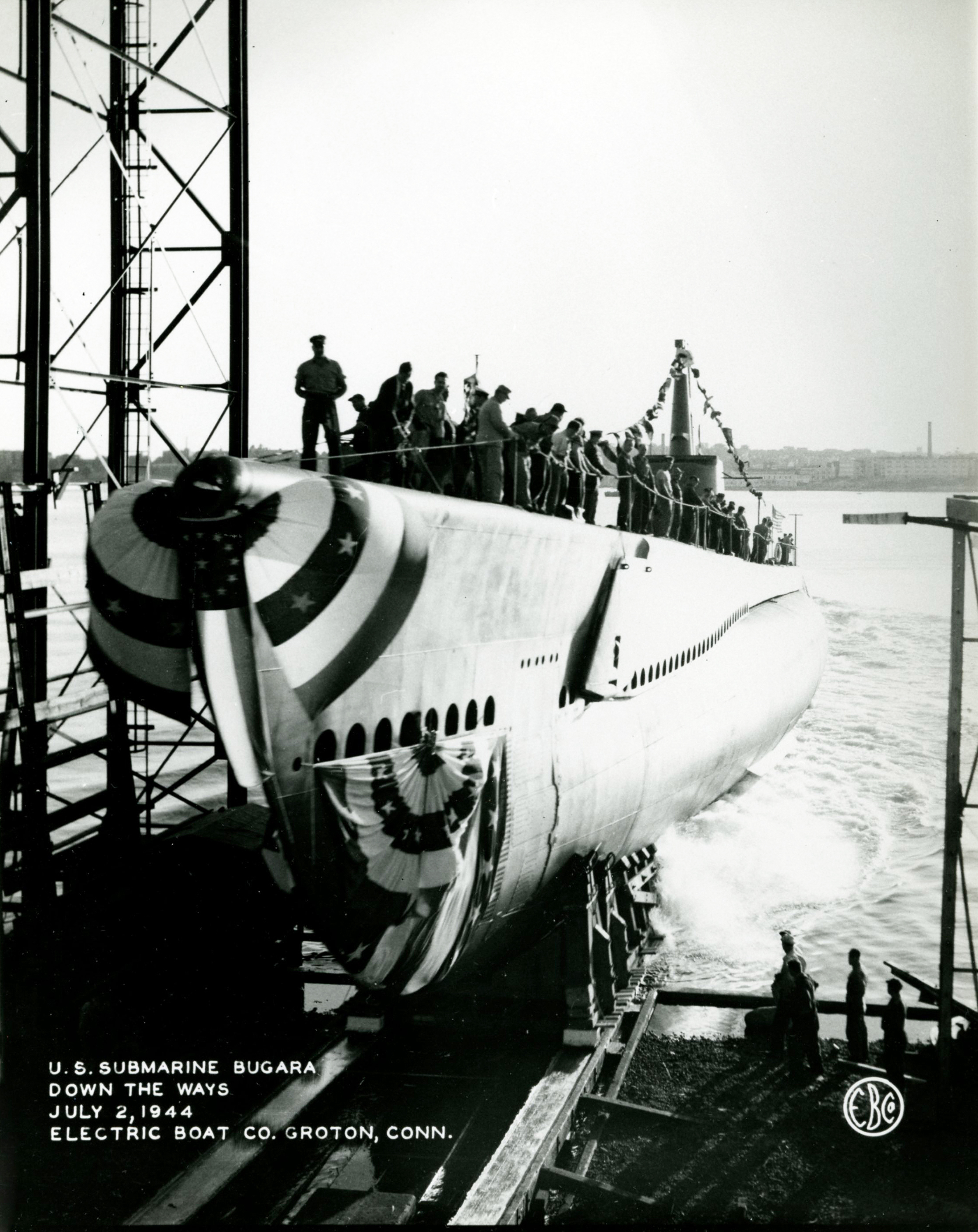
USS Bugara (SS-331) being launched on July 2, 1944 at the Electric Boat Company in Groton, Connecticut. Courtesy: Robert Schwemmer Maritime Library
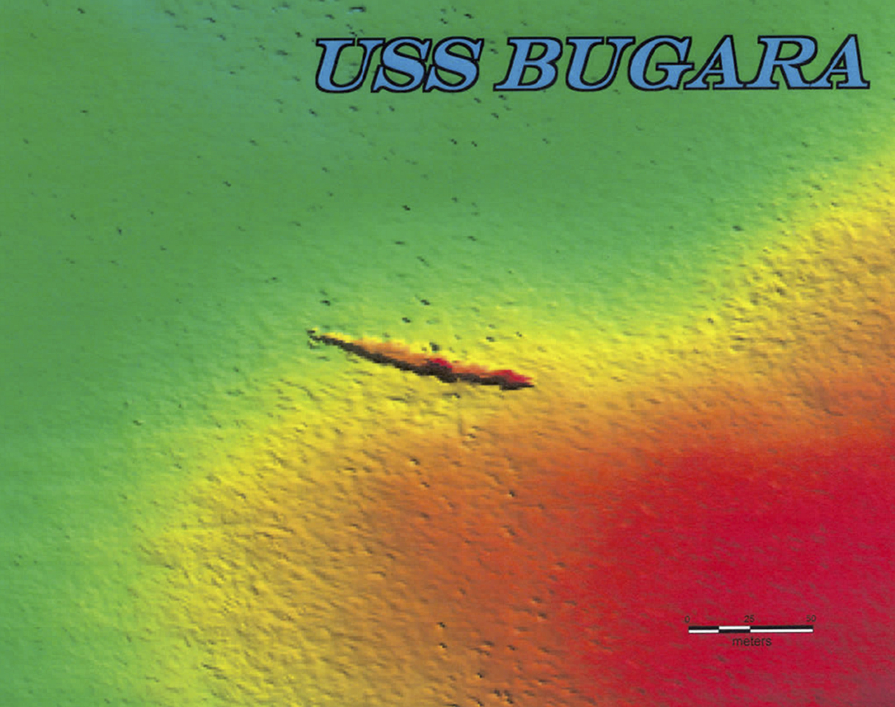
A multibeam sonar survey of the USS Bugara was conducted by the NOAA ship Okeanos Explorer in 2008 off Cape Flattery, Washington. Photo: NOAA R/V Okeanos Explorer
Crew members aboard USS Bugara in Subic Bay, Philippines, in 1966. Photo taken from the destroyer USS Fred T. Berry (DD-858). Photo Courtesy: NavSource and Richard Leonhardt
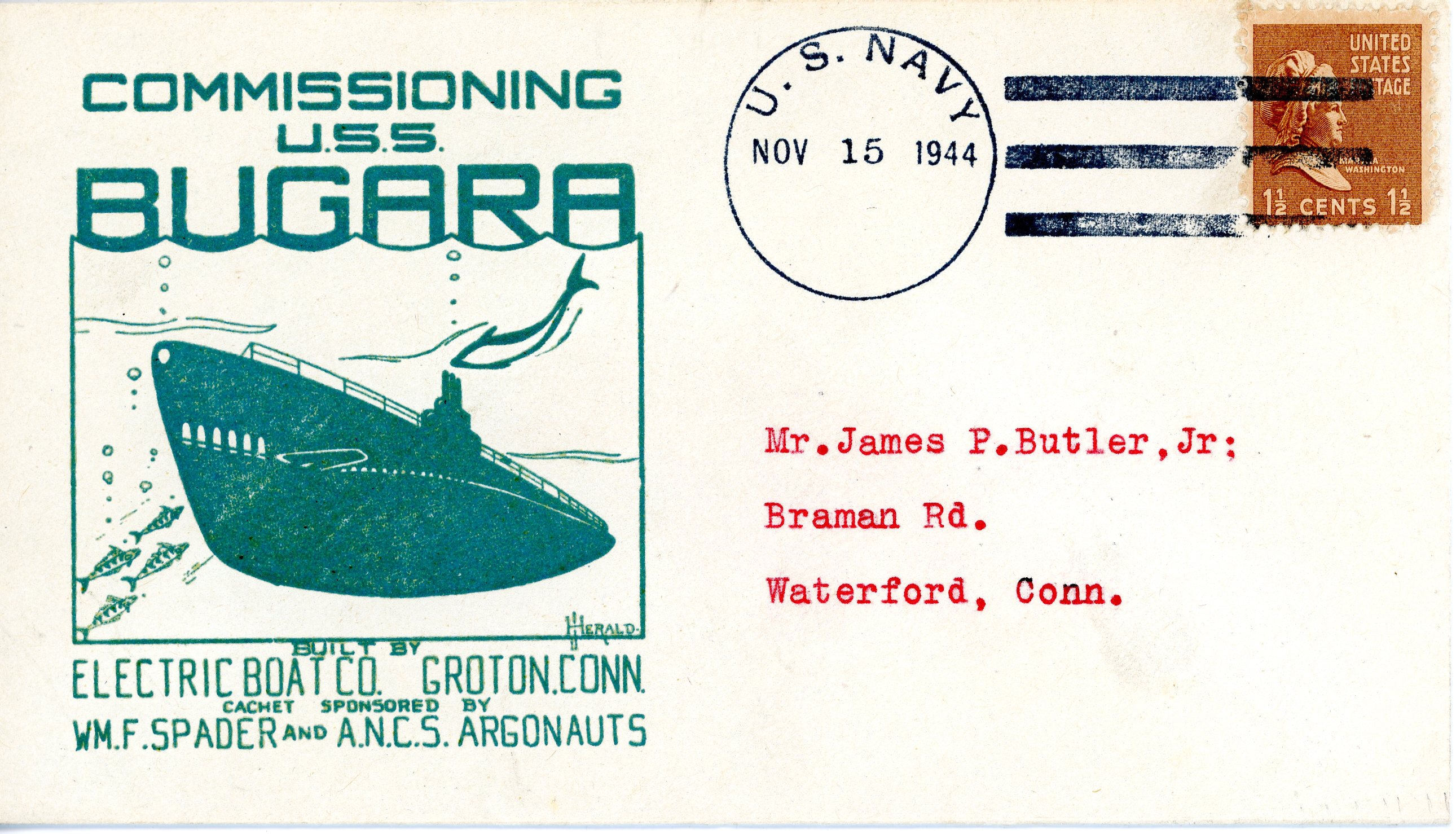
An envelope, also referred to as a cover, commemorates the commissioning of USS Bugara on November 15, 1944. Courtesy: Robert Schwemmer Maritime Library
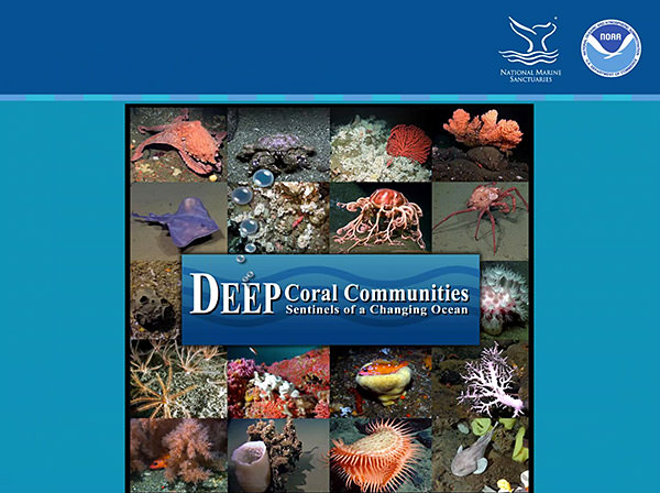
Deep-sea coral communities, like the ones found in the national marine sanctuaries of the West Coast, are home to many diverse species. This curriculum takes students into the deep sea to identify the soft corals, hard corals, invertebrates, and fish found in these communities and to investigate the unique biology of deep-sea corals. Learn the threats these animals face and what we can do help protect them.
Watch this webinar archive that introduces you to the Deep-Sea Coral Communities educational materials and hands-on activities.