NEW: The designation of Chumash Heritage National Marine Sanctuary became effective on November 30, 2024. NOAA announced the sanctuary’s birthday, November 30, 2024, in this Federal Register notice. See details about the sanctuary designation process here.
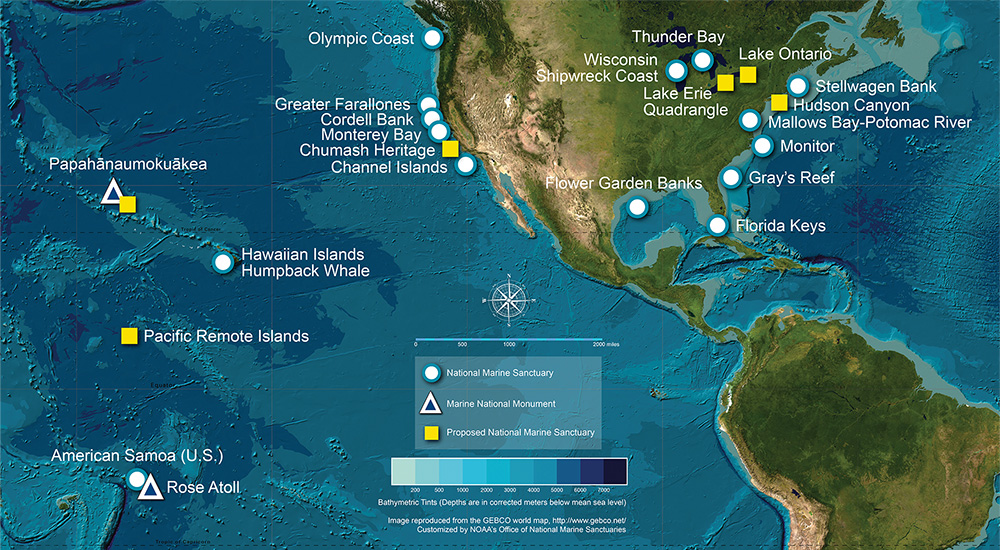
Designated in 2024, Chumash Heritage National Marine Sanctuary is America’s 17th national marine sanctuary, the sixth off the U.S. West Coast, and is one of the largest in the National Marine Sanctuary System. The sanctuary encompasses 4,543 square miles of Central California’s beautiful coastal and ocean waters, providing protection to nationally significant natural, cultural, and historical resources while bringing new opportunities for research, community engagement, and education and outreach activities.

Indigenous Peoples have lived on California's central coast for over 10,000 years. Submerged cultural resources, including possible ancient village locations once present along paleo shorelines, will now receive long-term protection through sanctuary regulations. The sanctuary honors the deep cultural and historical importance of this place to the region’s Indigenous Peoples. Respect will guide community-focused efforts to protect the marine environment and ensure long-term care of this treasured ocean place.
NOAA respectfully acknowledges that the ocean waters, seafloor, and coast within and beyond Chumash Heritage National Marine Sanctuary are, and always have been, the native homelands of Chumash Peoples and their ancestors, and that adjacent waters and coasts further north are also the native homelands of Salinan Peoples and their ancestors. NOAA designates this sanctuary with respect and reverence for the Indigenous Peoples of this coastal area, and looks forward to a future of partnership and collaborative co-stewardship to protect and honor this special place.