Proposed Chumash Heritage National Marine Sanctuary
NOAA is releasing for public comment the draft designation documents for the proposed Chumash Heritage National Marine Sanctuary. This action comes after the agency conducted a thorough analysis and evaluated feedback from the public, stakeholders, Indigenous communities, scientists, and federal and state agencies. The proposed sanctuary designation stretches along 134 miles of coastline and would encompass more than 5,600 square miles of water off of the Central California coast.
On behalf of a broad community consortium, the Northern Chumash Tribal Council submitted the sanctuary nomination in July 2015. NOAA’s Office of National Marine Sanctuaries issued a Notice of Intent to begin the designation process for the proposed sanctuary in November 2021. NOAA's proposed designation would protect the region’s important marine ecosystems and maritime heritage resources, support ocean-dependent economies, and highlight the cultural values and connections of Indigenous communities to the area.

Map of the Agency-Preferred Alternative boundary of the area NOAA is proposing to designate as Chumash Heritage National Marine Sanctuary. View maps of draft EIS boundary alternatives
Credit: NOAA

Proposed Chumash Heritage National Marine Sanctuary Factsheet
Kelp (Macrocystis pyrifera) forest located at Cojo Anchorage near Point Conception, Calif., hosts a variety of invertebrates, fish and marine mammals.
Credit: Robert Schwemmer, NOAA

Launch of tanker SS Montebello at Southwestern Shipbuilding Co., San Pedro, Calif., in 1921. Montebello was later torpedoed by a Japanese submarine south of Cambria, Calif., in 1941.
Credit: Unocal

A view of the steering wheel on the bridge of the USCG Cutter McCulloch. The McCulloch sank when it collided with the passenger steamship SS Governor on June 13, 1917.
Credit: NOAA/USCG/VideoRay
Jalama Beach is a popular destination for surfing, sport fishing enthusiasts and beachcombers.
Credit: Robert Schwemmer, NOAA
A view of the proposed Chumash Heritage National Marine Sanctuary near Montana de Oro State Park in San Luis Obispo County, California.
Credit: Robert Schwemmer/NOAA
Humpback whales are among the species that inhabit the waters of the proposed Chumash Heritage National Marine Sanctuary.
Credit: Robert Schwemmer, NOAA
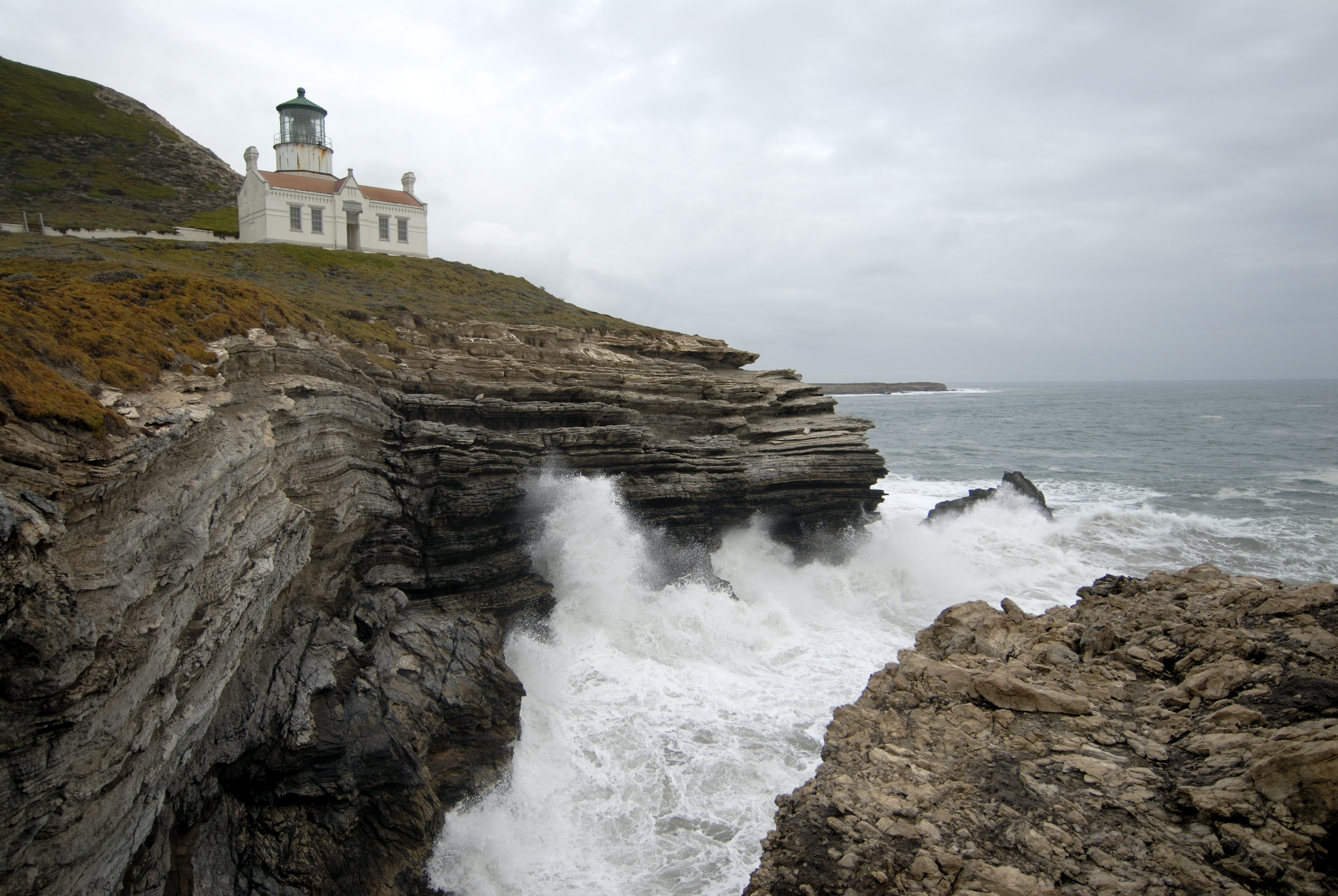
The second Point Conception lighthouse was rebuilt in 1881 and relocated to the lower bluff of the cape 133 feet above the Pacific Ocean, where fog would be less likely to obscure the light.
Credit: Robert Schwemmer, NOAA
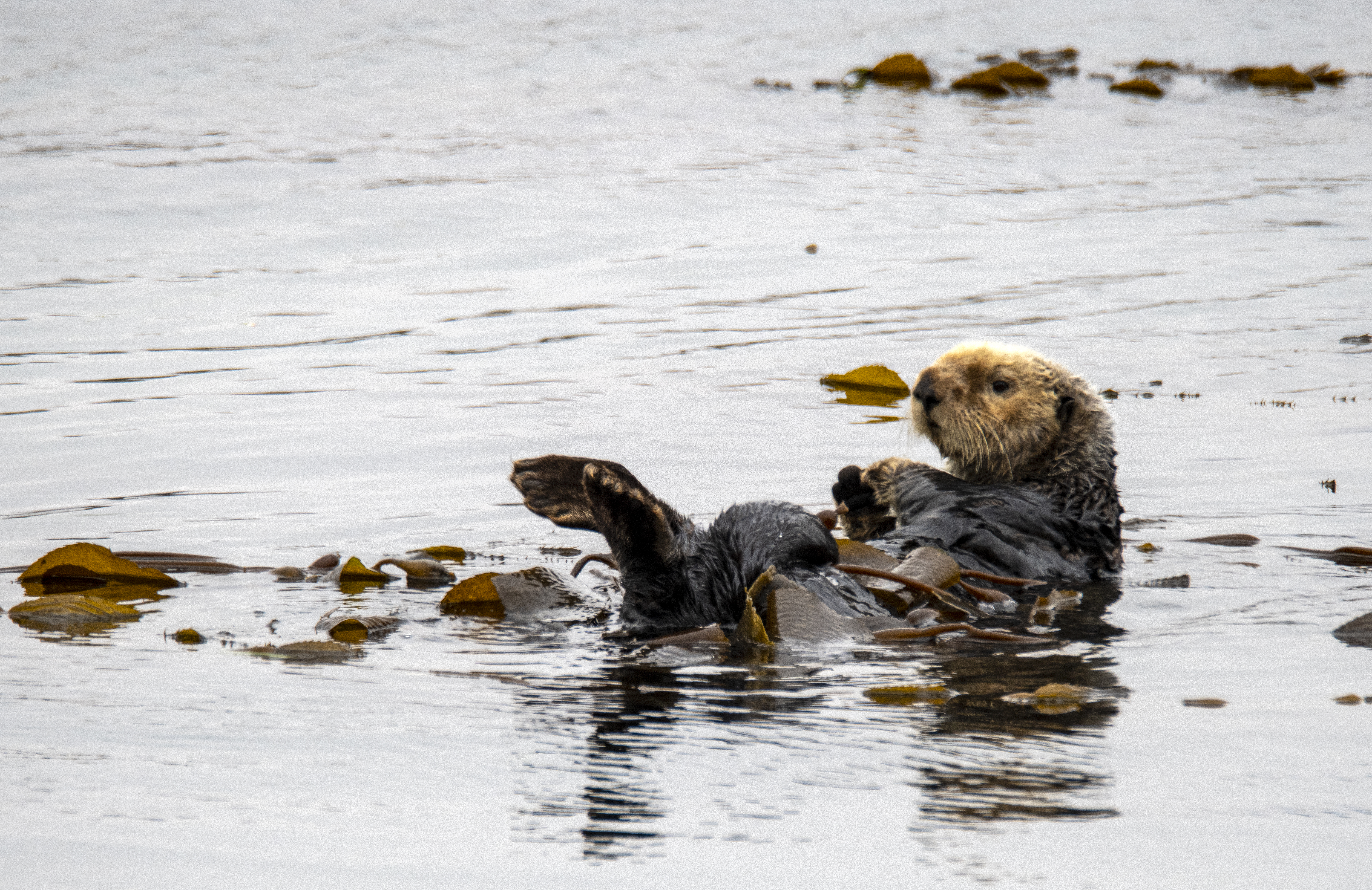
Sea otters (Enhydra lutris) are native to California's central coast. The kelp keeps them from drifting away and provides camouflage from predators.
Credit: Robert Schwemmer, NOAA

Shipwreck site of the steam schooner wrecker SS San Pedro lost in 1894 while salvaging the coal cargo from the shipwreck Gosford at Cojo Anchorage.
Credit: Robert Schwemmer, NOAA
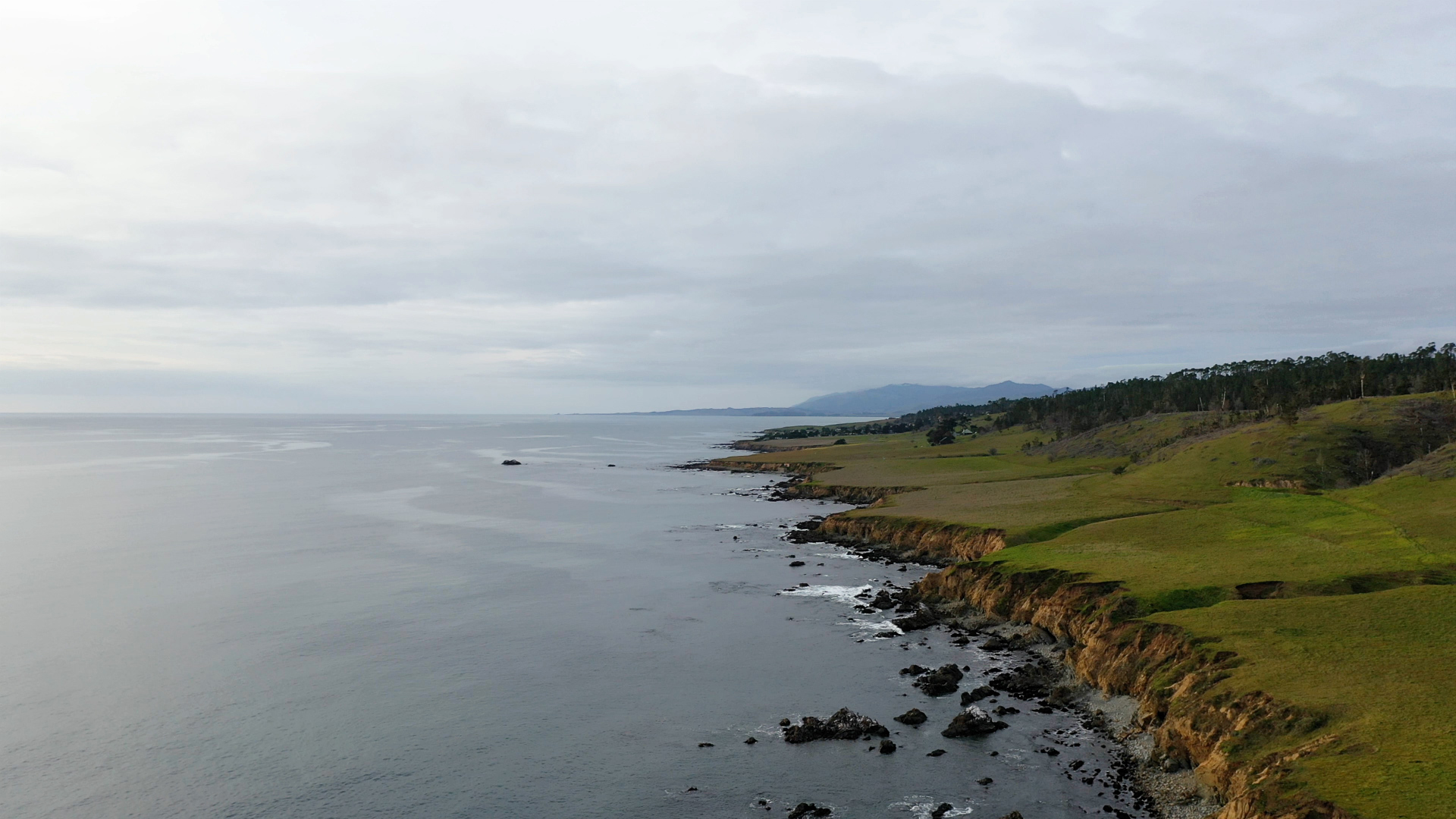
Aerial view of Sibley Ranch, part of UC Santa Barbara's Kenneth S. Norris Rancho Marino Reserve, south of Cambria.
Credit: Robert Schwemmer, NOAA
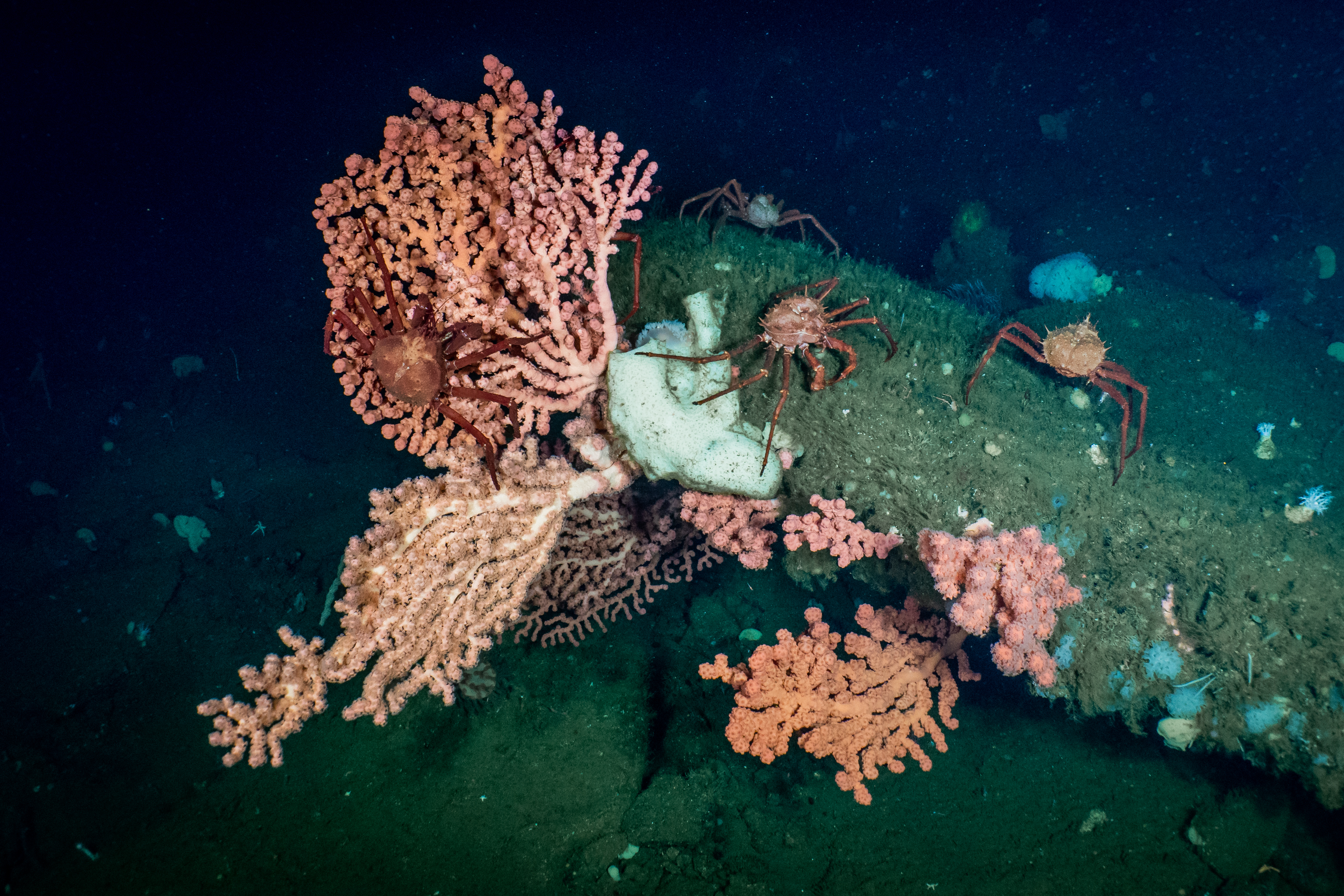
Deepwater bubblegum coral, a host for California king crab, observed during 2020 E/V Nautilus exploration of the Santa Lucia Bank. Corals and sponges that make up the area's seafloor habitats provide food and shelter for recreationally and commercially important fish species.
Credit: OET/NOAA
Santa Maria River estuary at Rancho Guadalupe Dunes Preserve is a popular seabird watching destination, and was once a seafood gathering place for the Chumash people.
Credit: Robert Schwemmer, NOAA

B-Roll video
Credit: NOAA

Video of proposed Chumash Heritage National Marine Sanctuary