Exploring Ocean Mysteries is a curriculum that makes it easy to teach the seven Ocean Literacy Principles while meeting NGSS, Common Core and Climate Literacy standards. Lessons are targeted to middle grades and adaptable for grades 4-12. They use the National Marine Sanctuary System as an engaging backdrop that helps students understand their importance for exploration, research, Indigenous cultures and more.
Ocean Literacy Essential Principle 1: Earth has one big ocean with many features.
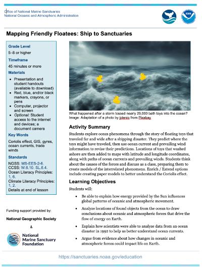
In the Mapping Friendly Floatees lesson, students explore ocean phenomena through the story of floating toys that traveled far and wide after a shipping disaster. They predict where the toys might have traveled, then use ocean current and prevailing wind information to revise their predictions. Students think about the causes of the forces and discuss them as a class, preparing them to create models of the interrelated phenomena.
Lesson Plan
Students will:
- Be able to explain how energy provided by the Sun influences global patterns of oceanic and atmospheric movement.
- Analyze locations of found objects from the ocean to draw conclusions about oceanic and atmospheric forces that drive the flow of energy on Earth.
- Explain how scientists were able to analyze data from an ocean disaster in 1992 to help us better understand ocean currents.
- Argue from evidence about how changes in oceanic and atmospheric forces could impact life on Earth.
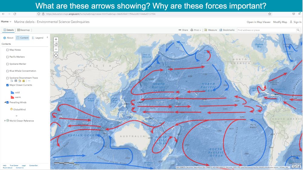
Students will mark locations of the Friendly Floatees spill and where some of them were found on a map. They will add features like “Major Ocean Currents” and “Prevailing Winds” from ArcGIS.
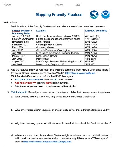
Pass out the “Our Global Ocean” maps, one for each student, and ask them to think about what they know about the ocean to help them predict where they, part of the so-called Friendly Floatees, might have traveled to and why.

Open the “Mapping Friendly Floatees” presentation. “Imagine that they are rubber ducks on a ship traveling from Hong Kong, China to the U.S.” (Click to show the cargo ship with containers.) “Suddenly, a storm slams into their ship and washes their cargo container overboard. The damaged container spews them into the turbulent North Pacific ocean basin, where they are now sloshing around with about 29,000 rubber ducks and other bath toys.”