Storied Seas: The Names and Tales of Sanctuary Places
50th Anniversary Sanctuary Signature Articles
By Elizabeth Moore | November 2021

By Any Other Name
We humans like to name things, placing monikers on everything around us—cliffs, coves, bays, anything of geographic significance. We renamed as new cultures evolved from older ones and colonists displaced native peoples, using different names in different languages. As we examine the records of human coastal habitation and use, from the oral traditions of the first people to settle along our shores, to early maps and charts of European explorers to more modern documents, we find names layered on top of one another in a historic collage.
As we explored out into and under our seas, there too we found features worth naming. While today, naming an underwater feature is a formalized process coordinated by international organizations, many names of underwater features reflect the history of how, and often who, discovered them. Your national marine sanctuaries have names too, usually derived from the geographic area they encompass or the resources they protect. But where did those names come from in the first place? Let’s take a voyage and learn the stories behind the names of some of the nation’s most important ocean places.
From Geography
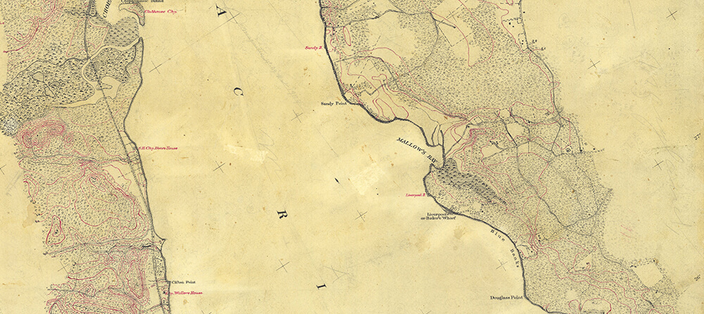
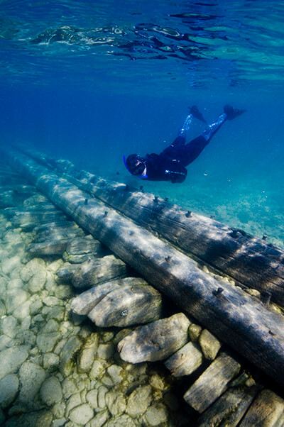
Some national marine sanctuaries are named for their geography. Mallows Bay-Potomac River National Marine Sanctuary is named for the area around the wooden steamship graveyard it protects. The exact origin of the name Mallows is unknown, but is believed to come from an early colonial family named Mallow or Marlowe who lived in the area. Both names were used in maps and documents into the late 19th century but Mallows won out by the early 20th century and appeared on official maps of the area since then.
Monterey Bay National Marine Sanctuary too is named after the bay at the center of this expansive protected area. At first dubbed La Bahia de los Pinos (“the bay of pines”) in 1542 by Portuguese explorer Juan Rodriguez Cabrillo, the city of Monterey gained its present name from Spanish explorer Sebastián Vizcaíno, possibly after the Spanish city Monterrei, meaning “mountain of the king.”
Olympic Coast National Marine Sanctuary takes its name from the Olympic Peninsula it abuts, including the Olympic Mountains named by Englishman John Meares in 1774 after the highest mountain in Greece, Mount Olympus, the mythological Greek home of the gods.
From Resources
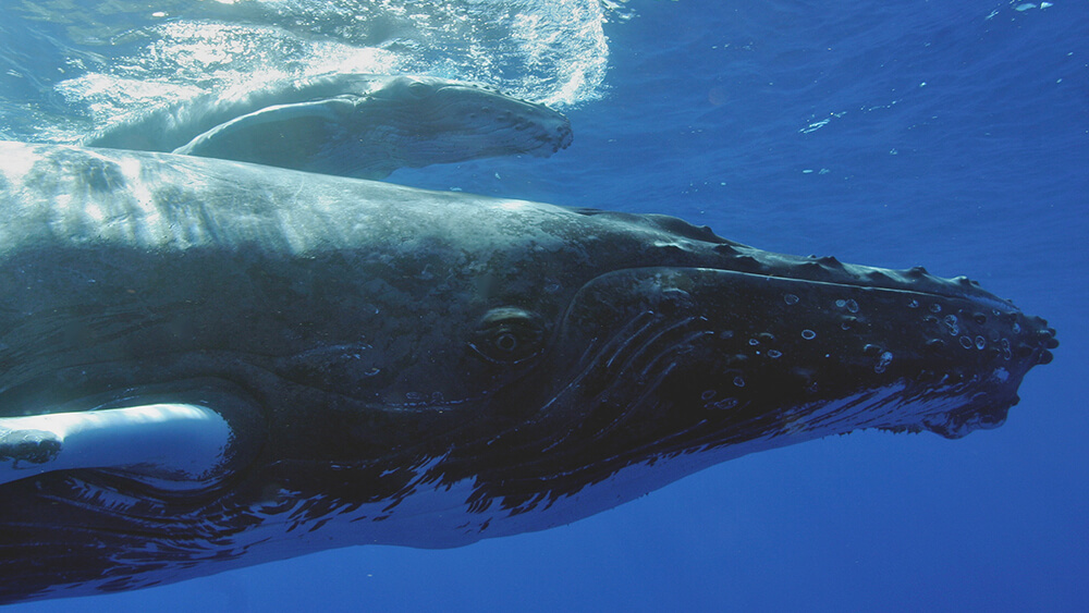
Several of the national marine sanctuaries are obviously named for the resources they protect. Monitor National Marine Sanctuary, for example, protects the wreck of the Civil-War ironclad USS Monitor. Hawaiian Islands Humpback Whale National Marine Sanctuary is named for the humpback whale and Hawaiian habitat it protects.
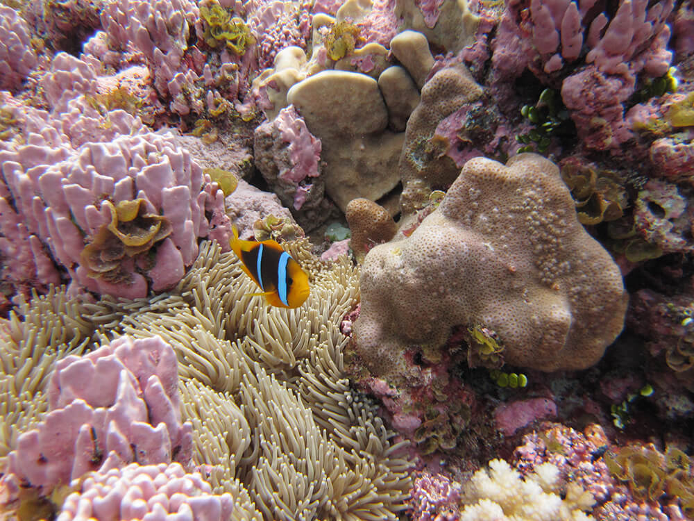
Another sanctuary’s name is also inspired by the resources it protects but perhaps not as obviously as other sites, and that is Flower Garden Banks National Marine Sanctuary. The banks we now call “flower gardens” were first discovered by snapper and grouper fishermen in the late 1800s. They named the banks after the sponges, algae, corals, and other marine life they could see on the colorful reefs below their boats, the colors so rich it reminded them of gardens full of blooms. The name was already in use during the first survey conducted by the U.S. Coast Survey in 1936.
In Honor of Scientists
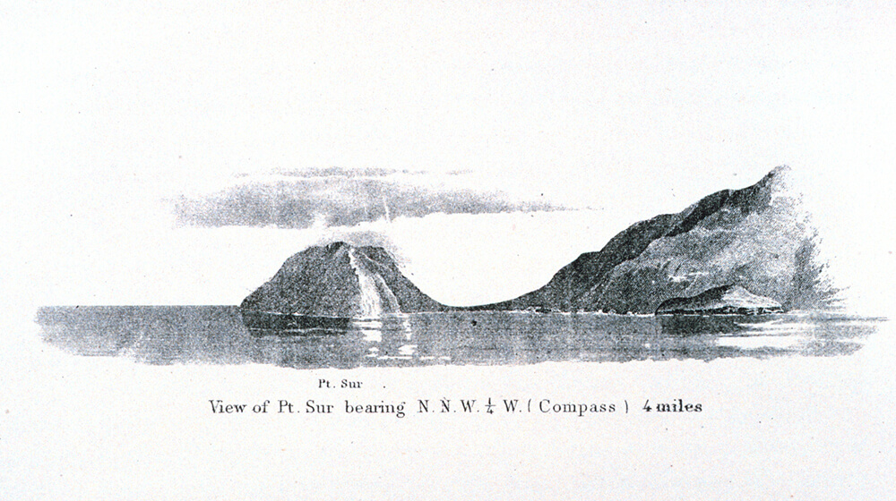
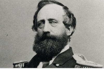
Many ocean places are named after the people who discovered or explored them first, almost always a man. Several sanctuaries and their central features were named for surveyors of our sister agency at NOAA, the U.S. Coast and Geodetic Survey, which is responsible for charting U.S. waters. Davidson Seamount, protected by Monterey Bay National Marine Sanctuary and the first to be characterized as a "seamount" in 1938 by the United States Board on Geographic Names, was named in honor of surveyor George Davidson. Cordell Bank, off the California coast and the centerpiece of the sanctuary that bears its name, was originally discovered by Davidson in 1853. By tradition the bank should have been named for him, but it was fellow surveyor Edward Cordell who was given that honor. Cordell carried out a more thorough survey of the bank in 1869. After he died unexpectedly of a seizure in San Francisco the following year, the bank was named after him.
Some years earlier, Cordell, as a new hydrographer with the Coast Survey, accompanied naval officer Henry S. Stellwagen as he surveyed a bank off the coast of Massachusetts that was later named for him (as is the sanctuary that protects it). The bank was long known to fishers and others from colonial times because of its rich productivity, and had the unofficial name “Middle Ground.” But the bank was eventually named in 1854 for Stellwagen, who carried out the first detailed exploration of the bank in 1854 and 1855.
Scientists too find their due in places they’ve studied. Milton B. “Sam” Gray, a biological collector and curator at the University of Georgia Marine Institute, conducted the first known survey of the reef that now bears his name in 1961 and was created as Gray’s Reef National Marine Sanctuary twenty years later. Ten of the banks added to the sanctuary in the 2021 expansion of Flower Garden Banks National Marine Sanctuary bear the names of oceanographers, geographers, and geophysicists who conducted research there and helped pioneer the drive for a sanctuary to protect the productive banks.

Native American Influences
Some of our places—those that were apparent to early human inhabitants and later European explorers, like islands and bays—carry far older names. The islands at the center of Channel Islands National Marine Sanctuary bore the original Chumash names of Tuqan (San Miguel), Wi'ma (Santa Rosa), Limuw (Santa Cruz), and 'Anyapax (Anacapa). Santa Barbara Island was called siwotʰ by the Tongva people, who may have accessed it seasonally, along with visits from Chumash people. The oldest chart held by NOAA of the area—a 1791 nautical chart drawn by British officer George Vancouver—bears the names for Catholic saints given to the islands by Spanish explorer Sebastián Vizcaíno in the early 1600s.
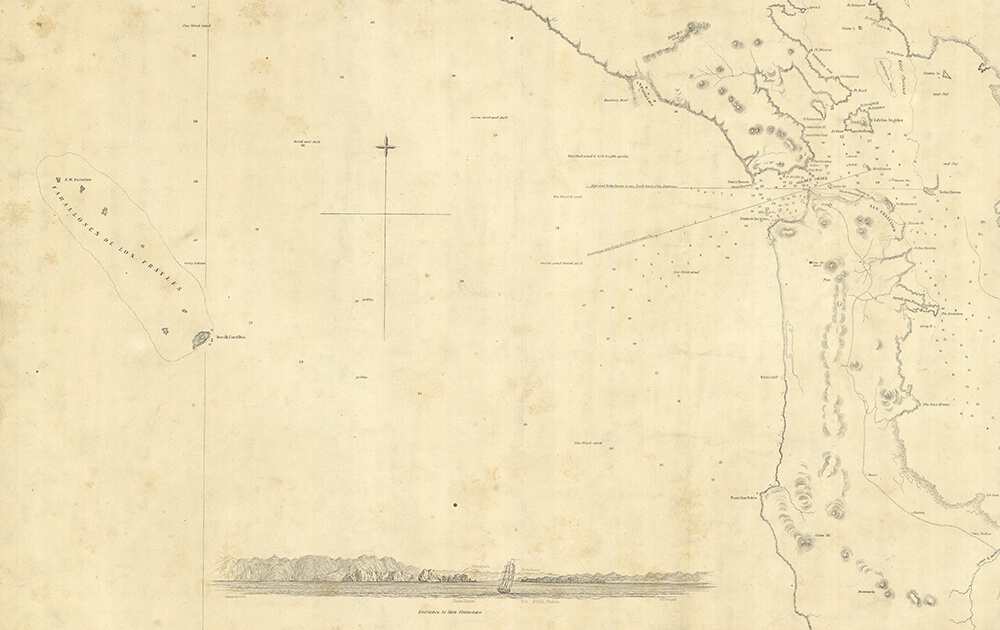
Northward along the California coast, the name used by the first inhabitants for what we now call the Farallon Islands is lost. The first European name given to them was the Islands of Saint James, by Francis Drake. But that name didn’t stick to the craggy islands. What did was Farallones, named from the Spanish word meaning a rocky island. An 1850 nautical chart, one of the earliest naming the island group, lists the full name as Farallones de los Frayles the rocky islets of the brothers. Friar Antonio de la Ascensión, a member of the Spanish explorer Sebastián Vizcaíno's 1603 expedition, is credited with bestowing the name. In 2015, during an event celebrating the expansion of Greater Farallones National Marine Sanctuary, elders of the Kashia people, a band of the Pomo Tribe, granted the sanctuary a name in their native language: "Ahqa Pilili walli," which translates to "the place of churning water."
Though place names used by the original Native Americans in Florida—such as the Calusa and the Tequesta—linger in the modern appellations of some cities and geographic features, the state’s name derives from Spanish explorers. Juan Ponce De León named the state in 1513 in honor of the Feast of Flowers, Pascua Florida, Spain’s Easter celebration. Though the original name given to the Keys by De León was Los Martires, the Martyrs (he thought the low-lying islands looked like suffering men), the archipelago was eventually named for the state and the Spanish word cayo (small island), from which the word key derives. What is now known as "Key West" was originally called "Cayo Hueso", which means island of bones. Some believe they called it this because it was littered with the bones of the Calusa and other Native Americans who inhabited the keys. Others believe it got its name from the bone-like appearance of the limestone rock formation. Either way, eventually English-speaking settlers started calling it Key West, because hueso sounded like west, and it was the western-most key in the island chain.
In Thunder Bay National Marine Sanctuary, though the Native American name of Thunder Bay is uncertain, its modern name may nevertheless result from early stories about it. “Thunder Bay” traces back to the old French name “L’anse du Tunnere,” which appeared on French maps as early as 1688, which may reflect a similar meaning Native American name for the area. According to oral tradition, while canoeing across Thunder Bay, the daughter of an Ottawa chief and her suitor were killed by a jealous rival, much to the dislike of the Manitou, or Great Spirit. A roar of thunder and flash of lightning followed and afterward the area was known as the Bay of Thunder.
Two areas—one a new sanctuary and the other currently in a designation process—bear names derived from Native American words. The new Wisconsin Shipwreck Coast National Marine Sanctuary takes its name from the state of Wisconsin. “Wisconsin,” according to the Wisconsin Historical Society, derives from a word of the Miami Tribe meaning “river that meanders through something red.” The proposed Lake Ontario National Marine Sanctuary, is named for the Great Lake in which it is situated. The name “Ontario” is thought to come from Native American words that may mean “beautiful lake or water” or “sparkling water.”
Pacific Traditions
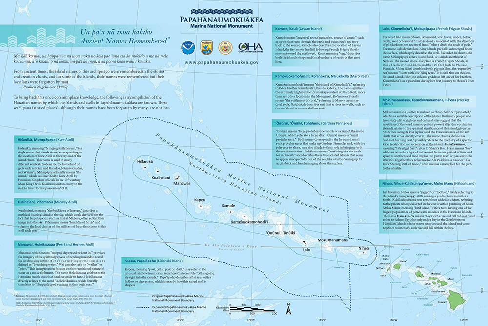
Papahānaumokuākea Marine National Monument comes from an ancient Hawaiian tradition concerning the genealogy and formation of the Hawaiian Islands, and a deep honoring of the dualisms of life. Papahānaumoku is a mother figure personified by the earth and Wākea is a father figure personified in the expansive sky; the two are honored and highly recognized ancestors of Native Hawaiian people. Their union resulted in the creation, or birthing, of the entire Hawaiian archipelago––thus the naming of the monument is to honor and preserve these names, to strengthen Hawaii’s cultural foundation, and to ground Hawaiians in an important part of their history.
The monument was named in 2007 through a process of working with Native Hawaiian elders to craft the appropriate name for such a sacred place. Efforts are also in motion to reclaim the Hawaiian names of the islands that comprise the monument from the more modern appellations they bear, many of the Hawaiian names deriving from the wildlife that lives in the monument. For example, Midway Atoll, famed for the World War II battle that decisively turned the tide of war in the Pacific toward American victory, is called Pihemanu, meaning “loud din of birds,” reflecting the millions of birds that come to the atoll each year. Pearl and Hermes Atoll, named for the wrecks of two English whalers lost there in 1822, is called Holoikauaua, honoring the Hawaiian monk seals (‘īlioholoikauaua in Hawaiian) that frequent the low, sandy beaches. Gardner Pinnacles, named so by Captain Joseph Allen of the whaler Maro in 1820, is called Pūhāhonu in Hawaiian, based on its resemblance to a surfacing honu (green sea turtle), head and shell rising above water as it comes up for air.
The same holds true for Rose Atoll Marine National Monument encompassed by National Marine Sanctuary of American Samoa. Though its English name reflects the pink coralline algae found in abundance at the atoll, its older Samoan name Nu‘u O Manu means “village of seabirds.” Similarly, the name of the territory, Samoa, itself derives from a word that might mean “place of the moa,” a now-extinct large flightless bird.
What’s in a Name?
When humans name something, it’s because we think it is valuable. We also create protected areas to preserve resources that we think are important. No matter their name, the nation’s national marine sanctuaries and national marine monuments all still do the same thing: study, share, and protect the most valuable ocean places in the nation.