Connectivity
Conservation Issue
Marine ecosystems are connected by the movement of biotic and abiotic ecosystem components and processes across varying spatial scales. Therefore, an understanding of ecosystem connectivity within, between, and around spatially managed areas, such as sanctuaries and marine reserves, is critical to the design and implementation of proper management actions. Channel Islands National Marine Sanctuary (CINMS) is a unique offshore site in close proximity to the highly populated Southern California region. A more comprehensive understanding of the relationship between the sanctuary and impactful mainland or island activities is critical to sanctuary management. In addition, connectivity is largely dependent on movements of individual organisms and larval dispersal and there is a pressing need to understand how such dispersal and connectivity may be impacted by climate change.
Description
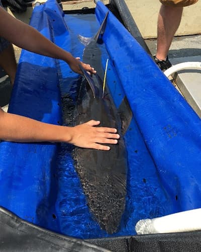
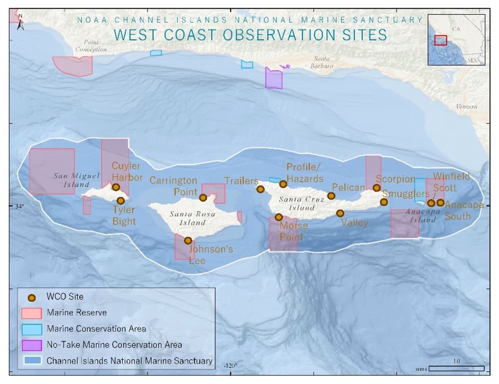
The connectivity of ecosystems across spatial scales is a critical component of ecosystem function and resiliency. However, this connectivity is often understudied in the context of marine area management and design. This is due to missing knowledge of the dispersal and movement patterns of marine flora and fauna across all stages of life, as well as the key biotic and abiotic factors that influence these behaviors. CINMS needs robust studies to quantify ecosystem connectivity to understand where specific, important habitats are within the sanctuary and whether they require additional protections such as marine reserves, as well as the sanctuary's role as critical habitat in the context of the larger California Current Large Marine Ecosystem. In an effort to support this role, CINMS has established an array of 14 acoustic receivers around the islands to track tagged fish from across the Northeast Pacific. This array feeds into the Southern California Acoustic Telemetry Tracking Network, an Integrated Ocean Observing System Animal Tracking Network subgroup that facilitates data sharing to understand long-distance movement patterns of tagged marine organisms. While not giving insight into patterns of larval dispersal, these data will contribute immensely to understanding of ecological connectivity through adult organisms.
Data and Analysis Needs
- Description and quantification of the extent of ecological connectivity within and among sanctuary habitats and throughout the Eastern Pacific, including state, federal, and international waters
- Identification of critical habitats and movement corridors and assessment of the need for additional protections
- Mobility ranges (including movement and larval dispersal), habitat use, and connectivity potential for keystone, invasive, and economically and ecologically relevant species; analysis of the efficacy of sanctuary protection for highly mobile species, if these protections (i.e., sanctuaries and marine reserves) are in areas of increased habitat use, and how many species from state, federal, and international waters use CINMS for part of their life history
- Effects of oceanographic, habitat-driven, or human impacts on ecosystem connectivity and forecasts of how climate change will alter those drivers
- Aspects of habitat quality and availability that enhance ecosystem connectivity
- Identification of ecosystem services that are heavily dependent on ecosystem connectivity and forecasts of the risk of climate change and other anthropogenic impacts to these services
- Analysis of critical transport pathways through and between sanctuary habitats including population sources and sinks, pollutants, and abiotic factors
- Expansion of the telemetry network and implementation of new telemetry projects around the Channel Islands
Potential Products
- Maps and models outlining ecosystem connectivity across management borders (i.e., MPAs, West Coast and Pacific Islands Region sanctuaries, ASBS, ATBA, National Park Service) to better inform adaptive management
- Network and seascape connectivity models that identify the sanctuary's role in regional connectivity, important corridors of connectivity, and potential bottlenecks and gaps
- Indicators, data streams, and risk assessments to track connectivity for ONMS condition reports and management plans, with a special focus on climate disruption
- Education and outreach materials on the importance of connectivity for the public, key stakeholders, students, and other targeted groups
Supplementary Information
- CINMS 2016 condition report
- National marine sanctuary climate change priorities workshop report
- Giant sea bass: Kings of the kelp forest
- Webinar: Sharks of the Channel Islands
Sanctuary Integrated Monitoring Network (SIMoN) Resources:
See also: CINMS Climate Change Science Needs Assessment
For more information about this assessment, contact research.CINMS@noaa.gov