National Marine Sanctuary System and System-Wide Monitoring
The National Marine Sanctuary System manages marine areas in both nearshore and open ocean waters that range in size from less than one to almost 140,000 square miles. Each area has its own concerns and requirements for environmental monitoring, but ecosystem structure and function in all these areas have similarities and are influenced by common factors that interact in comparable ways. Furthermore, the human influences that affect the structure and function of these sites are similar in a number of ways. For these reasons, in 2001, the program began to implement System-Wide Monitoring (SWiM). The monitoring framework (NMSP 2004a) facilitates the development of effective, ecosystem-based monitoring programs that address management information needs using a design process that can be applied in a consistent way at multiple spatial scales and to multiple resource types. It identifies four primary components common among marine ecosystems: water, habitats, living resources and maritime archaeological resources.
By assuming that a common marine ecosystem framework can be applied to all places, the National Marine Sanctuary System developed a series of questions that are posed to every sanctuary and used as evaluation criteria to assess resource condition and trends. The questions, which are shown on the following pages and explained in Appendix A, are derived from both a generalized ecosystem framework and from the National Marine Sanctuary System’s mission. They are widely applicable across the areas managed by the National Marine Sanctuary System and provide a tool with which the system can measure its progress toward maintaining and improving natural and archaeological resource quality.
Similar reports summarizing resource status and trends will be prepared for each marine sanctuary approximately every five years and updated as new information allows. The information in this report is intended to help set the stage for the management plan review process. The report also helps sanctuary staff identify monitoring, characterization and research priorities to address gaps, day-to-day information needs and new threats.
Papahānaumokuākea Marine National Monument is located west north-west of Hawaii's main eight volcanic, high islands, and spans 1,200 miles of the Pacific Ocean. Map: National Marine Sanctuary System
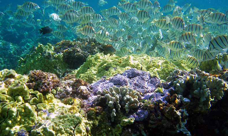
Papahānaumokuākea Marine National Monument
- 137,797 square miles of land and ocean and is the single largest conservation area under the U.S. flag
- Designated by Presidential Executive Order in 2000 as a Coral Reef Ecosystem Reserve; subsequently designated by Presidential Proclamation as a Marine National Monument in 2006
- Among the few large-scale, intact, predator-dominated reef ecosystems left in the world
- High incidence of marine endemism due to the age of the islands and relative isolation from other coral reefs
- A rich cultural history of deep ties between Native Hawaiians and the land and ocean, on genealogical, cultural and spiritual levels that remain today