Maritime Cultural Heritage Resource Management
Conservation Issue
Mallows Bay-Potomac River National Marine Sanctuary (MPNMS) protects the sanctuary’s collection of historically significant shipwrecks and cultural heritage resources. Documenting and monitoring these resources (e.g., for changes to or movement of wrecks; biodiversity; or threats like fires, storms, and vandalism) are critical components of sanctuary management and will provide a better understanding of the story of the sanctuary and surrounding area.
Description
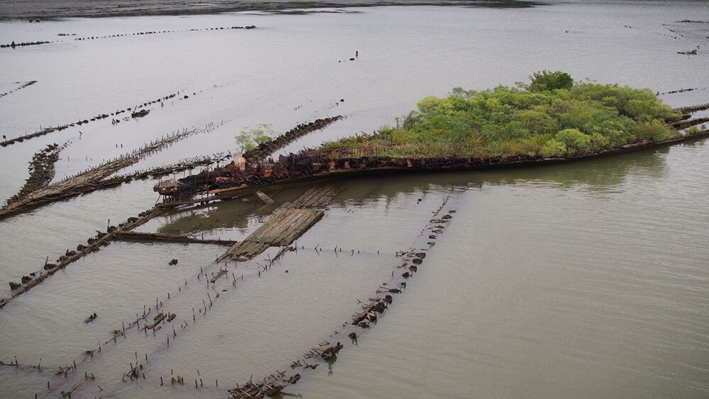
MPNMS boasts a diverse collection of historical shipwrecks potentially dating back to the Revolutionary War, but is most renowned for the remains of over 100 wooden steamships known as the “Ghost Fleet.” These ships were built in 1917–1919 for the U.S. Emergency Fleet as part of America’s engagement in World War I. Their construction at more than 40 shipyards in 17 states using nine different designs reflected a massive wartime effort that drove the expansion and economic development of communities and related maritime services. As such, the ships were built using different wood types most available locally to the shipyards, which may affect the stability and rates of decay of each vessel.
The long-term protection and study of the many historically significant shipwrecks within the sanctuary will require precise reference mapping and identification of each wreck, along with regular observation and monitoring of any variation in the condition of the wrecks over time. The remains of the wrecks that were burned to the waterline and the impacts of 100 years of natural processes are apparent; however, the specific changes that have occurred over this time and the predicted future condition of the wrecks and their accompanying biota require further research, at both the macro and micro level. Additionally, the remains of ships vary from site to site: some portions of each ship (wood and metal) may be fully submerged, fully above the waterline, and/or intermittently submerged as dictated by tide levels, sea level rise, or storm activity.
Detailed baseline knowledge is critical to developing both a focused management plan and a robust monitoring program. Reliable maps of the wrecks using 3D models and/or photogrammetry, remote sensing, and aerial surveys, as well as analyses of species diversity and the impact of biological organisms on wreck integrity, are important management tools to advance future study, create outreach materials and visualizations, and teach the public about the history and science of the wrecks.
Data and Analysis Needs
- Remote sensing and mapping, including precise locations and identification of each wreck within the sanctuary
- Photos, video, and other long-term spatial and temporal monitoring of wrecks to assess changes in condition, corrosion, concretion, and bioaccumulation
- Repeated measurements of water temperature, salinity, pH, and dissolved oxygen, which affect corrosion rates
Potential Products
- Detailed and accurate maps of MPNMS shipwrecks
- Characterization of shipwrecks and their associated marine habitat
- Web content and other outreach materials
- Visualizations, story maps, and virtual/augmented reality products
Suggested Scientific Approach and Actions
- Community science surveys
- Remote sensing (aerial, LiDAR, multibeam and side scan sonar)
- Photogrammetry
- Photo and video surveys
- Data buoys
- Conductivity, temperature, and depth (CTD) devices
- Biological field sampling
- Historical and archival research
- Virtual/digital ship modeling
Key Partners
Maryland Historical Trust ● Maryland Department of Natural Resources ● Virginia Department of Historic Resources ● Widewater State Park ● Piscataway Conoy Confederacy and Sub-Tribes ● Piscataway Indian Nation of Maryland ● Patowmeck Indian Tribe of Virginia ● Research institutions and universities
For more information about this assessment, contact mallows.bay@noaa.gov.