Maritime Cultural Landscapes
Conservation Issue
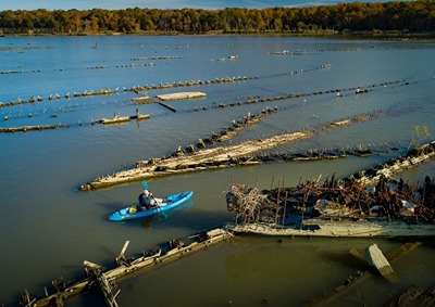
Mallows Bay-Potomac River National Marine Sanctuary (MPNMS) has a rich maritime cultural landscape, which includes historical, cultural, and natural resources and human habitation dating back thousands of years. The coastal environments within the sanctuary are connected with historic events, activities, or persons and demonstrate many aesthetic or cultural values. A complete and rigorous analysis of the sanctuary region’s maritime cultural landscape, considering all peoples through time and their connection to the maritime resources, is an important management goal.
Description
A maritime cultural landscape is a geographic area where the combination and interrelationships of human activity and the marine environment is expressed in significant ways, such as the distribution of heritage resources, traditions and cultural practices, or culturally important locations. Every maritime cultural landscape captures a unique combination of both material and intangible heritage, and includes meaning attached to a given location by different stakeholder groups. The maritime cultural landscape approach identifies and characterizes these landscapes and provides a comprehensive framework for better understanding and managing ocean resources.
MPNMS overlaps part of the traditional homeland and cultural landscape of the Piscataway Conoy Confederacy and Sub-Tribes and the Piscataway Indian Nation of Maryland, as well as the Patawomeck Indian Tribe of Virginia.
Together with the World War I U.S. Shipping Board Emergency Fleet wrecks, the area has also been the locus of important activities pertaining to the development of the United States. It was the site of a land-sea skirmish between Royal Navy forces, the Virginia State Navy, and the Maryland Militia during the American Revolution, and was also the site of pre-Civil War steamboat landings and Civil War campsites and batteries. The region also contains the historical and cultural remains of several regimes of the Potomac fisheries industry from the 1840s through the 1920s and is home to four U.S. Navy and Joint Bases along the Potomac River downstream of Washington, DC. The area also has connections to generations of African American heritage, including direct connections to the shipbreaking era during the 1920s–1940s. Due to the area’s historical significance, the Mallows Bay-Widewater Historic and Archeological District was listed on the National Park Service's National Register of Historic Places in April 2015.
The MPNMS management plan offers opportunities to enhance public understanding and stewardship of the sanctuary, its maritime resources, and the greater Chesapeake watershed through partnerships with formal and informal education providers and institutions, distance and other web-based learning, and specific educational programs and initiatives. The examination of the MPNMS maritime cultural landscape will add greatly to the “story” of the site and help guide research and outreach efforts.
Data and Analysis Needs
- Baseline characterization, assessment, and interpretation of sanctuary waters and adjacent terrestrial and wetlands areas, including remains of the Ghost Fleet and other historical and cultural resources
- Research on historical and cultural resources present at MPNMS
- Collaboration with the region’s Indigenous peoples to analyze and interpret Indigenous cultural heritage practices associated with MPNMS
- Analysis and interpretation of cultural heritage practices associated with MPNMS, in collaboration with African American communities, commercial and recreational fishing communities, and the Department of the Navy
Potential Products
- Geographic information system (GIS) products, such as interactive maps of human uses in the MPNMS area throughout history
- Outreach products related to the MPNMS maritime cultural landscape, including content for web and virtual products, signage, and educational activities
Suggested Scientific Approach and Actions
- Community science surveys in collaboration with the sanctuary co-management team
- Remote sensing (aerial, LiDAR, multibeam and side scan sonar)
- Photogrammetry
- Photo and video surveys
- Historical and archival research
- Oral histories
Key Partners
NOAA’s Office for Coastal Management ● Maryland Historical Trust ● Piscataway Conoy Confederacy and Sub-Tribes ● Piscataway Indian Nation of Maryland ● Patawomeck Indian Tribe of Virginia ● Smithsonian Institution ● Maryland Department of Natural Resources ● Virginia Department of Historic Resources ● Widewater State Park ● Charles County ● U.S. Department of the Navy ● Potomac River Fisheries Commission ● Research institutions and universities ● Local experts
For more information about this assessment, contact mallows.bay@noaa.gov.